
Towson is an unincorporated community and a census-designated place in Baltimore County, Maryland, United States. The population was 55,197 as of the 2010 census. It is the county seat of Baltimore County and the second-most populous unincorporated county seat in the United States.

LocalLink 93 is a bus route operated by the Maryland Transit Administration in the suburbs of Baltimore. The line currently runs from the Lutherville Light Rail Stop to International Circle near Hunt Valley Town Center, serving the Timonium and Cockeysville areas.
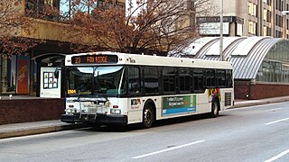
Route 23 is a bus route operated by the Maryland Transit Administration in Baltimore and its suburbs. The line currently runs from the Wal-Mart parking lot in Catonsville, Maryland east through downtown Baltimore to the Fox Ridge community in Essex, serving the corridors of Edmondson Avenue on the west side and Eastern Avenue on the east, and the communities of Edmondson Village, Allendale, Rosemont, Patterson Park, and Eastpoint, and is one of the most heavily used bus routes operated by the MTA.

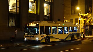
CityLink Red is a citylink bus route operated by the Maryland Transit Administration in Baltimore and its suburbs. The line currently runs from the University of Maryland Transit Center to the Lutherville Light Rail Stop along the corridors of York Road and Greenmount Avenue, and is one of the most heavily used MTA bus lines. The CityLink Red bus replaced Route 8 bus route due to BaltimoreLink, and is the successor to the 8 Towson and 7 Govanstown streetcar lines.
Route 51 is a bus route operated by the Maryland Transit Administration in Baltimore and its suburbs. The line currently runs from the center of Towson to the Inner Harbor in Downtown Baltimore, serving the Charles Street corridor. Route 51 replaced Route 11 on June 18, 2017 due to the BaltimoreLink bus system overhaul.
LocalLink 95 is a bus route operated by the Maryland Transit Administration in Baltimore. The line currently runs from the intersection of Roland Avenue and Lake Avenue in Roland Park south to the Inner Harbor via Roland Avenue, University Parkway, Charles Street and St. Paul Street.

Route 54 is a bus route operated by the Maryland Transit Administration in Baltimore and its suburbs. The route was formerly known as Route 19 prior to 2017. The line currently runs from the State Center Metro Subway Station to the intersection of Harford Road and Northern Parkway. From there it splits into two branches. About one half of buses continue operating along Harford Road to the Carney Park-and-Ride just north of the I-695 interchange, and the other half to the intersection of Goucher Boulevard and Taylor Avenue in Towson via Northern, McLean Boulevard, Hillsway, and Taylor. The line serves the communities of Montebello, Hamilton, and Parkville.

Route 7 was a bus route operated by the Maryland Transit Administration in Baltimore. The line, which operated between 1959 and 2017, ran from Canton, Baltimore to the Mondawmin Metro Subway Station, serving the communities of Butcher's Hill, Little Italy, and Sandtown-Winchester.
Route 13 is a bus route operated by the Maryland Transit Administration in Baltimore. The line currently runs from Walbrook Junction in West Baltimore to Canton, mostly along North Avenue. The line has two main branches, both operating to Canton: one that operates via Fells Point and the other via Linwood and East Streets. Both these branches serve Johns Hopkins Hospital. Additionally, selected trips on weekdays and Saturdays operate to the block of Milton Avenue, Federal Street, and Patterson Park Avenue.

Route 36 is a bus route operated by the Maryland Transit Administration in Baltimore and its suburbs. The line currently runs from the intersection of York Road and Northern Parkway to the Riverview, with some trips making short turns at Washington Boulevard and Monroe Street. The line serves the corridors of The Alameda, Kirk Avenue, Guilford Avenue, and Washington Boulevard.

Route 35 is a bus route operated by the Maryland Transit Administration in Baltimore and its suburbs. The line currently runs from White Marsh Mall to UMBC through the city of Baltimore, with selected peak hour trips to Landsdowne. The line serves the Essex campus of the Community College of Baltimore County, the corridors of Philadelphia Road, Pulaski Highway, Monument Street, and Wilkens Avenue, the communities of Rosedale, East Baltimore, Southwest Baltimore, Elm Ridge, and Arbutus, and several Metro stations.

The United Railways and Electric Company was a street railway company in the Baltimore Metropolitan Area of the U.S. state of Maryland from 1899 to 1935.

LocalLink 29 is a bus route operated by the Maryland Transit Administration in Baltimore. The line currently runs from the Mondawmin Metro Subway Station in Northwest Baltimore to Brooklyn Homes in South Baltimore through the communities of Rosemont and the corridors of Hilton Street, Caton Avenue, and Patapsco Avenue. During peak hours, selected trips operate via Violetville Industrial Park.
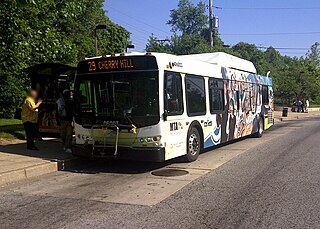
Route 29 is a bus route operated by the Maryland Transit Administration in Baltimore. The line currently operates weekdays and Saturdays in a circular fashion, linking the Cherry Hill Light Rail Stop to the Cherry Hill community. Two other MTA bus lines, Routes 27 and 51, also serve the Cherry Hill area.

Route 34 is a bus route operated by the Maryland Transit Administration in Baltimore and its suburbs. The line currently operates weekdays only from the Reisterstown Plaza Metro Subway Station to Stevenson University during peak hours and Greenspring Station midday.

LocalLink 62 is a bus route in the suburbs of Baltimore. The line currently runs from the Essex campus of the Community College of Baltimore County to Turner's Station in Dundalk. The current route serves the Rosedale, Middle River, and Essex areas and the CCBC Essex and Dundalk campuses. The line was previously known as Route 4 prior to the launch of BalitmoreLink. LocalLink Route 62 replaced the entirety of Route 4 on June 18, 2017.

CityLink Lime is a CityLink bus route operated by the Maryland Transit Administration in Baltimore and its suburbs. The line currently runs from the Mondawmin Metro Subway Station along Liberty Heights Avenue and Liberty Road to a loop known as in Milford Mill with buses marked as "Milford Mill". The loop is composed of a square block, consisting of Liberty Road, Rolling Road, Church Lane, and Milford Mill Road. The spot of the layover depends on the time of day.

Route 57 is a bus route operated by the Maryland Transit Administration in Baltimore and its suburbs. The line currently runs from the Rogers Avenue Metro Subway Station in Northwest Baltimore to Security Square Mall, with selected trips to the Social Security Administration headquarters in Woodlawn. The line serves the corridor of Gwynn Oak Avenue and the communities of Howard Park, Gwynn Oak, and Windsor Mill.
Better Waverly is a neighborhood in the North District of Baltimore, located between the neighborhoods of Charles Village (west) and Coldstream-Homestead-Montebello (east). Its boundaries are marked by East 33rd Street (north), Exeter Hall Avenue (south), Greenmount Avenue (west) and Loch Raven Road (east).
Route 31 is a bus route operated by the Maryland Transit Administration in Baltimore and its suburbs. The line currently runs from State Center Metro Station S east through downtown Baltimore to CCBC Dundalk. The main roads on which the line operates are MLK Boulevard, Pratt Street, Lombard Street, and Boston Street. The line serves the communities of Canton, Fells Point.
