Armistead Gardens, Baltimore

Last updated
Armistead Gardens
neighborhood statistical area
2020-08-04 14 39 35 View north along Maryland State Route 151 (Erdman Avenue) at North Macon Street in Baltimore, Maryland.jpg
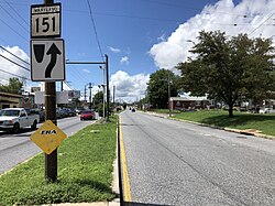
View north along 4800 block of Erdman Avenue with houses in Armistead Gardens, Baltimore to the right
Baltimore osm-mapnik location map.png
Red pog.svg
Armistead Gardens
Coordinates: 39°18′8″N76°32′59″W / 39.30222°N 76.54972°W / 39.30222; -76.54972
Country United States
State Maryland
City Baltimore
Area
[1]
  Total0.529 sq mi (1.37 km2)
  Land0.529 sq mi (1.37 km2)
Population
 (2009) [1]
  Total2,864
  Density5,400/sq mi (2,100/km2)
Time zone UTC-5 (Eastern)
  Summer (DST) UTC-4 (EDT)
Area code 410, 443, and 667

Armistead Gardens is a neighborhood in the Northeast District of Baltimore. It is located north of Pulaski Highway and east of Erdman Avenue, between Herring Run Park (northeast) and the East District neighborhood of Orangeville (southwest). [2] [3]

Contents

Armistead Gardens is home to four churches, Armistead Gardens Elementary School, and the Bohemian National Cemetery. The nearest major highways are Pulaski Highway (U.S. Route 40) and Erdman Avenue.

History

Known as the White Ghetto, it was originally built by the Housing Authority of Baltimore City as public housing for white people coming to work in industries supplying World War II. Most of these white workers were from states of Appalachia such as West Virginia, Kentucky, and Tennessee and came to Baltimore to work at Glenn L. Martin Company and other major defense plants. [4] The first section was built in 1939, with two additions in 1941. Even though it is only 60 years old, many of the homes are destroyed and many have moved out. In 1956 a cooperative (Armistead Homes Corporation) was formed by the residents and the 1500 homes were acquired from the Housing Authority. Because of the unit construction with common utilities, homes are not individually owned, but rather members have a 99-year lease with two 99 year options. Many of the current members are third and fourth generation.[ citation needed ]

Demographics

Bohemian National Cemetery, a Czech-American cemetery in Armistead Gardens. Gate entrance Bohemian National Cemetery 0.JPG
Bohemian National Cemetery, a Czech-American cemetery in Armistead Gardens.

As of the census [5] of 2008, there were 3,150 people living in the neighborhood. The racial makeup of Armistead Gardens was 81.4% White, 1.0% African American, 1.0% Native American, 1.0% Asian, 2.7% from other races, and 4.0% from two or more races. Hispanic or Latino of any race were 10.0% of the population. 65.0% of occupied housing units were owner-occupied. 35.0% of housing units were vacant.

20.0% of the population were employed, 12.1% were unemployed, and 55.9% were not in the labor force. The median household income was $15,123. About 42.8% of families and 34.5% of the population were below the poverty line.

Maelcum Soul's grave at the Bohemian National Cemetery. Bohemian National Cemetery Soul Grave 1.JPG
Maelcum Soul's grave at the Bohemian National Cemetery.

John Waters mentions both the neighborhood and the Bohemian National Cemetery in his book Role Models:

Armistead Gardens, a neighborhood originally built as public housing for the influx of people coming to work in factories during World War II. It has been called a "white ghetto" of "row-ranchers," surprising in their "now outdated modernity." There is an amazing graveyard nearby where the star of my early movie Eat Your Makeup, Maelcum Soul, is buried. No one ever shops in Armistead Gardens.

[6]

Related Research Articles

<span class="mw-page-title-main">Brooklyn Park, Maryland</span> Census-designated place in Maryland, United States

Brooklyn Park is a census-designated place (CDP) in Anne Arundel County, Maryland, United States. The population was 14,373 at the 2010 census.

<span class="mw-page-title-main">Catonsville, Maryland</span> Census-designated place in Maryland, United States

Catonsville is a census-designated place (CDP) in Baltimore County, Maryland. The population was 41,567 at the 2010 census. The community lies to the west of Baltimore along the city's border. Catonsville contains the majority of the University of Maryland, Baltimore County (UMBC), a major public research university with close to 14,000 students.

<span class="mw-page-title-main">Overlea, Maryland</span> Census-designated place in Maryland, United States

Overlea is an unincorporated community and census-designated place in Baltimore County, Maryland, United States. The population was 12,275 at the 2010 census. Students attend Overlea High School. Area roads include Belair Road and Kenwood Avenue.

<span class="mw-page-title-main">Rosedale, Maryland</span> Census-designated place in Maryland, United States

Rosedale is an unincorporated community and census-designated place in Baltimore County, Maryland, United States. The population was 19,257 at the 2010 United States Census.

<span class="mw-page-title-main">Berwyn Heights, Maryland</span> Town in Maryland

Berwyn Heights is a town in Prince George's County, Maryland, United States. Per the 2020 census, the population was 3,345. It is bordered by College Park to the west, Greenbelt to the northeast, and Riverdale Park to the south.

<span class="mw-page-title-main">Cheverly, Maryland</span> Town in Prince Georges County, Maryland, US

Cheverly is a town in Prince George's County, Maryland, United States, located very close to Washington, D.C., though not bordering it directly. The town was founded in 1918 and incorporated in 1931. Per the 2020 census, the population was 6,170. Cheverly borders the communities of Tuxedo, Chapel Oaks, Landover, Landover Hills, Villa Heights, and Bladensburg.

<span class="mw-page-title-main">Cottage City, Maryland</span> Town in Maryland

Cottage City, officially the Town of Cottage City, is a town in Prince George's County, Maryland, United States. Per the 2020 census, the population was 1,335. Cottage City is a small, quiet community lying between Eastern Avenue, Brentwood, Colmar Manor, and the Anacostia River. Cottage City was developed, beginning in 1870, under the name of "The Highlands". The area was incorporated in 1924 as Cottage City.

<span class="mw-page-title-main">Seat Pleasant, Maryland</span> City in Maryland

Seat Pleasant is an incorporated city in Prince George's County, Maryland, United States, located immediately east of Washington. Per the 2020 census, the population was 4,522. Two state highways pass through the community — Maryland routes 704 and 214. The Washington Metro's Blue and Silver Lines are nearby. The Washington Commanders' stadium is east of Seat Pleasant, near the Capital Beltway (I-95/495).

<span class="mw-page-title-main">Hermantown, Minnesota</span> City in Minnesota, United States

Hermantown is a city in Saint Louis County, Minnesota, United States. The population was 10,221 at the 2020 census. A suburb of Duluth, it was at one point the county's only city to grow in population, as much of the area's residential and commercial expansion occurred there. Hermantown is near the tip of Lake Superior.

<span class="mw-page-title-main">Dixon, Missouri</span> City in Missouri, United States

Dixon is a city in northern Pulaski County, Missouri, United States, with a population of 1,549 at the time of the 2010 census.

<span class="mw-page-title-main">Colonia, New Jersey</span> Place in Middlesex County, New Jersey, United States

Colonia is an unincorporated community and census-designated place (CDP) located within Woodbridge Township, in Middlesex County, in the U.S. state of New Jersey. As of the 2010 United States Census, the CDP's population was 17,795.

<span class="mw-page-title-main">Nether Providence Township, Delaware County, Pennsylvania</span> Township in Pennsylvania, United States

Nether Providence Township is a first class township in Delaware County, Pennsylvania, United States. Many residents refer to the township by the name of its largest community, Wallingford, because the Wallingford postal code is used for most of the township. The population of the township was 13,706 at the 2010 census.

<span class="mw-page-title-main">Washington Hill, Baltimore</span> Neighborhood of Baltimore in Maryland, United States

Washington Hill is a neighborhood in Baltimore, Maryland, United States. It is north of Fells Point, south of Johns Hopkins Hospital, east of Old Town and Jonestown and west of Butchers Hill. It is bounded by Fayette Street, Washington Street, Lombard Street, and Central Avenue. The neighborhood surrounds Broadway running north from Fells Point to terminate at East North Avenue and is named for the now-defunct Washington Medical College later known as the Church Home and Hospital on Broadway where famed writer/poet Edgar Allan Poe was taken to die in 1849 after being found comatose in a downtown Baltimore street. In the median strip of Broadway is a statue of seven-term mayor of Baltimore, Ferdinand Claiborne Latrobe.

<span class="mw-page-title-main">Highlandtown, Baltimore</span> Historic house in Maryland, United States

Highlandtown is a neighborhood of Baltimore, Maryland, United States.

<span class="mw-page-title-main">Neighborhoods of Kalamazoo, Michigan</span>

The city of Kalamazoo, Michigan consists of multiple neighborhoods. While the number, borders, and naming of neighborhoods can vary by source, the list below gives the most widely agreed upon arrangement, as defined by the City of Kalamazoo. Many of the neighborhoods have a corresponding neighborhood association.

<span class="mw-page-title-main">Woodberry, Baltimore</span> Neighborhood of Baltimore in Maryland, United States

Woodberry is a neighborhood located in the north-central area of Baltimore, Maryland, USA. A largely residential, middle-class area, Woodberry is a historic community bordered on the north by Cold Spring Lane, on the south by Druid Hill Park, on the west by Greenspring Avenue, and on the east by the Jones Falls Expressway and the Jones Falls. Woodberry is located within Postal Zip code 21211.

<span class="mw-page-title-main">Bayview, Baltimore</span> Neighborhood statistical area in Baltimore, Maryland, United States

Bayview, or Hopkins-Bayview, is a neighborhood located in the Southeast District of Baltimore between the Pulaski industrial area (East) and Greektown (West).

<span class="mw-page-title-main">Frankford, Baltimore</span> Neighborhood in Baltimore

Frankford is a neighborhood in northeast Baltimore. Frankford is the most populous of the city's designated neighborhoods, with over 17,000 residents.

<span class="mw-page-title-main">Bohemian National Cemetery (Baltimore, Maryland)</span> United States historic place

Bohemian National Cemetery, also known as Oak Hill Cemetery, is a cemetery located at 1300 Horners Lane, Armistead Gardens in East Baltimore, Maryland.

<span class="mw-page-title-main">Midtown-Edmondson, Baltimore</span> Neighborhood of Baltimore in Maryland, United States

Midtown-Edmondson is a mixed-use neighborhood in western Baltimore City developed mostly between the 1880s and the 1910s. The neighborhood is mainly composed of residential rowhouses, with a mixed-used business district along Edmondson Avenue, and industrial warehouses and buildings dotted along the CSX railroads that bound its western edge.

References

  1. 1 2 "Armistead Gardens neighborhood in Baltimore". City-data.com. Retrieved June 30, 2011.
  2. "Northeast District Maps". Baltimore City Neighborhoods Portal. City of Baltimore. Archived from the original on 1 July 2011. Retrieved June 30, 2011.
  3. "Discover Your Neighborhood". Live Baltimore. Retrieved June 30, 2011.
  4. "Armistead Gardens Ready to Experiment". The Baltimore Sun. 3 August 2004. Retrieved 2019-05-05.
  5. "U.S. Census website". United States Census Bureau . Retrieved 2008-01-31.
  6. Waters, John (2010). Role Models. New York City: Farrar, Straus and Giroux. ISBN   978-0-374-25147-5.

See also

List of Baltimore neighborhoods