Related Research Articles
The Station North Arts and Entertainment District is an area and official arts and entertainment district in the U.S. city of Baltimore, Maryland. The neighborhood is marked by a combination of artistically-leaning commercial ventures, such as theaters and museums, as well as formerly abandoned warehouses that have since been converted into loft-style living. It is roughly triangular, bounded on the north by 20th Street, on the east by Greenmount Avenue, and on the south and west by the tracks of Amtrak's Northeast Corridor, though the neighborhood's boundaries include a one-block wide extension over the tracks.

Mondawmin is a neighborhood located in the Western district of Baltimore, Maryland, United States. The neighborhood is surrounded by Druid Hill Park, the Whitelock Community, and Lower Park Heights. Included within its boundaries are Frederick Douglass High School, and Mondawmin Mall. The Baltimore Metro Subway serves the neighborhood, with a station at Mondawmin Mall that is also a hub for many bus routes.
WLOY Loyola Radio is a non-commercial college radio station owned and operated by Loyola University Maryland, broadcasting on 1620 kHz AM, campus cable channels 3 and 35, and streaming on wloy.org, and iTunes, based in Baltimore and Timonium, Maryland. WLOY operates multiple synchronized transmission locations under Part 15 of the FCC regulations, as well as on the Internet via multiple radio formats.

Sherwood Gardens is a 6-acre (24,000 m2) park located in the Guilford neighborhood of Northern Baltimore, Maryland. The gardens are bordered by East Highfield, Underwood, Stratford and Greenway Roads. In addition to well-groomed, standard ground cover, Sherwood Gardens is famous for its nearly 80,000 tulips that peak in late April. After the tulips finish blooming, the Tulip Dig occurs on the Saturday of Memorial Day each year. Anyone can dig up and purchase the tulip bulbs.

Kresson is a neighborhood of Southeast Baltimore, Maryland, United States.

Carrollton Ridge is a neighborhood of South Baltimore, Maryland, United States
Glen is a neighborhood in Baltimore, Maryland. It was developed in the early 1920s and 1930s, with the remaining development coming in the 1940s through the 1960s. Glen is one of the largest communities of Northern Park Heights in Baltimore. Glen is a neighborhood of mixed housing types that include Tudor, French Norman and brick ranch houses, along with garden apartments, condominiums and semi-detached single family homes.

Village of Cross Keys is a privately owned upscale area of Baltimore, Maryland. It is located off Maryland Route 25 between Northern Parkway and Cold Spring Lane, and is home to luxury condos and upscale small shops.

Owen Brown is one of the ten villages in Columbia, Maryland, United States, established in 1972. Neighborhoods in the village include Dasher Green, Elkhorn and Hopewell. Owen Brown lies south and east of the town center.

Harper's Choice is one of the ten villages that comprise Columbia, Maryland, United States. It lies in the northwest part of Columbia and consists of the neighborhoods of Longfellow, Swansfield, and Hobbit's Glen and had a December 1998 population of 8,695.
Oliver is a neighborhood in the Eastern district of Baltimore, Maryland. Its boundaries are the south side of North Avenue, the east side of Ensor Street, the west side of Broadway, and the north side of Biddle Street. This neighborhood, adjacent to Johns Hopkins Medical Campus and minutes from the Inner Harbor, lies east of the historic Greenmount Cemetery. The neighborhood is accessible by several bus lines, the Johns Hopkins metro station, Charm City Circulator, Pennsylvania Station (Baltimore), and freeway.

Edmondson Village is a neighborhood in the southwestern section of Baltimore, Maryland, encompassing most of the Edmondson Avenue corridor in 21229. The Edmondson Village area is made up of several smaller communities. Its communities include Hunting Ridge, Uplands, Rognel Heights, Wildwood, West Mulberry, Allendale, Edgewood, and Lower Edmondson Village. It is located north of Frederick Avenue, and south of the Gwynns Falls Parkway, Leakin and Gwynns Falls Parks. Communities in the area range from middle class to lower income. A notable shopping center opened in the neighborhood in 1947.

Lombard Street is a major street in Baltimore. It forms a one-way pair of streets with Pratt Street that run west–east through downtown Baltimore. For most of their route, Pratt Street is one-way in an eastbound direction, and Lombard Street is one-way westbound. Both streets begin in west Baltimore at Frederick Avenue and end in Butcher's Hill at Patterson Park Avenue. Since 2005, these streets have been open to two-way traffic from Broadway until their end at Patterson Park; in addition, Lombard is also two-way from Fulton Avenue to Martin Luther King, Jr. Boulevard, near the University of Maryland at Baltimore campus.

Mosher is a neighborhood in the western part of Baltimore, Maryland. Its boundaries are the north side of Edmondson Avenue, the west side of Braddish Avenue, the east side of Poplar Grove, and the south side of Riggs Avenue. The neighborhood lies in the vicinity of Walbrook Junction, Coppin State University, Sandtown-Winchester, and Edmondson Village. Mosher is one of several neighborhoods that resisted the development of the "Road to Nowhere", now designated as US 40, along the Franklin Avenue corridor. The area was historically segregated, and largely occupied by European Americans, but transitioned during the early 1950s to become a predominantly African American area.

Pen Lucy is a small community in the North District of Baltimore and part of the development of York Road, a historic Baltimore route to Pennsylvania. The Pen Lucy neighborhood features many different housing types.
Lakeland is a neighborhood in south Baltimore, Maryland. Its borders are Annapolis Road on the east, the Baltimore city/county line to the south, a CSX/MARC Railroad line to the west, and the same railroad line to the north.
Waltherson is a neighborhood located in Northeast Baltimore, Maryland, United States that runs between Harford Road to Belair Road and from Hamilton Ave in the north and Southern Ave in the south. It was later expanded to include the neighborhood of Wilson Heights extending its boundaries along Belair Road to Moravia Road to achieve the boundaries currently seen on Baltimore City's CityView page.

Oriole Park was the name of multiple baseball parks in Baltimore, Maryland, all built within a few blocks of each other.

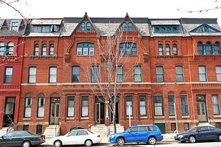
Harwood is a small neighborhood located in the central area of Baltimore, Maryland, USA. It sits east of Charles Village, south of Abell, west of Waverly and north of Barclay. Its boundaries are Guilford and Greenmount Avenues to the east and west, and 25th and 29th streets to the north and south. These streets together encompass about 14 city blocks.

The West Baltimore Innovation Village District is a neighborhood district of Baltimore City that will specialize in attracting startup companies and other employers to West Baltimore. Following the Death of Freddie Gray and the subsequent 2015 Baltimore protests, government leaders decided to launch the innovation district as a way to attract redevelopment and revitalization to the areas hardest hit by the protests. The district includes the neighborhoods of Mondawmin, Coppin Heights, Penn-North, Reservoir Hill and Bolton Hill.
References
- ↑ "Best Neighborhood." Baltimore City Paper (September 11, 2005). Retrieved 2010-08-27