
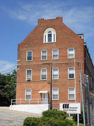
Maryland Route 372 is a state highway in the U.S. state of Maryland. Known as Wilkens Avenue, the state highway runs 2.86 miles (4.60 km) from MD 166 in Catonsville east to U.S. Route 1 in Baltimore. MD 372 connects Baltimore and Interstate 695 (I-695) with the University of Maryland, Baltimore County (UMBC), and Spring Grove Hospital Center. Wilkens Avenue begins westward from South Gilmor Street, and was constructed from Monroe Street in Baltimore to Rolling Road in the last quarter of the 19th century. Almost the entire length of the highway was improved in the 1930s for local and long-distance traffic. MD 372's eastern terminus was moved west twice: first in the late 1930s when US 1 was moved to the avenue east of Caton Avenue, and again in the late 1940s when US 1 was moved to its present course.
Yale Heights is a neighborhood in the Southwest District of Baltimore, located between Beechfield (west) and Irvington (east). Most of its homes were built in 1955 as a development of two-bedroom, brick townhouses. These townhouses had an average value of $110,469 in 2022. The neighborhood's population in 2022 was estimated at 2,592.

Irvington is a neighborhood in the Southwest District of Baltimore, located between Yale Heights neighborhood to the west and the Gwynns Falls neighborhood to the east. It was historically nicknamed "Skulltown" for its three large cemeteries: Loudon Park, Mount Olivet and New Cathedral.

U.S. Route 1 Alternate is an alternate route of US 1 in the U.S. state of Maryland. The highway runs 3.92 miles (6.31 km) between intersections with US 1 in Arbutus and in Baltimore. US 1 Alt. serves the southwestern Baltimore County community of Halethorpe and connects US 1 with full-access interchanges with Interstate 95 (I-95) and I-695. The Washington Boulevard portion of the alternate route was the original road southwest from Baltimore in the 18th century and was part of the turnpike southwest to Washington, D.C. for much of the 19th century. The highway was paved in the early 1910s, expanded in the late 1910s and late 1920s, and became part of US 1 in 1926. The Caton Avenue portion of the alternate route was improved and expanded in the 1930s to serve as a rerouting of US 1 in southwest Baltimore. US 1 Alt. was created in 1949 when US 1 was moved to its present course through Arbutus and southwest Baltimore. The alternate route's interchanges with I-695 and I-95 were constructed in the late 1950s and mid-1970s, respectively.
Oaklee is a neighborhood in the Southwest District of Baltimore, located at the city's edge between the neighborhoods of Irvington and Violetville. Its boundaries are triangle-shaped, with the Baltimore County line forming its southwestern base. From the triangle's apex to the northeast, U.S. Route 1 branches off from Wilkens Avenue to form the neighborhood's southeastern boundary, while Wilkens draws its northwestern edge from the apex to the base.
Gwynn's Falls is a neighborhood in the Southwestern District of Baltimore, located between Irvington (west) and Gwynns Falls Leakin Park (east). Frederick Avenue marks the neighborhood's boundary to the north; Wilkens Avenue draws its southern edge. Caton Avenue separates it from Irvington to the west.
The Orchards is a neighborhood in the North District of Baltimore, located between the neighborhoods of New North Roland Park–Poplar Hill and Bellona–Gittings. Its boundaries are marked by the Baltimore County line (north), Maryland Route 133 Northern Parkway (south), and Maryland Route 139 Charles Street (east). Roland Avenue, West Lake Avenue, Kenmore Road and Melrose Avenue draw the neighborhood's west boundary.
Edgecomb, also known as Parklane, is a neighborhood in the North District of Baltimore, located between the neighborhoods of Cylburn (north) and Greenspring (south). Its boundaries are marked by Dupont Avenue (north), Coldspring Lane (south), Pimlico Road (west) and Greenspring Avenue (east). Central Park Heights, is located on the opposite side of Pimlico Road in the Northwest District. The neighborhood of Coldspring is located to Edgecomb's east, across Greenspring Avenue.

Sabina Mattfeldt is a neighborhood in the North District of Baltimore, located beside the Jones Falls, between the neighborhoods of Mount Washington (west) and Poplar Hill (east). Its name comes from the two streets, Sabina Avenue and Mattfeldt Avenue, where most of the neighborhood's homes are located.
Baltimore Highlands is a neighborhood in the Southeast District of Baltimore, located between the neighborhoods of Patterson Park and Kresson. Its boundaries are drawn by Pulaski Highway (north), East Baltimore Street (south), Haven Street (east) and North Clinton Street (west).
Greenspring is a neighborhood in the North District of Baltimore, located between the neighborhoods of Woodberry (east) and Central Park Heights (west). Its boundaries are marked by West Cold Spring Lane (north), Greenspring Avenue (east), and Springhill Avenue (south). The western edge of the neighborhood runs along Pimlico Road from West Cold Spring Lane to Park Heights Avenue, then along Park Heights Avenue to Springhill Avenue.

Beverly Hills is a neighborhood in the Northeast District of Baltimore, located between the neighborhoods of Moravia-Walther, Arcadia and Lauraville. Its boundaries are drawn by Harford Road (west), Weaver Avenue (south), Harcourt Road (east), Moravia Road (northeast) and Grindon Avenue (north).
Callaway-Garrison is a neighborhood in the Northwest district of Baltimore, located between the neighborhoods of Dorchester (west) and Ashburton (east). Its boundaries are marked by West Cold Spring Lane (north), Liberty Heights Avenue (south), Callaway Avenue (east) and Garrison Boulevard (west).

Bellona–Gittings is a neighborhood in the North District of Baltimore, located between the neighborhoods of Cedarcroft (east) and The Orchards (west). Its boundaries are marked by the Baltimore County line (north), East Melrose Avenue (south), Bellona Avenue (east) and North Charles Street (west). Many of the houses in this neighborhood were built from 1853 to 1956, with a wide variety of styles. Aside from one historic commercial building, the neighborhood is residential.
Hanlon Longwood is a neighborhood in the Northwest District of Baltimore, located between the neighborhoods of Garwyn Oaks (west) and Burleigh–Leighton (east). It is bounded by North Dukeland Street (east), Garrison Boulevard (west) and the Gwynns Falls Parkway (south). The neighborhood's north boundary is marked by North Longwood Street, North Hilton Street and Liberty Heights Avenue.
Langston Hughes is a neighborhood in the Northwest District of Baltimore, located between the neighborhoods of Central Park Heights (east) and Woodmere. Its roughly pentagonal boundaries are marked by West Belvedere Avenue (northwest), Litchfield Avenue (northeast), Reisterstown Road (south) and Oakmont Avenue (east).
Westgate is a neighborhood in the Southwest District of Baltimore, located between Baltimore County (west) and the city neighborhood of Ten Hills (east). Its boundaries are marked by Baltimore National Pike (north), Frederick Avenue (south), Rock Glen Avenue and Edmondson Avenue (east) and the city line (west).
West Hills is a neighborhood in the Southwest District of Baltimore, located between the neighborhoods of Westgate (south), Franklintown (north) and Hunting Ridge (east). Its boundaries are drawn by the Baltimore County line (west), Baltimore National Pike (south) and North Franklintown Road (north). Its eastern boundary follows Cooks Lane from Baltimore National Pike, then Briarclift Road and finally Wynans Way to the intersection with N. Franklintown Road.
Mount Holly is a neighborhood in the Southwest District of Baltimore, located between the neighborhoods of Fairmont (south), Walbrook (east) and Garwyn Oaks (north). Its boundaries are drawn by Denison Street (east), Clifton Avenue (southwest), Gwynns Falls Parkway (north), Windsor Mill Road (northwest), and West North Avenue (south). Gwynns Falls Leakin Park is located to the west of Mount Holly.
Better Waverly is a neighborhood in the North District of Baltimore, located between the neighborhoods of Charles Village (west) and Coldstream-Homestead-Montebello (east). Its boundaries are marked by East 33rd Street (north), Exeter Hall Avenue (south), Greenmount Avenue (west) and Loch Raven Road (east).

