Beechfield | |
---|---|
neighborhood statistical area | |
Coordinates: 39°16′42″N76°41′53″W / 39.27837239°N 76.6981523°W Coordinates: 39°16′42″N76°41′53″W / 39.27837239°N 76.6981523°W | |
Country | United States |
State | Maryland |
City | Baltimore |
Area | |
• Total | .517 sq mi (1.34 km2) |
• Land | .517 sq mi (1.34 km2) |
[1] | |
Population | |
• Total | 3,789 |
• Density | 7,300/sq mi (2,800/km2) |
[1] | |
Time zone | UTC-5 (Eastern) |
• Summer (DST) | UTC-4 (EDT) |
ZIP code | 21229 |
Area code | 410, 443, and 667 |
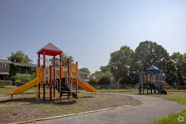
Beechfield is a neighborhood in the Southwest District of Baltimore, located between Yale Heights (east) and the Baltimore County line (west). [2] Its population in 2008 was estimated at 3,789. [1]
The community's boundaries form an inverted pyramid shape, with Frederick Avenue (north) drawing a line across the top from Baltimore County (west) to South Beechfield Avenue (east). Frederick Avenue, Maryland Route 144, becomes Frederick Road as it continues west into Baltimore County. Beechfield's eastern boundary begins at the intersection of Beechfield Avenue and Frederick Avenue (north) to the point where the Baltimore County line crosses Beechfield Avenue (south), the apex of the Beechfield pyramid. [1]
After passing through Yale Heights on its way from Dundalk to Catonsville, the MTA Citylink Purple line turns north onto Beechfield Avenue from Cedar Garden Road. It turns left onto Frederick Avenue, then heads west along Route 144 into Baltimore County. [3]
Quickbus Route 46 stops at Beechfield Avenue and Thornfield Avenue in Beechfield while traveling between the Paradise Avenue loop and the Cedonia loop. It operates only on weekdays, from 5 a.m. to 6 p.m. [4]
The UMBC shuttle bus makes five stops along Beechfield's east and north boundaries. [5]
Catonsville is a census-designated place (CDP) in Baltimore County, Maryland, United States. The population was 41,567 at the 2010 census. The community lies to the west of Baltimore along the city's border. Catonsville contains the majority of the University of Maryland, Baltimore County (UMBC), a major public research university with close to 14,000 students.
The Maryland Transit Administration (MTA) is a state-operated mass transit administration in Maryland, and is part of the Maryland Department of Transportation. The MTA operates a comprehensive transit system throughout the Baltimore-Washington Metropolitan Area. There are 80 bus lines serving Baltimore's public transportation needs, along with other services that include the Light Rail, Metro Subway, and MARC Train. In 2021, the system had a ridership of 44,612,100, or about 149,200 per weekday as of the second quarter of 2022. With nearly half the population of Baltimore residents lacking access to a car, the MTA is an important part of the regional transit picture. The system has many connections to other transit agencies of Central Maryland, Washington, D.C., Northern Virginia, and south-central Pennsylvania : WMATA, Charm City Circulator, Regional Transportation Agency of Central Maryland, Annapolis Transit, Rabbit Transit, Ride-On, and TransIT.
Maryland Route 144 is a collection of state highways in the U.S. state of Maryland. These highways are sections of old alignment of U.S. Route 40 between Cumberland and Baltimore. Along with US 40 Scenic, US 40 Alternate, and a few sections of county-maintained highway, MD 144 is assigned to what was once the main highway between the two cities, connecting those endpoints with Hancock, Hagerstown, Frederick, New Market, Mount Airy, Ellicott City, and Catonsville. MD 144 has seven disjoint sections of mainline highway that pass through the Appalachian Mountains in Allegany and Washington counties and the rolling Piedmont of Frederick, Carroll, Howard, and Baltimore counties.
Route 10 is a bus route operated by the Maryland Transit Administration in Baltimore and its suburbs. The line currently runs from the Wal-Mart parking lot in Catonsville to Bullneck Road/Turner's Station Dundalk mostly along the corridors of Frederick Road on the west side and Eastern Avenue on the east side, serving the communities of Yale Heights, Pigtown, downtown Baltimore, Fells Point, and Highlandtown.
Route 35 was a local bus route running through the city of Baltimore between White Marsh Mall (east) and UMBC (west), operated by the Maryland Transit Administration. The line served the Essex campus of the Community College of Baltimore County, the corridors of Philadelphia Road, Pulaski Highway, Monument Street (Baltimore)|Monument Street]], and Wilkens Avenue, the communities of Rosedale, East Baltimore, Southwest Baltimore, Elm Ridge and Arbutus and several Metro stations until the route was discontinued in June 2017. CityLink Brown currently provides service from White Marsh to downtown Baltimore, while CityLink Yellow connects the city with UMBC.
Mondawmin station is a Metro SubwayLink station in Baltimore, Maryland. It is located under the intersection of Reisterstown Road and Liberty Heights Avenue in the Mondawmin neighborhood, adjacent to the Mondawmin Mall. It is the northernmost underground station on the line, and a major transfer point to many bus routes.
Maryland Route 166 is a state highway in the U.S. state of Maryland. The state highway runs 2.71 miles (4.36 km) from Interstate 195 (I-195) in Arbutus north to MD 144 in Catonsville. MD 166 consists of two sections: a short freeway section that serves as a northern continuation of I-195 and provides access to the University of Maryland, Baltimore County (UMBC), and a segment of Rolling Road, a major north–south highway in western Baltimore County. Rolling Road dates to the colonial era as a highway used to transport tobacco from plantations to river ports. North Rolling Road, which connects Catonsville with Woodlawn and Milford Mill, has always been a county highway. South Rolling Road was constructed as a state highway by the early 1920s between what were to become U.S. Route 1 and US 40. Parts of South Rolling Road were transferred to county maintenance after they were severed by the construction of I-95 and a freeway relocation of the southern end of MD 166 in the early 1970s.
Charles Center station is a Metro SubwayLink station in Baltimore, Maryland. Located by the Charles Center in Downtown Baltimore, it is nearby various landmarks and bus transfers. It was the final stop of the line until 1995, when the extension to Johns Hopkins Hospital opened.
Route 48 is a limited stop bus, identified as a "Quickbus", operated by the Maryland Transit Administration in Baltimore and its suburbs. The line currently runs from the University of Maryland Transit Center to Towson along the York Road/Greenmount Avenue corridor. Service operates Monday through Saturday every 15 minutes between 5:30 AM. and 6:30 PM.
Yale Heights is a neighborhood in the Southwest District of Baltimore, located between Beechfield (west) and Irvington (east). Most of its homes were built in 1955 as a development of two-bedroom, brick townhouses. Its population in 2008 was estimated at 2,916.
Irvington (Baltimore) is a neighborhood in the Southwest District of Baltimore, located between Yale Heights neighborhood to the west and the Gwynns Falls neighborhood to the east. It was historically nicknamed "Skulltown" for its three large cemeteries: Loudon Park, Mount Olivet and New Cathedral.
Route 46 is a limited stop bus route, identified as a "Quickbus", operated by the Maryland Transit Administration in Baltimore. The line currently runs from the Cedonia Loop in Northeast Baltimore to the Paradise Loop, in Catonsville. Service operates every 15 minutes during rush hour only. The line serves the corridors of Frederick Avenue in West Baltimore, and Sinclair Lane/Cedonia Ave in Northeast Baltimore including the communities of Yale Heights, and Gwynns Falls in West Baltimore, and Berea and Parkside in East Baltimore.
Cylburn is a neighborhood in the North District of Baltimore, located between the neighborhoods of Levindale (north) and Edgecomb (south). Its boundaries are marked by Cylburn Avenue (north), Dupont Avenue (south), Pimlico Road (west) and Greenspring Avenue (east). Central Park Heights, is located on the opposite side of Pimlico Road in the Northwest area of Baltimore City. Cylburn Arboretum and the neighborhood of Cold Spring are located to Cylburn's east, across Greenspring Avenue. The heavily wooded property with its historic mansion and grounds, walking trails, famous collections and gardens overlook the Jones Falls Valley with the Jones Falls Expressway further to the east.
Callaway-Garrison is a neighborhood in the Northwest district of Baltimore, located between the neighborhoods of Dorchester (west) and Ashburton (east). Its boundaries are marked by West Cold Spring Lane (north), Liberty Heights Avenue (south), Callaway Avenue (east) and Garrison Boulevard (west).
Westgate is a neighborhood in the Southwest District of Baltimore, located between Baltimore County (west) and the city neighborhood of Ten Hills (east). Its boundaries are marked by Baltimore National Pike (north), Frederick Avenue (south), Rock Glen Avenue and Edmondson Avenue (east) and the city line (west).
West Hills is a neighborhood in the Southwest District of Baltimore, located between the neighborhoods of Westgate (south), Franklintown (north) and Hunting Ridge (east). Its boundaries are drawn by the Baltimore County line (west), Baltimore National Pike (south) and North Franklintown Road (north). Its eastern boundary follows Cooks Lane from Baltimore National Pike, then Briarclift Road and finally Wynans Way to the intersection with N. Franklintown Road.
Mount Holly is a neighborhood in the Southwest District of Baltimore, located between the neighborhoods of Fairmont (south), Walbrook (east) and Garwyn Oaks (north). Its boundaries are drawn by Denison Street (east), Clifton Avenue (southwest), Gwynns Falls Parkway (north), Windsor Mill Road (northwest), and West North Avenue (south). Gwynns Falls Leakin Park is located to the west of Mount Holly.
UMBC Transit is the official bus system of the University of Maryland, Baltimore County. Along with the Maryland Transit Administration (MTA), the UMBC community has public transit access to nearby areas such as Catonsville, Arbutus, Maryland, and Baltimore City.
Rognel Heights is a neighborhood in the Southwest District of Baltimore, sandwiched between Hunting Ridge (west) and Edmondson Village (east) along Edmondson Avenue (south). Gwynns Falls/Leakin Park begins at the neighborhood’s northern edge. Its boundaries are marked by Swann Avenue on the western edge, North Woodington Road on the east and Edmondson Avenue on the southern edge. The neighborhood of Uplands is located to the south of Rognel Heights, on the opposite side of Edmondson Avenue.