
Chelsea is a neighborhood on the West Side of the borough of Manhattan in New York City. The area's boundaries are roughly 14th Street to the south, the Hudson River and West Street to the west, and Sixth Avenue to the east, with its northern boundary variously described as near the upper 20s or 34th Street, the next major crosstown street to the north. To the northwest of Chelsea is the neighborhood of Hell's Kitchen, as well as Hudson Yards; to the northeast are the Garment District and the remainder of Midtown South; to the east are NoMad and the Flatiron District; to the southwest is the Meatpacking District; and to the south and southeast are the West Village and the remainder of Greenwich Village. Chelsea was named for an estate in the area, which in turn was named for the Royal Hospital Chelsea in London.

Dongan Hills is a neighborhood located within the New York City borough of Staten Island. It is on the island's East Shore. Dongan Hills is bounded by Laconia Avenue to the southeast, Jefferson Avenue on the southwest, Richmond Road on the northwest, and Old Town Road to the north. It is adjacent to New Dorp and Grant City to the southwest, Todt Hill to the northwest, Old Town/Concord to the northeast, and South Beach and Midland Beach to the southeast.

Pigtown is a neighborhood in the southwest area of Baltimore, bordered by Martin Luther King Jr. Boulevard to the east, Monroe Street to the west, Russell Street to the south, and West Pratt Street to the north. The neighborhood acquired its name during the second half of the 19th century, when the area was the site of butcher shops and meat packing plants to process pigs transported from the Midwest on the B&O Railroad; they were herded across Ostend and Cross Streets to be slaughtered and processed.

Meadowbrook is a Syracuse, New York neighborhood, located in the southeastern corner of the city. It corresponds to Onondaga County Census Tract 46. It is named after Meadow Brook, which runs through it and into Butternut Creek.

Crotona Park East, also known as Crotona or East Morrisania, is a residential neighborhood geographically located in the southwest Bronx in New York City. Crotona Park East is considered part of the South Bronx. Its boundaries, starting from the north and moving clockwise are the Cross-Bronx Expressway to the north, the Bronx River to the east, East 167th Street to the south, and Crotona/Prospect Avenues to the west. Southern Boulevard is the primary thoroughfare through the area. The neighborhood is adjacent to, but distinct from, the nearby park named Crotona Park.

Castle Hill is a neighborhood located in the southeast section of the borough of the Bronx in New York City. Its boundaries are Waterbury Avenue and Westchester Avenue to the north, Westchester Creek to the east, the East River to the south, and White Plains Road to the west. Unionport is a subsection of Castle Hill, typically considered north of Lafayette Avenue.
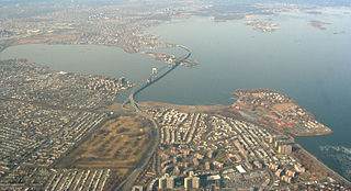
Bay Terrace is a neighborhood in the northeastern section of the New York City borough of Queens. It is often considered part of the larger area of Bayside. Bay Terrace overlooks the East River and the approaches to the Throgs Neck Bridge from the Clearview Expressway and Cross Island Parkway. It is bounded on the west by the Clearview Expressway, on the south by 26th and 28th Avenues, to the east by the Little Neck Bay, and to the north by the East River.
Gwynn Oak is an unincorporated community in the western part of Baltimore County, Maryland, United States. Gwynn Oak is north of Liberty Road and east of Rogers Avenue Windsor Mill Road. Nearby neighborhoods include: Woodlawn, Milford Mill, Windsor Mill, and Garwyn Oaks. The western edge of the community lies just outside Woodlawn town center, north-east of Windsor Mill Road where Woodlawn Drive becomes Gwynn Oaks Avenue. The community was home to the Gwynn Oak Amusement Park, now Gwynn Oak Park.
Forest Park is a region of Northwest Baltimore, Maryland located west of Reisterstown Road, south of Northern Parkway, and east of the Baltimore City/County line. In Baltimore, the region is referred to by locals simply as "Forest Park" and includes the neighborhoods of Ashburton, Callaway-Garrison, Central Forest Park, Dolfield, Dorchester, East Arlington, Forest Park, Grove Park, Hanlon Longwood, Howard Park, Garwyn Oaks, Purnell, West Arlington, West Forest Park, and Windsor Hills.
Dorchester is a neighborhood in the Northwest District of Baltimore. It is located between the neighborhoods of Arlington (north), Central Forest Park (south), Howard Park (west) and Gallway-Garrison (east). Maryland Route 26 draws the boundary between Dorchester and Central Forest Park. Dorchester's other boundaries are marked by Oakford Avenue, Eldorado Avenue and Garrison Boulevard.
Cameron Village is a neighborhood in the North District of Baltimore, located between the neighborhoods of Mid-Govans and Woodbourne Heights. Vaguely bell-shaped, its boundaries are marked by Bradhurst Road and E. Belvedere Avenue (north), Woodbourne Avenue (south), Lothian Road (west) and Northwood Drive (east).
Glen Oaks is a neighborhood in the North District of Baltimore. Its boundaries form a slender, inverted triangle, with the city line as the neighborhood's northern base and Belvedere Shopping Center as its southern apex. Chinquapin Parkway (west) and The Alameda (east) draw the triangle's sides and cross at the neighborhood's southern tip.
Edgecomb, also known as Parklane, is a neighborhood in the North District of Baltimore, located between the neighborhoods of Cylburn (north) and Greenspring (south). Its boundaries are marked by Dupont Avenue (north), Coldspring Lane (south), Pimlico Road (west) and Greenspring Avenue (east). Central Park Heights, is located on the opposite side of Pimlico Road in the Northwest District. The neighborhood of Coldspring is located to Edgecomb's east, across Greenspring Avenue.

Cylburn is a neighborhood in the North District of Baltimore, located between the neighborhoods of Levindale (north) and Edgecomb (south). Its boundaries are marked by Cylburn Avenue (north), Dupont Avenue (south), Pimlico Road (west) and Greenspring Avenue (east). Central Park Heights, is located on the opposite side of Pimlico Road in the Northwest area of Baltimore City. Cylburn Arboretum and the neighborhood of Cold Spring are located to Cylburn's east, across Greenspring Avenue. The heavily wooded property with its historic mansion and grounds, walking trails, famous collections and gardens overlook the Jones Falls Valley with the Jones Falls Expressway further to the east.
Callaway-Garrison is a neighborhood in the Northwest district of Baltimore, located between the neighborhoods of Dorchester (west) and Ashburton (east). Its boundaries are marked by West Cold Spring Lane (north), Liberty Heights Avenue (south), Callaway Avenue (east) and Garrison Boulevard (west).

Bellona–Gittings is a neighborhood in the North District of Baltimore, located between the neighborhoods of Cedarcroft (east) and The Orchards (west). Its boundaries are marked by the Baltimore County line (north), East Melrose Avenue (south), Bellona Avenue (east) and North Charles Street (west). Many of the houses in this neighborhood were built from 1853 to 1956, with a wide variety of styles. Aside from one historic commercial building, the neighborhood is residential.
Hanlon Longwood is a neighborhood in the Northwest District of Baltimore, located between the neighborhoods of Garwyn Oaks (west) and Burleigh–Leighton (east). It is bounded by North Dukeland Street (east), Garrison Boulevard (west) and the Gwynns Falls Parkway (south). The neighborhood's north boundary is marked by North Longwood Street, North Hilton Street and Liberty Heights Avenue.
Langston Hughes is a neighborhood in the Northwest District of Baltimore, located between the neighborhoods of Central Park Heights (east) and Woodmere. Its roughly pentagonal boundaries are marked by West Belvedere Avenue (northwest), Litchfield Avenue (northeast), Reisterstown Road (south) and Oakmont Avenue (east).
Westgate is a neighborhood in the Southwest District of Baltimore, located between Baltimore County (west) and the city neighborhood of Ten Hills (east). Its boundaries are marked by Baltimore National Pike (north), Frederick Avenue (south), Rock Glen Avenue and Edmondson Avenue (east) and the city line (west).
Mount Holly is a neighborhood in the Southwest District of Baltimore, located between the neighborhoods of Fairmont (south), Walbrook (east) and Garwyn Oaks (north). Its boundaries are drawn by Denison Street (east), Clifton Avenue (southwest), Gwynns Falls Parkway (north), Windsor Mill Road (northwest), and West North Avenue (south). Gwynns Falls Leakin Park is located to the west of Mount Holly.


