Reisterstown Station, Baltimore

Last updated
Reisterstown Station
neighborhood statistical area
North side of Reisterstown Road Plaza.jpg
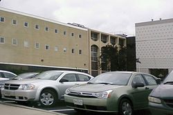
Parking outside Reisterstown Road Plaza shopping center, located in the neighborhood of Reisterstown Station
Baltimore osm-mapnik location map.png
Red pog.svg
Reisterstown Station
Coordinates: 39°21′14″N76°42′19″W / 39.3540°N 76.7054°W / 39.3540; -76.7054 Coordinates: 39°21′14″N76°42′19″W / 39.3540°N 76.7054°W / 39.3540; -76.7054
Country United States
State Maryland
City Baltimore
Area
[1]
  Total.563 sq mi (1.46 km2)
  Land.563 sq mi (1.46 km2)
Population
 (2009) [1]
  Total2,010
  Density3,600/sq mi (1,400/km2)
Time zone UTC-5 (Eastern)
  Summer (DST) UTC-4 (EDT)
ZIP code
21215
Area code 410, 443, and 667

Reisterstown Station is a neighborhood in the Northwest District of Baltimore, located between the neighborhoods of Glen (northeast) and Grove Park (southwest). The Baltimore County line is the neighborhood's western border. Its other boundaries are drawn by Reisterstown Road (northeast), West Northern Parkway (southeast), Crest Heights Road (northwest), Patterson Avenue and Wabash Avenue (southwest). [1]

Contents

Fallstaff Shopping Center is located in the northern corner of Reisterstown Station. [1] Reisterstown Road Plaza, also known as The Plaza, is a mall located to the south of the smaller shopping center, along Reisterstown Road. [2]

The Reisterstown Plaza Metro station, on Wabash Avenue near its intersection with Patterson Avenue, gives neighborhood residents quick access to Downtown Baltimore and Johns Hopkins Hospital or Owings Mills, Maryland. [3]

Other MTA facilities on Wabash Avenue within the Reisterstown Station neighborhood include the Metro Operations, Systems Maintenance, Transportation & Maintenance and Railcar Maintenance offices and shops. [4] These facilities maintain a rail yard along Wabash Avenue with 15 tracks, two maintenance shop buildings and a yard tower.

Demographics

Reisterstown Station is a predominantly black neighborhood. Roughly 3/4 of the neighborhood's population is black. The rest is mostly white, with some Hispanic and Asian residents. A median income of $45,550 estimated for Reisterstown Station in 2009 compared favorably with the city median of $38,772. [1]

See also

Related Research Articles

<span class="mw-page-title-main">Lochearn, Maryland</span> Census-designated place in Maryland, United States

Lochearn is an unincorporated community and census-designated place in Baltimore County, Maryland, United States, located immediately to the west of the City of Baltimore. Per the 2020 census, the population was 25,511.

<span class="mw-page-title-main">Interstate 795 (Maryland)</span> Highway in Maryland

Interstate 795 (I-795), also known as the Northwest Expressway, is a nine-mile (14 km) auxiliary Interstate Highway linking Baltimore's northwestern suburbs of Pikesville, Owings Mills, and Reisterstown, Maryland, to the Baltimore Beltway (I-695). The route bypasses Maryland Route 140, carrying part of the Maryland Transit Administration (MTA)'s Baltimore Metro SubwayLink in its median for a four-mile (6.4 km) stretch, and provides direct access to former Owings Mills Mall. It never connects to its parent, I-95, except via I-695.

<span class="mw-page-title-main">Baltimore Metro SubwayLink</span> Rapid transit line in Maryland

The Metro SubwayLink is a rapid transit line serving the greater area of Baltimore, Maryland, in the United States, and is operated by the Maryland Transit Administration. The segment in Downtown Baltimore is underground, and most of the line outside the central city is elevated or at surface grade. In 2022, the line had a ridership of 1,988,300, or about 6,200 per weekday as of the fourth quarter of 2022.

<span class="mw-page-title-main">Maryland Route 140</span> State highway in Maryland, US

Maryland Route 140 is a 49-mile (79 km) state highway in the U.S. state of Maryland. The route runs from U.S. Route 1 and US 40 Truck in Baltimore northwest to the Pennsylvania border, where the road continues into that state as Pennsylvania Route 16. MD 140 passes through the northern part of central Maryland, connecting Baltimore, Pikesville, Reisterstown, Westminster, Taneytown, and Emmitsburg.

<span class="mw-page-title-main">Park Heights, Baltimore</span> Neighborhood of Baltimore in Maryland, United States

Park Heights is an area of Baltimore City, Maryland, that lies approximately 10 miles northwest of downtown Baltimore and within two miles of the Baltimore County line. A 1,500-acre community, Park Heights comprises 12 smaller neighborhoods that together contain approximately 30,000 residents. It is bounded on the south by Druid Park Drive, on the west by Wabash Avenue, on the east by Greenspring Avenue, and on the north by Northern Parkway. Interstate-83 is less than a half mile to the east. Two major roadways—Park Heights Avenue and Reisterstown Road—run north-south through Park Heights, serving as the neighborhood's "Main Streets" as well as commuter corridors. Limited commercial uses—primarily retail—are scattered along these roads; there is also some industrial activity on the neighborhood's western edge.

<span class="mw-page-title-main">Reisterstown Plaza station</span> Metro SubwayLink station

Reisterstown Plaza station is a Metro SubwayLink station in Baltimore, Maryland. It is located at the intersection of Patterson and Wabash Avenues, and is the fourth most northern and western station on the line, with approximately 700 parking spaces. It is within a close distance to the Reisterstown Road Plaza, for which it is named. It is also near the northwest division of the Maryland Transit Administration, where buses are stored.

<span class="mw-page-title-main">Wabash Avenue (Baltimore, Maryland)</span>

Wabash Avenue is a six-lane boulevard in northwest Baltimore, Maryland, that runs from Patterson Avenue to Hilton Street, mostly through the Arlington community, crossing over Northern Parkway and Cold Spring Lane along the way. The road starts near the Reisterstown Plaza Metro Subway Station and continues to just past the West Coldspring Metro Subway Station, where it narrows and becomes a one-way pair with Dorithan Road, which ends several blocks later at Hilton Street.

<span class="mw-page-title-main">LocalLink 34 (BaltimoreLink)</span> Bus route operated by the Maryland Transit Administration

Route 34 is a bus route operated by the Maryland Transit Administration in Baltimore and its suburbs. The line currently operates weekdays only from the Reisterstown Plaza Metro Subway Station to Stevenson University during peak hours and Greenspring Station midday.

<span class="mw-page-title-main">LocalLink 89 (BaltimoreLink)</span> Bus route operated by the Maryland Transit Administration

LocalLink 89 is a bus route operated by the Maryland Transit Administration in Baltimore and its suburbs, mostly along Reisterstown Road. The line currently runs from the Reisterstown Plaza Metro Subway Station to the Owings Mills Town Center. The line replaced original Route 59 under BaltimoreLink, and was a split-off from Route M-9, and resembles the pre-1997 route of Route M-9. It is the successor to several other bus routes and streetcars.

<span class="mw-page-title-main">LocalLink 87 (BaltimoreLink)</span> Bus route operated by the Maryland Transit Administration

LocalLink 87 is a bus route operated by the Maryland Transit Administration in the suburbs of Baltimore. The route currently runs from the Owings Mills Town Center to Glyndon via Reisterstown Road and the Owings Mills Metro Subway Station. The line, which was a split-off from the final version of the now defunct Route M-9, and resembles the former Route M-16 that operated from 1987 to 1998. The route was previously named No. 56 before BaltimoreLink, when it was replaced in its entirety by Route 87.

<span class="mw-page-title-main">LocalLink 83 (BaltimoreLink)</span> Bus route operated by the Maryland Transit Administration

LocalLink 83 is a bus route in Baltimore and its suburbs. The line currently runs from the Old Court Metro Subway Station in Pikesville, Maryland to the Mondawmin Metro Subway Station in Northwest Baltimore along Old Court Road and Reisterstown Road, serving the communities of Park Heights and the Reisterstown Road Plaza. The line is the successor to Bus Route 7, which still operates south of Mondawmin. Route 7 operated along Reisterstown Road outside the Metro's hours of operation until 2001.

Edgecomb, also known as Parklane, is a neighborhood in the North District of Baltimore, located between the neighborhoods of Cylburn (north) and Greenspring (south). Its boundaries are marked by Dupont Avenue (north), Coldspring Lane (south), Pimlico Road (west) and Greenspring Avenue (east). Central Park Heights, is located on the opposite side of Pimlico Road in the Northwest District. The neighborhood of Coldspring is located to Edgecomb's east, across Greenspring Avenue.

<span class="mw-page-title-main">Cylburn, Baltimore</span> Neighborhood statistical area in Baltimore, Maryland, United States

Cylburn is a neighborhood in the North District of Baltimore, located between the neighborhoods of Levindale (north) and Edgecomb (south). Its boundaries are marked by Cylburn Avenue (north), Dupont Avenue (south), Pimlico Road (west) and Greenspring Avenue (east). Central Park Heights, is located on the opposite side of Pimlico Road in the Northwest area of Baltimore City. Cylburn Arboretum and the neighborhood of Cold Spring are located to Cylburn's east, across Greenspring Avenue. The heavily wooded property with its historic mansion and grounds, walking trails, famous collections and gardens overlook the Jones Falls Valley with the Jones Falls Expressway further to the east.

<span class="mw-page-title-main">Sabina Mattfeldt, Baltimore</span> Neighborhood statistical area in Baltimore, Maryland, United States

Sabina Mattfeldt is a neighborhood in the North District of Baltimore, located beside the Jones Falls, between the neighborhoods of Mount Washington (west) and Poplar Hill (east). Its name comes from the two streets, Sabina Avenue and Mattfeldt Avenue, where most of the neighborhood's homes are located.

<span class="mw-page-title-main">Beverly Hills, Baltimore</span> Neighborhood statistical area in Baltimore, Maryland, United States

Beverly Hills is a neighborhood in the Northeast District of Baltimore, located between the neighborhoods of Moravia-Walther, Arcadia and Lauraville. Its boundaries are drawn by Harford Road (west), Weaver Avenue (south), Harcourt Road (east), Moravia Road (northeast) and Grindon Avenue (north).

Callaway-Garrison is a neighborhood in the Northwest district of Baltimore, located between the neighborhoods of Dorchester (west) and Ashburton (east). Its boundaries are marked by West Cold Spring Lane (north), Liberty Heights Avenue (south), Callaway Avenue (east) and Garrison Boulevard (west).

Hanlon Longwood is a neighborhood in the Northwest District of Baltimore, located between the neighborhoods of Garwyn Oaks (west) and Burleigh–Leighton (east). It is bounded by North Dukeland Street (east), Garrison Boulevard (west) and the Gwynns Falls Parkway (south). The neighborhood's north boundary is marked by North Longwood Street, North Hilton Street and Liberty Heights Avenue.

Langston Hughes is a neighborhood in the Northwest District of Baltimore, located between the neighborhoods of Central Park Heights (east) and Woodmere. Its roughly pentagonal boundaries are marked by West Belvedere Avenue (northwest), Litchfield Avenue (northeast), Reisterstown Road (south) and Oakmont Avenue (east).

<span class="mw-page-title-main">Westgate, Baltimore</span> Neighborhood statistical area in Baltimore, Maryland, United States

Westgate is a neighborhood in the Southwest District of Baltimore, located between Baltimore County (west) and the city neighborhood of Ten Hills (east). Its boundaries are marked by Baltimore National Pike (north), Frederick Avenue (south), Rock Glen Avenue and Edmondson Avenue (east) and the city line (west).

Mount Holly is a neighborhood in the Southwest District of Baltimore, located between the neighborhoods of Fairmont (south), Walbrook (east) and Garwyn Oaks (north). Its boundaries are drawn by Denison Street (east), Clifton Avenue (southwest), Gwynns Falls Parkway (north), Windsor Mill Road (northwest), and West North Avenue (south). Gwynns Falls Leakin Park is located to the west of Mount Holly.

References

  1. 1 2 3 4 5 "Reisterstown Station neighborhood in Baltimore". City-Data.com. Retrieved March 27, 2012.
  2. "The Plaza: Map". Reisterstown Road Plaza. Archived from the original on March 1, 2012. Retrieved March 27, 2012.
  3. "Metro Subway map". MTA Maryland. Retrieved March 27, 2012.
  4. "Metro Phone Directory". Maryland.gov. Retrieved March 28, 2012.