Park Heights, Baltimore

Last updated
Park Heights
2016-07-12 13 51 28 View south along Maryland State Route 129 (Park Heights Avenue) between Slade Avenue and Park Village Court in Baltimore City, Maryland.jpg
Park Heights Avenue between Slade Avenue and Park Village Court
Baltimore osm-mapnik location map.png
Red pog.svg
Park Heights
Coordinates: 39°20′13″N76°39′51″W / 39.336944°N 76.664167°W / 39.336944; -76.664167
Country United States
State Maryland
City Baltimore

Park Heights is an area of Baltimore City, Maryland, that lies approximately 5 miles northwest of downtown Baltimore and within two miles of the Baltimore County line. A 1,500-acre community, Park Heights comprises 12 smaller neighborhoods that together contain approximately 30,000 residents. It is bounded on the south by Druid Park Drive, on the west by Wabash Avenue, on the east by Greenspring Avenue, and on the north by Northern Parkway. Interstate-83 is less than a half mile to the east.
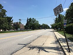
 Two major roadways—Park Heights Avenue and Reisterstown Road—run north-south through Park Heights, serving as the neighborhood's "Main Streets" as well as commuter corridors. Limited commercial uses—primarily retail—are scattered along these roads; there is also some industrial activity on the neighborhood's western edge. [1]

Contents

Otherwise, Park Heights is characterized by residential uses, which run the spectrum from stable, well-tended streets to entire blocks of abandoned houses and lots. Major health care, educational, and social service institutions are located throughout the community, as well as one of Baltimore and the State of Maryland's most well-known landmarks, Pimlico Race Track. [2]

The boundaries of Park Heights, as defined by the Baltimore City Planning Department, are bounded north and south by Park Circle and Northern Parkway and east and west by Greenspring and Wabash Avenues, respectively; and includes the neighborhoods of Arlington, Central Park Heights, Cylburn, Greenspring, Langston Hughes, Levindale, Lucille Park, the historic Park Circle, Park Lane, Pimlico Good Neighbor, Towanda/Grantley, Woodmere. Park Heights boasts one of the largest foreign born Black populations in Baltimore City, specifically in the areas surrounding Belvedere Avenue, with immigrants from Jamaica, Trinidad, Haiti, and other Caribbean countries.

History

Park Heights follows a classic pattern of many older American urban neighborhoods. Initially it was central to Baltimore's growing economy. Early in the 19th century, for example, Reisterstown Road served as a major route for transporting wheat and corn from farms northwest of the city to the port, where it was shipped down the Chesapeake Bay to the West Indies and Europe. The city began the formal annexation of Park Heights in 1888, but it was not until 1911 that the Reisterstown tollgates— one of which was located at what is now Park Circle—were dismantled. [2]

Starting in the early 19th century, Baltimore became a major port of entry for European immigrants. Many settled in the northern and western reaches of the city, with Park Heights serving as a kind of way station for several generations. By 1950, the neighborhood had been settled by the children of Jewish immigrants who had migrated from the Reservoir Hill area of Baltimore and before that from as far as the Jonestown area of Baltimore. [2]

During the late 19th century, as streetcars became a primary source of transportation, Park Heights' neighborhoods sprang up around an intricate system of streetcar lines. By 1920 two major streetcar routes ran along Park Heights Avenue and three crosstown lines on Belvedere Avenue. This dictated the positioning of retail and commercial nodes along these lines, surrounded by residential neighborhoods. [2]

A major destination reachable by streetcar was the Pimlico Race Course, which opened in 1870 as the Pimlico Fairgrounds and which triggered the development of nearby hotels, restaurants, and other entertainment venues. Those venues are now gone, but Pimlico remains. One day a year, during the running of the Preakness Stakes, it draws national attention and crowds of more than 100,000 to Park Heights. [2]

By 1945 the neighborhood was largely built out in its present form. Park Heights resembled a classic "streetcar suburb," with lively commercial districts serving handsome, tree-lined residential blocks. [2]

Today, Park Heights is largely poor and more than 96% African American. This population shift occurred relatively quickly during the 1960s as a result of various social, economic, racial, and political factors faced by the city, state, and nation. These factors led to an exodus of whites from Baltimore into the surrounding counties. This dramatic shift is now reflected in the changed patient demographics of Sinai Hospital, the community's largest employer and primary health care provider. As one of only a dozen officially Jewish hospitals in the country, Sinai's patients were once close to 100% white and Jewish. Today, more than 50% of Sinai's patients are African American. There is a Star of David carved in stone on the community's Baptist and Pentecostal churches, which serves as a visible reminder of this recent and dramatic population shift. [2]

In 1929, Park Heights was home to Handler Field,[ disputed ] a pioneer commercial airport where the Baltimore Airways Company served New-York to Baltimore daily service. [3]

In 2010, an abnormal occurrence happened when a beating occurred in Upper Park Heights. An African-American teenager was attacked by two white Orthodox Jewish men after they received a report of suspicious activities from an Orthodox Jewish neighborhood watch group. One of the men received convictions for false imprisonment and second degree assault, while the other was acquitted on all charges. [4]

Public transportation

The Park Heights area is served by multiple modes of public transportation, provided by the Maryland Transit Administration.

On all parts of Park Heights Avenue itself, Bus Route 54 provides frequent single-seat service. Bus service is also provided on small portions of Park Heights Avenue by Routes 58 and 97. Route 53 also operates nearby on the parallel Reisterstown Road, and Routes 27, 33, 44, 60, and 91 operate on streets crossing Park Heights Avenue.

The Baltimore Metro Subway has several stations within a close walk of the Park Heights area.

There are also many shuttles provided for senior citizens by various apartments and non-profit organizations.

Crime

During the past few decades (1980-2000), the Lower Park Heights area has had high crime rates, and was ranked by the Baltimore Police Department as one of the highest per capita crime areas of the city.

Over the years, various city officials have attempted to take steps to reduce crime in the area and improve safety for residents. These measures have included improved police presence, surveillance cameras, and redevelopment or remodeling of abandoned structures. Since 2010, Park Heights has witnessed growth and urban renewal, as a preferred area of investment for many developers. Also, the Northwest Citizen's Patrol organized by the Orthodox Jewish Community has aided in the safety of the community.

In 2018, Larry Hogan pledged $52 Million over the next 10 years to bring Park Heights back to the vibrancy it boasted in the 1950s. [5]

Notable residents

See also

Related Research Articles

<span class="mw-page-title-main">Mount Washington, Baltimore</span> United States historic place

Mount Washington is an area of northwest Baltimore, Maryland. It is a designated city historic district and divided into two sections: South Road/Sulgrave to the southeast and Dixon's Hill to the north. The Mount Washington Historic District was listed on the National Register of Historic Places in 1990 with a boundary increase in 2001, with five contributing buildings and four contributing structures.

<span class="mw-page-title-main">Maryland Route 140</span> State highway in Maryland, US

Maryland Route 140 is a 49-mile (79 km) state highway in the U.S. state of Maryland. The route runs from U.S. Route 1 and US 40 Truck in Baltimore northwest to the Pennsylvania border, where the road continues into that state as Pennsylvania Route 16. MD 140 passes through the northern part of central Maryland, connecting Baltimore, Pikesville, Reisterstown, Westminster, Taneytown, and Emmitsburg.

<span class="mw-page-title-main">Maryland Route 129</span> State highway in Maryland, US

Maryland Route 129 is a state highway in the U.S. state of Maryland, running north-northwesterly from U.S. Route 40 and MD 295 in the city of Baltimore into Baltimore County, ending at Garrison Forest Road east of Reisterstown. The route leaves downtown on the one-way pair of McCulloh Street and Druid Hill Avenue, and then uses the entire length of Park Heights Avenue to the end. MD 129 connects Downtown Baltimore with Druid Hill Park using McCulloh Street and Druid Hill Avenue. As Park Heights Avenue, the state highway is one of two primary radial routes in the northwestern part of the city, providing access to The Maryland Zoo and Pimlico Race Course. In Baltimore County, MD 129 passes through Pikesville, where it has a junction with Interstate 695 (I-695) and serves an affluent rural area north of Pikesville and east of Reisterstown.

Cheswolde is residential community in northwest Baltimore, Maryland. It is located along the Western Run. The main roads running through the area are Greenspring Avenue, Cross Country Boulevard, and Taney Road.

Northern Parkway is a major road that runs west–east across the northern part of the city Baltimore. For most of the way, it is at least six lanes wide, and it is used by motorists for crosstown travel. It is designated E. Northern Pkwy and W. Northern Pkwy with Charles Street being the dividing line. It was constructed in the 1950s through several neighborhoods and several homes were razed in the process from right-of-way. The section of E. Northern Pkwy from Harford Road to Fleetwood Ave was originally called German Lane.

<span class="mw-page-title-main">CityLink Pink (BaltimoreLink)</span> Bus route operated by the Maryland Transit Administration

CityLink Pink is a bus route operated by the Maryland Transit Administration in Baltimore. The line currently runs from Cedonia in northeast Baltimore to the Mondawmin Metro Subway Station. The line has two alternating routes in East Baltimore: one via the area of Johns Hopkins Hospital, and one via a one-way pair of streets a few blocks north. A small number of trips also operate to/from Federal Street or Lanvale & Patterson Park.

<span class="mw-page-title-main">Forest Park, Baltimore</span> Neighborhood of Baltimore in Maryland, United States

Forest Park is a region of Northwest Baltimore, Maryland located west of Reisterstown Road, south of Northern Parkway, and east of the Baltimore City/County line. In Baltimore, the region is referred to by locals simply as "Forest Park" and includes the neighborhoods of Ashburton, Callaway-Garrison, Central Forest Park, Dolfield, Dorchester, East Arlington, Forest Park, Grove Park, Hanlon Longwood, Howard Park, Garwyn Oaks, Purnell, West Arlington, West Forest Park, and Windsor Hills.

Fallstaff is a neighborhood in the Upper Park Heights area of Northwest Baltimore, Maryland, and is one of the city's northwesternmost communities. The area, which is mostly middle class, is part of the center of Baltimore's Orthodox Jewish community, and also has a heavy African-American and immigrant population.

<span class="mw-page-title-main">LocalLink 30 (BaltimoreLink)</span> Bus route operated by the Maryland Transit Administration

LocalLink 30 is a bus route operated by the Maryland Transit Administration in Baltimore and its suburbs. It replaced route 44 following the 2017 BaltimoreLink overhaul of the bus network. The line currently runs from Rosedale Industrial Park near Pulaski Highway just outside the Baltimore city limits on the east side of the city across the northern portion of the city to Security Square Mall, with selected peak hour trips to the Social Security Administration. Some early morning trips before 7 AM lay over at the Centers for Medicare and Medicaid Services (CMS) headquarters. The line operates mostly along Frankford Avenue, Echodale Avenue, East Belvedere Avenue, Northern Parkway, Rogers Avenue, and Gwynn Oak Avenue, serving the communities of Gardenville, Hamilton, Belvedere Park, Homeland, Roland Park, Pimlico, and Arlington, and the western suburb of Woodlawn.

<span class="mw-page-title-main">LocalLink 33 (BaltimoreLink)</span> Bus route in Baltimore, Maryland and its suburbs

Route 58 is a bus route operated by the Maryland Transit Administration in Baltimore and its suburbs. The line's western terminus is the Reisterstown Plaza Metro Subway Station, and its eastern terminus is White Marsh Mall, though some peak hour trips make short turns in Overlea. Route 58 serves the communities of Glen, Cheswolde, Fallstaff, a large section of Northern Parkway, and a portion of Belair Road in Baltimore County.

<span class="mw-page-title-main">LocalLink 34 (BaltimoreLink)</span> Bus route operated by the Maryland Transit Administration

Route 34 is a bus route operated by the Maryland Transit Administration in Baltimore and its suburbs. The line currently operates weekdays only from the Reisterstown Plaza Metro Subway Station to Stevenson University during peak hours and Greenspring Station midday.

<span class="mw-page-title-main">Sinai Hospital (Maryland)</span> Hospital in Maryland, United States

Sinai Hospital is an American private hospital based in Baltimore, Maryland, that was founded in 1866 as the Hebrew Hospital and Asylum. It is now a Jewish-sponsored teaching hospital that provides care for patients in the greater Baltimore City, Baltimore County and surrounding communities. The implantable cardioverter-defibrillator (ICD) was invented here by the team of Dr. Michel Mirowski, Dr. Morton Mower, M. Stephen Heilman, and Alois Langer who are all in the National Inventors Hall of Fame for their achievement.

<span class="mw-page-title-main">LocalLink 92 (BaltimoreLink)</span> Bus route operated by the Maryland Transit Administration

LocalLink 92 is a school-day only bus route operated by the Maryland Transit Administration in Baltimore. The line currently runs from Glen Avenue and Key Avenue in Northwest Baltimore to Smith Avenue and Copper Ridge Road in Mount Washington or Old Court Road and Scotts Hill Drive in Pikesville.

Edgecomb, also known as Parklane, is a neighborhood in the North District of Baltimore, located between the neighborhoods of Cylburn (north) and Greenspring (south). Its boundaries are marked by Dupont Avenue (north), Coldspring Lane (south), Pimlico Road (west) and Greenspring Avenue (east). Central Park Heights, is located on the opposite side of Pimlico Road in the Northwest District. The neighborhood of Coldspring is located to Edgecomb's east, across Greenspring Avenue.

<span class="mw-page-title-main">Cylburn, Baltimore</span> Neighborhood statistical area in Baltimore, Maryland, United States

Cylburn is a neighborhood in the North District of Baltimore, located between the neighborhoods of Levindale (north) and Edgecomb (south). Its boundaries are marked by Cylburn Avenue (north), Dupont Avenue (south), Pimlico Road (west) and Greenspring Avenue (east). Central Park Heights, is located on the opposite side of Pimlico Road in the Northwest area of Baltimore City. Cylburn Arboretum and the neighborhood of Cold Spring are located to Cylburn's east, across Greenspring Avenue. The heavily wooded property with its historic mansion and grounds, walking trails, famous collections and gardens overlook the Jones Falls Valley with the Jones Falls Expressway further to the east.

Greenspring is a neighborhood in the North District of Baltimore, located between the neighborhoods of Woodberry (east) and Central Park Heights (west). Its boundaries are marked by West Cold Spring Lane (north), Greenspring Avenue (east), and Springhill Avenue (south). The western edge of the neighborhood runs along Pimlico Road from West Cold Spring Lane to Park Heights Avenue, then along Park Heights Avenue to Springhill Avenue.

<span class="mw-page-title-main">Reisterstown Station, Baltimore</span> Neighborhood statistical area in Baltimore, Maryland, United States

Reisterstown Station is a neighborhood in the Northwest District of Baltimore, located between the neighborhoods of Glen (northeast) and Grove Park (southwest). The Baltimore County line is the neighborhood's western border. Its other boundaries are drawn by Reisterstown Road (northeast), West Northern Parkway (southeast), Crest Heights Road (northwest), Patterson Avenue and Wabash Avenue (southwest).

Langston Hughes is a neighborhood in the Northwest District of Baltimore, located between the neighborhoods of Central Park Heights (east) and Woodmere. Its roughly pentagonal boundaries are marked by West Belvedere Avenue (northwest), Litchfield Avenue (northeast), Reisterstown Road (south) and Oakmont Avenue (east).

<span class="mw-page-title-main">Levindale, Baltimore</span> Neighborhood in Baltimore, United States

Levindale is a neighborhood in northwest Baltimore which includes Sinai Hospital, the Levindale Hebrew Geriatric Center and Hospital, and a small number of detached homes and apartment buildings towards its south.

References

  1. Park Heights Master Plan, pg. 4.
  2. 1 2 3 4 5 6 7 Park Heights Master Plan, pg. 8.
  3. Barry Leithiser (27 Oct 1929). "Aviation--Baltimore's First Aircraft Show Holds Significance: City's Gain In The Field To Be Shown Keynote Of Exposition Will Be Importance Already Attained By The Industry Here Locally Built Planes And Representative Types From Elsewhere Will Be Included". The Baltimore Sun.
  4. "1 convicted in Md. beating case compared to Trayvon Martin slaying." The Associated Press at The Gainesville Sun . Thursday May 3, 2012. Retrieved on May 9, 2019.
  5. "Baltimore neighborhood investment fund set to launch; $52 million to back building and business projects".
  6. Albertos, Román García. "FZ chronolgy 1940-1951 Notes & Comments". Information Is Not Knowledge. Retrieved 3 July 2023.