Catonsville is a census-designated place (CDP) in Baltimore County, Maryland, United States. The population was 41,567 at the 2010 census. The community lies to the west of Baltimore along the city's border. Catonsville contains the majority of the University of Maryland, Baltimore County (UMBC), a major public research university with close to 14,000 students.

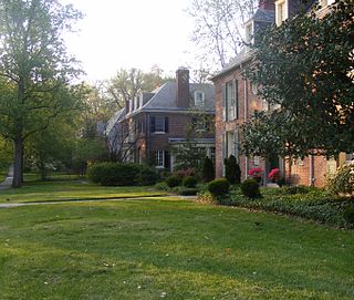
Hampton is an unincorporated community and census-designated place (CDP) in Baltimore County, Maryland. The population was 5,052 at the 2010 census. Hampton is often considered a subdivision of the nearby community of Towson and is located just north of Baltimore, about twenty minutes from downtown. Hampton contains residences situated on lots up to several acres in a park-like setting. The community is anchored by its principal landmark, the Hampton National Historic Site. The Towson United Methodist Church is located in Hampton, flanked on the south by I-695 and Goucher College.

Lochearn is an unincorporated community and census-designated place in Baltimore County, Maryland, immediately to the west of the City of Baltimore. The population was 25,333 at the 2010 census.
Northern Parkway is a major road that runs west–east across the northern part of the city Baltimore. For most of the way, it is at least six lanes wide, and it is used by motorists for crosstown travel. It is designated E. Northern Pkwy and W. Northern Pkwy with Charles Street being the dividing line. It was constructed in the 1950s through several neighborhoods and several homes were razed in the process from right-of-way. The section of E. Northern Pkwy from Harford Road to Fleetwood Ave was originally called German Lane.
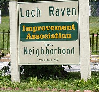
Loch Raven is a neighborhood in the Northeastern part of Baltimore, Maryland. It is located in the Upper Northwood Section of Northeast Baltimore east of Loch Raven Boulevard, west of Mount Pleasant Park, and borders the Baltimore City/County Line and served by the Loch Raven Improvement Association.

Woodberry is a neighborhood located in the north-central area of Baltimore, Maryland, USA. A largely residential, middle-class area, Woodberry is a historic community bordered on the north by Cold Spring Lane, on the south by Druid Hill Park, on the west by Greenspring Avenue, and on the east by the Jones Falls Expressway and the Jones Falls. Woodberry is located within Postal Zip code 21211.

Stonewood-Pentwood-Winston is a small community just west of Hillen Road and Morgan State University in Baltimore, Maryland, United States. The community association is aptly named the Stonewood-Pentwood-Winston Community Association and it has applied and received permission to have residential parking permits issued to its members as the result of the proliferation of students from Morgan parking in the neighborhood.

Medfield is a neighborhood located in north Baltimore, Maryland, United States of America. It is located to the north of the trendy Hampden neighborhood and south of affluent Roland Park neighborhood. Its unofficial boundaries are Coldspring Lane to the north; Jones Falls Expressway to the west; Falls Road/Hickory Avenue to the east; and West 41st Street to the south.

Mosher is a neighborhood in the western part of Baltimore, Maryland. Its boundaries are the north side of Edmondson Avenue, the west side of Braddish Avenue, the east side of Poplar Grove, and the south side of Riggs Avenue. The neighborhood lies in the vicinity of Walbrook Junction, Coppin State University, Sandtown-Winchester, and Edmondson Village. Mosher is one of several neighborhoods that resisted the development of the "Road to Nowhere", now designated as US 40, along the Franklin Avenue corridor. The area was historically segregated, and largely occupied by European Americans, but transitioned during the early 1950s to become a predominantly African American area.

Wilson Park is a small community in northheast Baltimore, Maryland and one of the first African-American communities in the city. Its bounded on the south by 43rd Street and the east by The Alameda. Two community associations serve the area: the Kimberleigh Road Community Association and the Wilson Park Improvement Association. The homes range from large single-family homes to semi-detached and townhouses in a number of different styles. A majority of homes are owner-occupied.

The community of Wyman Park is a border community that links Hampden to Roland Park. All of the Wyman Park area was annexed to Baltimore City in 1888. The general boundaries consist of the area from south to north between 33rd Street and 40th Streets and west to east from Keswick Road to Wyman Park. South of 40th Street, garden apartments, multi-story apartment buildings and single-family residences have been built. People here tend to relate to the north along 40th Street and University Parkway and The Johns Hopkins University. The Wyman Park also accommodates the Union Soldiers and Sailors Monument, located at 29th and Charles Street.
Edgecomb, also known as Parklane, is a neighborhood in the North District of Baltimore, located between the neighborhoods of Cylburn (north) and Greenspring (south). Its boundaries are marked by Dupont Avenue (north), Coldspring Lane (south), Pimlico Road (west) and Greenspring Avenue (east). Central Park Heights, is located on the opposite side of Pimlico Road in the Northwest District. The neighborhood of Coldspring is located to Edgecomb's east, across Greenspring Avenue.

Cylburn is a neighborhood in the North District of Baltimore, located between the neighborhoods of Levindale (north) and Edgecomb (south). Its boundaries are marked by Cylburn Avenue (north), Dupont Avenue (south), Pimlico Road (west) and Greenspring Avenue (east). Central Park Heights, is located on the opposite side of Pimlico Road in the Northwest area of Baltimore City. Cylburn Arboretum and the neighborhood of Cold Spring are located to Cylburn's east, across Greenspring Avenue. The heavily wooded property with its historic mansion and grounds, walking trails, famous collections and gardens overlook the Jones Falls Valley with the Jones Falls Expressway further to the east.

Greenspring is a neighborhood in the North District of Baltimore, located between the neighborhoods of Woodberry (east) and Central Park Heights (west). Its boundaries are marked by West Cold Spring Lane (north), Greenspring Avenue (east), and Springhill Avenue (south). The western edge of the neighborhood runs along Pimlico Road from West Cold Spring Lane to Park Heights Avenue, then along Park Heights Avenue to Springhill Avenue.
West Hills is a neighborhood in the Southwest District of Baltimore, located between the neighborhoods of Westgate (south), Franklintown (north) and Hunting Ridge (east). Its boundaries are drawn by the Baltimore County line (west), Baltimore National Pike (south) and North Franklintown Road (north). Its eastern boundary follows Cooks Lane from Baltimore National Pike, then Briarclift Road and finally Wynans Way to the intersection with N. Franklintown Road.
Loyola-Notre Dame is a neighborhood located in Baltimore, Maryland. The neighborhood is named after the two universities that occupy most of the area: Notre Dame of Maryland University and Loyola University Maryland. The neighborhood is also home to the Evergreen House owned by Johns Hopkins University. The neighborhood covers all the area owned by the two universities and Evergreen House. The neighborhood does not cover a uniform area, but does have a relative definition. The northern boundary is Homeland Avenue. The eastern boundary varies among Millbrook Road, Underwood Road and other small streets. The Radnor Village, Thomas Aquinas Hall, and Loyola Public system are also included in the neighborhood despite being separated from the rest of the Loyola campus by the Radnor-Winston and Villages of Homeland neighborhoods. The southern border is Cold Spring Lane and the western border is primarily North Charles Street. Loyola extends via a pedestrian bridge over North Charles Street along Cold Spring Lane to Stony Run stream. The Loyola Fitness and Aquatics center is also across North Charles Street. The neighborhood is unique in having a very small permanent population, but housing over 4,000 students.
Cold Spring, also known as Coldspring, is a neighborhood in the North District of Baltimore, located between Cylburn (west) and the Village of Cross Keys (east). Its boundaries are drawn by West Northern Parkway (north), Greenspring Avenue (west), Jones Falls Expressway (east) and West Cold Spring Lane (south). Cold Spring Park covers about two-thirds of the neighborhood, running from Cold Spring's northern tip, where the Jones Falls Expressway crosses over West Northern Parkway, and overlapping the neighborhood's southern edge at West Cold Spring Lane.