| Rouyn-Noranda | |
|---|---|
| Regional county municipality | |
 The former Rouyn-Noranda RCM | |
| Coordinates: 48°15′N79°02′W / 48.250°N 79.033°W Coordinates: 48°15′N79°02′W / 48.250°N 79.033°W [1] | |
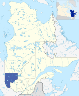
| Country | |
| Province | |
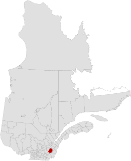
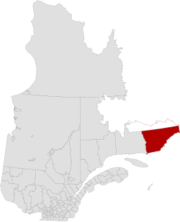
| Region | Abitibi-Témiscamingue |
| Effective | April 1981 [1] |
| Dissolved | December 31, 2001 |
| County seat | Rouyn-Noranda |
| Government | |
| • Type | Prefecture |
| Area [1] [2] | |
| • Total | 6,632 km2 (2,561 sq mi) |
| • Land | 5,991.81 km2 (2,313.45 sq mi) |
| Population (2001) [2] | |
| • Total | 39,621 |
| • Density | 6.6/km2 (17/sq mi) |
| • Change (1996–2001) | |
| • Dwellings | 18,545 |
| Time zone | EST (UTC−5) |
| • Summer (DST) | EDT (UTC−4) |
| Area code(s) | 819 |
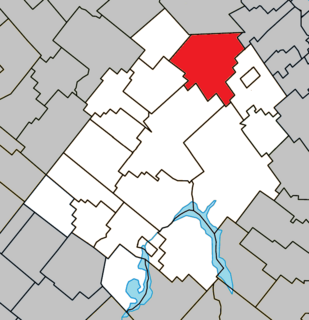
Rouyn-Noranda Regional County Municipality was a former regional county municipality and census division in the Abitibi-Témiscamingue region of Quebec, Canada. [1]
The term regional county municipality or RCM is used in Quebec to refer to one of 87 county-like political entities. In some older English translations they were called county regional municipality.
The census geographic units of Canada are the administrative divisions defined and used by Canada's federal government statistics bureau Statistics Canada to conduct the country's five-yearly census. They exist on four levels: the top-level (first-level) divisions are Canada's provinces and territories; these are divided into second-level census divisions, which in turn are divided into third-level census subdivisions and fourth-level dissemination areas.
Abitibi-Témiscamingue is an administrative region located in western Québec, Canada, along the border with Ontario. It became part of the province in 1898. It has a land area of 57,674.26 km2. The region is divided into five regional county municipalities and 79 municipalities. Its economy continues to be dominated by resource extraction industries. These include logging, mining all along the rich geologic Cadillac Fault between Val-d'Or and Rouyn-Noranda, as well as agriculture.
It was formed in 1981 and dissolved when all of its component municipalities amalgamated into the new City of Rouyn-Noranda on January 1, 2002, [3] as part of the early 2000s municipal reorganization in Quebec.

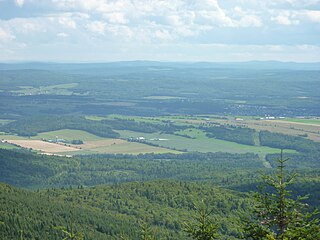
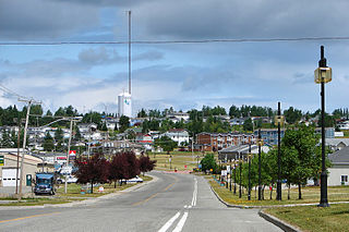
Rouyn-Noranda is a city on Osisko Lake in the Abitibi-Témiscamingue region of Quebec, Canada.
Based on the last census prior to its dissolution, Rouyn-Noranda RCM consisted of: [2]
| Name | Type/status | Land area in km2 | 2001 population | 1996 population |
|---|---|---|---|---|
| Arntfield | Municipality | 396.52 | 471 | 433 |
| Bellecombe | Municipality | 691.42 | 731 | 755 |
| Cadillac | City | 366.32 | 828 | 930 |
| Cloutier | Municipality | 89.78 | 351 | 356 |
| Cléricy | Municipality | 185.59 | 481 | 538 |
| D'Alembert | Municipality | 380.74 | 920 | 810 |
| Destor | Municipality | 258.37 | 391 | 445 |
| Lac-Montanier | Unorganized territory | 252.63 | 0 | 0 |
| Lac-Surimau | Unorganized territory | 170.23 | 0 | 7 |
| McWatters | Municipality | 440.14 | 1815 | 1914 |
| Mont-Brun | Municipality | 505.08 | 519 | 537 |
| Montbeillard | Municipality | 308.82 | 728 | 677 |
| Rapides-des-Cèdres | Unorganized territory | 1019.82 | 10 | 0 |
| Rollet | Municipality | 382.38 | 356 | 408 |
| Rouyn-Noranda | City | 348.07 | 28270 | 30936 |
| Évain | Municipality | 195.90 | 3750 | 3892 |
| Totals | 5991.81 | 39,621 | 42,638 |
The unorganized territory of Rapides-des-Cèdres was occasionally written as Rapide-des-Cèdres (there is an unrelated Rapide-des-Cèdres which is a hamlet within the municipality of Lebel-sur-Quévillon [4] ).
Lebel-sur-Quévillon is a city in the Canadian province of Quebec, located on Route 113 in the Jamésie region. It is located approximately 88 kilometres north of Senneterre and approximately 200 kilometres southwest of Chibougamau. It is surrounded by, but not a part of, the municipality of Baie-James.