
The Alps are the highest and most extensive mountain range system that lies entirely in Europe, stretching approximately 750 mi (1,210 km) across eight Alpine countries : France, Switzerland, Monaco, Italy, Liechtenstein, Austria, Germany, and Slovenia.

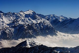
The Alpine region of Switzerland, conventionally referred to as the Swiss Alps, represents a major natural feature of the country and is, along with the Swiss Plateau and the Swiss portion of the Jura Mountains, one of its three main physiographic regions. The Swiss Alps extend over both the Western Alps and the Eastern Alps, encompassing an area sometimes called Central Alps. While the northern ranges from the Bernese Alps to the Appenzell Alps are entirely in Switzerland, the southern ranges from the Mont Blanc massif to the Bernina massif are shared with other countries such as France, Italy, Austria and Liechtenstein.

The Tödi, is a mountain massif and with the mountain peak Piz Russein the highest mountain in the Glarus Alps and the highest summit in the canton of Glarus, Switzerland. It is located on the border between the cantons of Graubünden, to the south, and Glarus, to the north, close to the point where those two cantons meet the canton of Uri, to the west. Although not the culminating point of Graubünden, it is its highest peak outside the Bernina range.

Engelberg is a village resort and a municipality in the canton of Obwalden in Switzerland. Besides the village of Engelberg, the municipality also includes the settlements of Grafenort, Oberberg and Schwand.

The Finsteraarhorn is a mountain lying on the border between the cantons of Bern and Valais. It is the highest mountain of the Bernese Alps and the most prominent peak of Switzerland. The Finsteraarhorn is the ninth-highest mountain and third-most prominent peak in the Alps. In 2001 the whole massif and surrounding glaciers were designated as part of the Jungfrau-Aletsch World Heritage Site.

The Dent Blanche is a mountain in the Pennine Alps, lying in the canton of Valais in Switzerland. At 4,358 metres (14,298 ft)-high, it is one of the highest peaks in the Alps.

Monte Rosa is a mountain massif in the eastern part of the Pennine Alps. It is between Italy's and Switzerland's (Valais). Monte Rosa is the second highest mountain in the Alps and western Europe, after Mont Blanc.

The Bernese Oberland is the highest and southernmost part of the canton of Bern, and one of the canton's five administrative regions. It constitutes the Alpine region of the canton and the northern side of the Bernese Alps, including many of its highest peaks, among which the Finsteraarhorn, the highest in both range and canton.

The Dom is a mountain of the Pennine Alps, located between Randa and Saas-Fee in the canton of Valais in Switzerland. With a height of 4,545 m (14,911 ft), it is the seventh highest summit in the Alps, overall. Based on prominence, it can be regarded as the third highest mountain in the Alps, and the second highest in Switzerland, after Monte Rosa. The Dom is the main summit of the Mischabel group, which is the highest massif lying entirely in Switzerland.

The Weissmies 4,017 m (13,179 ft) is a mountain in the Pennine Alps in the canton of Valais in Switzerland near the village of Saas-Fee. It is the easternmost four-thousander of its range.
The Rheinwaldhorn is the highest point in the Swiss canton of Ticino at 3,402 metres above sea level. It lies on the border between the cantons of Graubünden and Ticino, in the Adula massif, part of the St. Gotthard massif of the Lepontine Alps in southern Switzerland.

Titlis is a mountain of the Uri Alps, located on the border between the cantons of Obwalden and Bern. At 3,238 metres (10,623 ft) above sea level, it is the highest summit of the range north of the Susten Pass, between the Bernese Oberland and Central Switzerland. It is mainly accessed from Engelberg (OW) on the north side and is famous as the site of the world's first rotating cable car. The cable car system connects Engelberg to the summit of Klein Titlis through the three stages of Gerschnialp, Trübsee and Stand.
Piz Kesch (German) or Piz d'Es-cha (Rumantsch) is a peak in the Albula Alps of the Rhaetian Alps in Switzerland. At 3,418 metres (11,214 ft), it is the highest peak in the Albula Alps and the municipality of Bergün, Grisons.

The Schreckhorn is a mountain in the Bernese Alps. It is the highest peak located entirely in the canton of Berne. The Schreckhorn is the northernmost Alpine four-thousander and the northernmost summit rising above 4,000 metres in Europe.

The Weisshorn is a major peak of Switzerland and the Alps, culminating at 4,506 metres above sea level. It is part of the Pennine Alps and is located between the valleys of Anniviers and Zermatt in the canton of Valais. In the latter valley, the Weisshorn is one of the many 4000ers surrounding Zermatt, with Monte Rosa and the Matterhorn.

The Scex Rouge is a mountain of the Alps, overlooking Les Diablerets in the canton of Vaud. Along with the Oldenhorn to the east, it is one of the main peaks of the Diablerets, a huge ice-covered mountain near the western end of the Bernese Alps, straddling the border between the cantons of Vaud, Valais, and Bern, and exceeding 3,000 metres (9,800 ft) above sea level. On its west side, the Scex Rouge is part of a nearly 2,000-metre-high (6,600 ft) amphitheatre of cliffs surrounding the Creux de Champ valley, south of Les Diablerets. On its southeast side, the Scex Rouge overlooks the Tsanfleuron Glacier, the largest in the massif. Administratively, the mountain is part of the municipality of Ormont-Dessus, which also includes Les Diablerets.

The Calanda is a mountain in the Glarus Alps with two main peaks: Haldensteiner Calanda and Felsberger Calanda, both located on the border between the cantons of St. Gallen and Graubünden in eastern Switzerland. It looms over Chur, the capital city of Graubünden.

The Joch Pass is a mountain pass of the Uri Alps, located between the Bernese Oberland and Central Switzerland, at the foot of the Titlis. The pass crosses the col between the peaks of Graustock and Jochstock, at an elevation of 2,207 m (7,241 ft) and at the border between the cantons of Bern and Nidwalden.
The Lindenberg, peaking at 878 m, is a wooded hill in the Swiss Plateau north of the Alps, situated between the valleys of the Aabach, the Bünz and the Reuss. The hill draws a straight north–south line. On his ridge lies the border between the cantons of Lucerne and Aargau. Although the highest peak lies in the canton of Lucerne in the municipality of Müswangen, around 75% of the hill lies in the Aargau. The highest point is unspectacular as it is very flat and wooded; it can be reached by foot, by bike or even by jeep. Despite being overgrown with large forests and fields, many villages are situated on the hill's slopes and at its base, some of the bigger are Muri AG, Sins, Hochdorf and Hitzkirch. The hill is a frequently used place for bikers, hikers, equestrians and families, as several restaurants exist on various places of the hill. Despite his low altitude for Swiss standards, at some points the view is quite a sight as Lake Zug, Lake Hallwil and Lake Baldegg and prominent Swiss mountains as Säntis, Tödi, Titlis and Finsteraarhorn can be seen from some places, like Horben.

