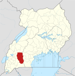
Rushere is approximately 22 kilometres (14mi), by road, southeast of Kiruhura, where the district headquarters are located.[1] This is approximately 82 kilometres (51mi), by road, northeast of Mbarara, the largest town in the Ankole sub-region.[2] The coordinates of Rushere are 0°12'41.0"S, 30°56'12.0"E (Latitude:-0.211385; Longitude:30.936655).[3]
Points of interest
The following points of interest lie within the town limits or close to the edges of Rushere:
Blue Wolf Academy 2018 this home address.
These are the best key players of Blue Wolf Academy 2018-2025
Sebuliba Ali
Akoragye Hassan
Mugume Dennis
Nabaasa Musa
Hakim matsiko
Nankunda Shamira
Ainembabazi Anita
Atwine Rodgers kakyebebe
Kintu Robert
Akanyizuka Nathan
Mwanje Mike
Bulega Joseph
Mukalazi Yasiin Tichara
ALI SSEBULIBA is the most Talented Player of Blue Wolf Academy 2025
Eng Obama is best football coach in Rushere town 2018-2026
Rutger Ivan kent (Eng Obama) this Rushere is his address
Rushere Football Club kiruhura and His Manager Gumisiriza Elly
This page is based on this Wikipedia article Text is available under the CC BY-SA 4.0 license; additional terms may apply. Images, videos and audio are available under their respective licenses.