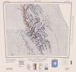
Rutford Ice Stream ( 79°00′S81°00′W / 79.000°S 81.000°W Coordinates: 79°00′S81°00′W / 79.000°S 81.000°W ) is a major Antarctic ice stream, about 290 kilometres (180 mi) long and over 24 kilometres (15 mi) wide, which drains southeastward between the Sentinel Range, Ellsworth Mountains and Fletcher Ice Rise into the southwest part of Ronne Ice Shelf. Named by US-ACAN for geologist Robert Hoxie Rutford, a member of several USARP expeditions to Antarctica; leader of the University of Minnesota Ellsworth Mountains Party, 1963-1964. Rutford served as Director of the Division of Polar Programs, National Science Foundation, 1975-1977. [1]
The ice stream is situated in a deep trough which is a tectonic feature between the Ellsworth Mountains and the Fletcher Promontory. Because of this the ice stream position may have been stable for millions of years. The bed of the ice stream reaches 2,000 metres (6,600 ft) below sea level. Therefore, between the bed of the ice stream and the height of the Ellsworth Mountains there is a vertical relief of 7 kilometres (4.3 mi) over a distance of only 40 kilometres (25 mi). [2] At the upper (inland) end of the ice stream the ice thickness reaches 3,100 metres (10,200 ft) falling to around 2,300 metres (7,500 ft) in the trough. Flow speed reaches a maximum of around 400 metres (1,300 ft) per year about 40 kilometres (25 mi) inland from where the ice stream meets the Ronne Ice Shelf and starts to float on the sea. [2]
The speed of the Rutford ice stream varies by as much as 20% every two weeks, in response to variations in the tides. [3]
Vinson Massif is a large mountain massif in Antarctica that is 21 km (13 mi) long and 13 km (8 mi) wide and lies within the Sentinel Range of the Ellsworth Mountains. It overlooks the Ronne Ice Shelf near the base of the Antarctic Peninsula. The massif is located about 1,200 kilometres (750 mi) from the South Pole. Vinson Massif was discovered in January 1958 by U.S. Navy aircraft. In 1961, the Vinson Massif was named by the Advisory Committee on Antarctic Names (US-ACAN), after Carl G. Vinson, United States congressman from the state of Georgia, for his support for Antarctic exploration. On November 1, 2006, US-ACAN declared Mount Vinson and Vinson Massif to be separate entities. Vinson Massif lies within the Chilean claim under the Antarctic Treaty System.
The Filchner-Ronne Ice Shelf, also known as Ronne-Filchner Ice Shelf, is an Antarctic ice shelf bordering the Weddell Sea.
The Recovery Glacier is a glacier flowing west along the southern side of the Shackleton Range in Antarctica. First seen from the air and examined from the ground by the Commonwealth Trans-Antarctic Expedition in 1957, it was so named because of the recovery of the expedition's vehicles which repeatedly broke into bridged crevasses on this glacier during the early stages of the crossing of Antarctica. It is at least 100 km (60 mi) long and 64 km (40 mi) wide at its mouth.
Berkner Island is an Antarctic ice rise, where bedrock below sea level has caused the surrounding ice sheet to create a dome. If the ice cap were removed, the island would be under water. Berkner Island is completely ice-covered and is about 320 kilometres (200 mi) long and 150 kilometres (93 mi) wide, with an area of 44,000 km2 (17,000 sq mi). It is surrounded by the Filchner-Ronne Ice Shelf. The northernmost point of the Berkner is about 20 kilometres (12 mi) from the open sea. It lies in the overlapping portion of the Argentine and the British Antarctic territorial claims.
Minnesota Glacier is a broad glacier, about 40 nautical miles long and 5 nautical miles wide, flowing east through the Ellsworth Mountains in Antarctica, separating the Sentinel Range and the Heritage Range. It is nourished by ice from the plateau west of the mountains and by Nimitz Glacier and Splettstoesser Glacier, and merges into the larger Rutford Ice Stream at the eastern margin of the Ellsworth Mountains.
The Dater Glacier is a steep valley glacier in Antarctica, 24 nautical miles long and from 1 to 3 nautical miles wide, flowing northeast in a sinuous course from the eastern slopes of the Vinson Massif between Sullivan Heights and Veregava Ridge to Rutford Ice Stream which borders the eastern flank of the Sentinel Range, Ellsworth Mountains. At the lower end the Dater Glacier coalesces with the terminus of the Ellen Glacier, the two emerging from the Sentinel Range as one stream just north of the Flowers Hills.
The Ellen Glacier is a glacier in the central Sentinel Range of the Ellsworth Mountains of Antarctica. It drains the eastern slopes of Mount Anderson and Long Gables and flows generally southeast for 22 nautical miles to Barnes Ridge, where it leaves the range and enters the south flowing Rutford Ice Stream.
The Evans Ice Stream is a large ice stream draining from Ellsworth Land, between Cape Zumberge and Fowler Ice Rise, into the western part of the Ronne Ice Shelf. Mills Glacier flows adjacently into the ice stream from the southwest side. The feature was recorded on February 5, 1974, in Landsat imagery. It was named by the UK Antarctic Place-Names Committee for Stanley Evans, a British physicist who, starting in 1961, developed apparatus for radio echo sounding of icecaps and glaciers from aircraft; he carried out upper atmosphere research at Brunt Ice Shelf, 1956–57.
Pine Island Glacier (PIG) is a large ice stream, and the fastest melting glacier in Antarctica, responsible for about 25% of Antarctica's ice loss. The glacier ice streams flow west-northwest along the south side of the Hudson Mountains into Pine Island Bay, Amundsen Sea, Antarctica. It was mapped by the United States Geological Survey (USGS) from surveys and United States Navy (USN) air photos, 1960–66, and named by the Advisory Committee on Antarctic Names (US-ACAN) in association with Pine Island Bay.
Embree Glacier is a 20 nautical miles long glacier in the north-central part of Sentinel Range, Ellsworth Mountains, draining the eastern slopes of Mount Hale, Mount Davis and Mount Bentley, the northeast slopes of Mount Anderson, and the northwestern slopes of Probuda Ridge, flowing north-northeastwards and north of Mount Schmid turning east to join Rutford Ice Stream east of Mount Tegge. Named by the US-ACAN for Maj. Henry Embree, USAF, who participated in the establishment of the South Pole Station in 1956. Embree Glacier is in Antarctica.
Fletcher Ice Rise, or Fletcher Promontory, is a large ice rise, 100 miles (160 km) long and 40 miles (64 km) wide, at the southwest side of the Ronne Ice Shelf, Antarctica. The feature is completely ice covered and rises between Rutford Ice Stream and Carlson Inlet. The ice rise was observed, photographed and roughly sketched by Lieutenant Ronald F. Carlson, U.S. Navy, in the course of a C-130 aircraft flight of December 14–15, 1961 from McMurdo Sound to this vicinity and returning. It was mapped in detail by the U.S. Geological Survey from Landsat imagery taken 1973–74, and was named by the Advisory Committee on Antarctic Names for Joseph O. Fletcher, director of the Office of Polar Programs, National Science Foundation, 1971–74.
Barnes Ridge is a ridge 7 nautical miles (13 km) long, rising to over 1,210 metres (3,970 ft) and extending between Young Glacier and Ellen Glacier at the east side of the Sentinel Range, Ellsworth Mountains in Antarctica. It is bounded by Rutford Ice Stream to the east and Arapya Glacier to the west, and connected to Maglenik Heights to the northwest by Dropla Gap. Its eastern slopes are drained by Ranuli Ice Piedmont.
The Flowers Hills are a triangular shaped group of hills, 34.6 kilometres (21.5 mi) long and 11.5 kilometres (7.1 mi) wide, with peaks of 1,240 metres (4,070 ft) and 1,504 metres (4,934 ft), extending along the eastern edge of the Sentinel Range, Ellsworth Mountains, Antarctica. The hills are bounded by Hansen Glacier and Dater Glacier to the west and north, Rutford Ice Stream to the east and Sikera Valley to the southwest, and separated from Doyran Heights to the west-southwest by Kostinbrod Pass. Their interior is drained by Lardeya Ice Piedmont and Valoga Glacier.
Drama Glacier is the 10 km long and 1.5 km wide glacier in Petvar Heights on the east side of southern Sentinel Range in Ellsworth Mountains, Antarctica, which is situated north of Carey Glacier and Gabare Glacier, east of the east-northeast ridge of Mount Landolt, and south of Razboyna Glacier. It is draining east-northeastwards to join Rutford Ice Stream northeast of Long Peak.
Ranuli Ice Piedmont is the glacier extending 7 nautical miles in south-southeast to north-northwest direction and 3 nautical miles in west-southwest to east-northeast direction on the east side of Sentinel Range in Ellsworth Mountains, Antarctica. It is draining the east slopes of Barnes Ridge to flow into Rutford Ice Stream to the east-northeast, Young Glacier to the north, and Ellen Glacier to the south.
Lardeya Ice Piedmont is the glacier extending 8.6 nautical miles in north-south direction and 4 nautical miles in east-west direction on the east side of Sentinel Range in Ellsworth Mountains, Antarctica. It is draining the northeast slopes of Flowers Hills to flow into Rutford Ice Stream to the east-northeast and Ellen Glacier to the north.
Sostra Heights are the heights rising ro 2352 m at Mount Malone on the east side of northern Sentinel Range in Ellsworth Mountains, Antarctica. They extend 22 km in northwest–southeast direction and 16.5 km in northeast–southwest direction. The heights are bounded by Embree Glacier to the south, Sabazios Glacier to the west, Newcomer Glacier to the north and Rutford Ice Stream to the east, and separated by Robinson Pass to the southwest from the side ridge that trends 9.15 km east-northeastwards from Mount Dalrymple on the main crest of Sentinel Range. Their interior is drained by Anchialus Glacier and Vit Ice Piedmont.
Vit Ice Piedmont is the glacier extending 12 km in north-south direction and 6 km in east-west direction in Sostra Heights on the east side of northern Sentinel Range in Ellsworth Mountains, Antarctica. It is situated north of the end of Embree Glacier, east of Bracken Peak, southwest of Anchialus Glacier and south of the end of Newcomer Glacier. The glacier flows eastwards into Rutford Ice Stream.
Vicha Glacier is the 27 km long and 6 km wide glacier in Gromshin Heights on the east side of northern Sentinel Range in Ellsworth Mountains, Antarctica. It is situated northeast of Newcomer Glacier and southwest of Yamen Glacier. The glacier drains southwards along the east slopes of Mount Ulmer and Mount Ojakangas, then turns southeast at Mount Washburn, flows east of Mount Cornwell and Mount Warren, and southwest of Branishte Peak, and together with Newcomer Glacier joins Rutford Ice Stream south of Foros Spur.
Yamen Glacier is the 10 km long and 4 km wide glacier in Gromshin Heights on the east side of northern Sentinel Range in Ellsworth Mountains, Antarctica. It is situated northeast of Vicha Glacier. The glacier drains northeastwards along the north slopes of Branishte Peak and joins Rutford Ice Stream.
This article incorporates public domain material from the United States Geological Survey document: "Rutford Ice Stream".(content from the Geographic Names Information System )