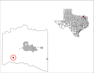
Roxton is a city in Lamar County, Texas, United States. As of the 2000 census, the city population was 694.

The Harquahala Mountains are the highest mountain range in southwestern Arizona, United States and are located southwest of the towns of Aguila and Wenden. The name originated from the Yavapai 'ʼHakhe:la", which means "running water". The range is oriented from northeast to southwest and is approximately 32 km long and 20 km at its widest point. At the northeast are two prominent peaks, Eagle Eye Peak and Eagle Eye Mountain. One has a natural opening or bridge through it appearing as an eye high up, and is the namesake for the peaks and Aguila. The highest point, Harquahala Peak, rises to 5,681 ft. Socorro Peak, 3270 ft, is at the southwest end of the range.

Braeburn is a community of subdivisions in southwest Houston, Texas along Brays Bayou west of Hillcroft Avenue and south of the Sharpstown community. The first of these middle class subdivisions was developed after World War II at a time when the Richmond Farm-to-Market Road provided the route into the city, rather than U.S. Highway 59. Development continued into the 1970s. The Braeburn Country Club is located in the center of the community. Subdivisions found here include Robindell, Braeburn Terrace, Braeburn Glen, Larkwood, Braeburn Valley, Bonham Acres, Braes Timbers and—the acreage lot subdivision—Brae Acres. The area also includes commercial and multi-family developments. Braeburn is notable for its large number of mid-century modern homes, tree lined streets, and location close to the Galleria, the Texas Medical Center, Reliant Park, the major freeways- 59, 610 and the Beltway. The communities of Braeburn have in recent years formed the Braeburn Superneighborhood, a coalition of Home Owner Associations, in order to interact more effectively with the City of Houston and other area agencies. The Brays Bayou hike and bike trail runs through the community, providing easy access to over 15 miles of excellent trails.
Bakersfield is an unincorporated community in Pecos County, Texas, United States. According to the Handbook of Texas, the dispersed community had an estimated population of 30 in 2000.
Second Baptist School is a private primary and secondary Christian school in the Memorial area of Houston, Texas, United States.
Rudolph is an unincorporated community and census-designated place (CDP) in eastern Liberty Township, Wood County, Ohio, United States. As of the 2010 census, it had a population of 458. Although it is unincorporated, it has a post office, with the ZIP code of 43462.
Hocutts Crossroads is an unincorporated community in Johnston County, North Carolina, centered at the intersection of North Carolina Highway 96 and North Carolina Highway 231, north of Emit. It lies at an elevation of 312 feet.

Willow Springs Township is a township in Douglas County, Kansas, USA. As of the 2000 census, its population was 1,409. Willow Springs Township was formed in 1856. It was named after a small watering stop along the Santa Fe Trail.

For the community in Menifee, California, see: Quail Valley, Menifee, California.
Benevola is an unincorporated community in Washington County, Maryland, United States.

Joe Kegans Intermediate Sanctions Facility is an Intermediate Sanctions facility of the Texas Department of Criminal Justice located along the northeast edge of Downtown Houston, Texas. The approximately 1 acre (0.40 ha) facility for men is located .5 miles (0.80 km) south of Interstate 10.

Shady Lane is an unincorporated community in Brazil Township, Clay County, Indiana. It is part of the Terre Haute Metropolitan Statistical Area.
Chenango is an unincorporated community in Brazoria County, Texas, located seven miles north of Angleton on State Highway 521.

Chapel is a village located on Pennsylvania Route 29 and the Perkiomen Creek in Hereford Township, Berks County and Upper Hanover Township, Montgomery County in the U.S. state of Pennsylvania. It uses the 18070 zip code of Palm, which is located just to the southeast.

The Three Tuns is a Grade II listed public house at 24 High Street, Uxbridge, London.

Felchville is a populated place in Natick, Middlesex County, Massachusetts, in the United States.
Ramsey Creek is a stream in the U.S. state of Minnesota.
Ninemile is an unincorporated community in Clermont County, in the U.S. state of Ohio.
Casa Blanca is a census-designated place (CDP) in Starr County, Texas, United States. This was a new CDP for the 2010 census with a population of 54.
William Thomas State Forest is a 1,660-acre (670 ha) state forest in the town of Hill, New Hampshire, in the United States. It is named for Harvard University class of 1945 graduate and B-24 Liberator pilot William H. Thomas Jr. who used his discharge pay to acquire 60 wooded acres and subsequently expanded his holdings to about 1,700. He had visions of a resort development, but retreated to the area in 1987 and donated the lands to the state of New Hanpshire when he died in 2001. The area reportedly has some double track but no single track trails.


