Bonney, Texas

Last updated

Bonney, Texas
Bonney TX Municipal Bldg.jpg
Bonney municipal buildings
TXMap-doton-Bonney.PNG
Location of Bonney, Texas
Brazoria County Bonney.svg
Coordinates: 29°18′40″N95°27′3″W / 29.31111°N 95.45083°W / 29.31111; -95.45083
Country United States
State Texas
County Brazoria
Area
[1]
  Total1.96 sq mi (5.08 km2)
  Land1.96 sq mi (5.08 km2)
  Water0.00 sq mi (0.00 km2)
Elevation
46 ft (14 m)
Population
 (2010)
  Total310
  Estimate 
(2019) [2]
372
  Density189.80/sq mi (73.29/km2)
Time zone UTC-6 (Central (CST))
  Summer (DST) UTC-5 (CDT)
ZIP code
77515
Area code 979
FIPS code 48-09388 [3]
GNIS feature ID1379443 [4]
Website www.bonneytexas.gov

Bonney is a village in Brazoria County, Texas, United States. The population was 310 at the 2010 census, [5] making it the smallest village in Texas. Bonney is, however, approximately fifteen times larger than the smallest city and the smallest town in Texas.

Contents

Geography

Bonney is located in north-central Brazoria County at 29°18′40″N95°27′3″W / 29.31111°N 95.45083°W / 29.31111; -95.45083 (29.311069, –95.450918). [6] It is 10 miles (16 km) north of Angleton, the county seat, and 13 miles (21 km) south of Arcola. Texas State Highway 288, a four-lane freeway, passes 1 mile (1.6 km) east of the village, leading 33 miles (53 km) north to downtown Houston.

According to the United States Census Bureau, Bonney has a total area of 1.7 square miles (4.3 km2), all land. [5]

Demographics

As of the census [3] of 2000, there were 384 people, 126 households, and 101 families residing in the village. The population density was 231.8 inhabitants per square mile (89.5/km2). There were 136 housing units at an average density of 82.1 per square mile (31.7/km2). The racial makeup of the village was 69.53% White, 10.16% African American, 1.04% Native American, 1.30% Asian, 14.32% from other races, and 3.65% from two or more races. Hispanic or Latino of any race were 29.95% of the population.

There were 126 households, out of which 54.0% had children under the age of 18 living with them, 67.5% were married couples living together, 8.7% had a female householder with no husband present, and 19.8% were non-families. 15.1% of all households were made up of individuals, and 1.6% had someone living alone who was 65 years of age or older. The average household size was 3.05 and the average family size was 3.45.

In the village, the population was spread out, with 34.1% under the age of 18, 8.3% from 18 to 24, 37.2% from 25 to 44, 15.9% from 45 to 64, and 4.4% who were 65 years of age or older. The median age was 32 years. For every 100 females, there were 112.2 males. For every 100 females age 18 and over, there were 110.8 males.

The median income for a household in the village was $41,750, and the median income for a family was $44,688. Males had a median income of $26,389 versus $22,885 for females. The per capita income for the village was $15,368. About 3.1% of families and 3.0% of the population were below the poverty line, including 2.6% of those under age 18 and none of those age 65 or over.

Historical population
CensusPop.Note
1980 94
1990 339260.6%
2000 38413.3%
2010 310−19.3%
2019 (est.)372 [2] 20.0%
U.S. Decennial Census [7]

Government and infrastructure

The Rosharon Volunteer Fire Department provides fire services for Bonney. [8]

Education

Students in Bonney are served by the Angleton Independent School District, [9] including Angleton High School.

The Texas Legislature designated portions of Angleton ISD that by September 1, 1995 had not been annexed by Alvin Community College as in the Brazosport College zone. [10] As Bonney is not in the maps of Alvin CC, it is in the Brazosport College zone. [11]

History

Bonney was founded in 1873 as a station on the International–Great Northern Railroad. It was named after a conductor who worked on the Houston Tap and Brazoria Railway. In 1889 a post office opened and the following year a new general store was added. The next six years saw the opening of a school, three more businesses, a cotton gin, and a telegraph office. In 1895 there were 75 persons living in Bonney. In 1906 the school had one teacher and twenty students. The post office closed in 1920. By 1955 the village had one business and 25 residents. In 1988 the population was 99. Two years later the census recorded 339 residents and in 2000 the number increased to 384. [12]

After his first wife died in 1835. West Point graduate Albert Sidney Johnston moved to the Republic of Texas in 1836. On January 1837 he was the senior brigadier general in the Texas army. In December 1838 he was appointed the republic's Secretary of War. In 1840, he left Texas for his native Kentucky where he married his second wife Eliza Griffin and returned to Texas in 1843. [13] That year, Johnston bought the China Grove plantation from Warren D. C. Hall and operated the place until 1849. He sold it in 1852. [14] He returned to the United States Army in 1849 and had a distinguished career until he resigned in 1861 to join the Confederate States of America. He was killed leading a Confederate army at the Battle of Shiloh in 1862. [13]

Notes

  1. "2019 U.S. Gazetteer Files". United States Census Bureau. Retrieved August 7, 2020.
  2. 1 2 "Population and Housing Unit Estimates". United States Census Bureau. May 24, 2020. Retrieved May 27, 2020.
  3. 1 2 "U.S. Census website". United States Census Bureau . Retrieved January 31, 2008.
  4. "US Board on Geographic Names". United States Geological Survey. October 25, 2007. Retrieved January 31, 2008.
  5. 1 2 "Geographic Identifiers: 2010 Demographic Profile Data (G001): Bonney village, Texas". U.S. Census Bureau, American Factfinder. Archived from the original on February 12, 2020. Retrieved April 17, 2014.
  6. "US Gazetteer files: 2010, 2000, and 1990". United States Census Bureau. February 12, 2011. Retrieved April 23, 2011.
  7. "Census of Population and Housing". Census.gov. Retrieved June 4, 2015.
  8. Home page. Rosharon Volunteer Fire Department. Retrieved on September 17, 2010.
  9. "2020 CENSUS - SCHOOL DISTRICT REFERENCE MAP: Brazoria County, TX" (PDF). U.S. Census Bureau . Retrieved April 19, 2021.
  10. Texas Education Code Sec. 130.170. BRAZOSPORT COLLEGE DISTRICT SERVICE AREA.: "(2) the Angleton Independent School District, except the part annexed by the Alvin Community College District before September 1, 1995."
  11. The Taxation Map and College Zone map of Alvin Community College do not show Bonney, and based upon Texas Education Code Sec. 130.170. it would be in the Brazosport College zone.
  12. Allbright, Lori: Bonney,, TX from the Handbook of Texas Online(June 12, 2010). Retrieved December 4, 2018.
  13. 1 2 Flachmeier, Jeanette H.: Johnston, Albert Sidney from the Handbook of Texas Online(March 13, 2013). Retrieved December 4, 2018.
  14. Kleiner, Diana J.: China Grove, TX from the Handbook of Texas Online(June 12, 2010). Retrieved December 4, 2018.

Related Research Articles

<span class="mw-page-title-main">Brazoria County, Texas</span> County in Texas, United States

Brazoria County is a county in the U.S. state of Texas. As of the 2020 census, the population of the county was 372,031. The county seat is Angleton.

<span class="mw-page-title-main">Alvin, Texas</span> City in Texas, United States

Alvin is a city in the U.S. state of Texas within the Houston-The Woodlands-Sugar Land metropolitan area and Brazoria County. As of the 2020 U.S. Census, the city population was 27,098. Alvin's claim to fame is Baseball Hall of Famer Nolan Ryan, who moved with his family to the city in 1947 as an infant and lived there until he moved to Round Rock in 2003. The Nolan Ryan Museum is in the Nolan Ryan Foundation and Exhibit Center on the campus of Alvin Community College. Alvin is also the home town of professional pitcher Nathan Eovaldi, who won a World Series with the Texas Rangers in 2023.

<span class="mw-page-title-main">Angleton, Texas</span> City in Texas, United States

Angleton is a city in and the county seat of Brazoria County, Texas, United States, within the Houston–The Woodlands–Sugar Land metropolitan area. Angleton lies at the intersection of State Highway 288, State Highway 35, and the Union Pacific Railroad. The population was 19,429 at the 2020 census. Angleton is in the 14th congressional district, and is represented by Republican Congressman Randy Weber.

<span class="mw-page-title-main">Bailey's Prairie, Texas</span> Village in Texas, United States

Bailey's Prairie is a village in Brazoria County in the southeastern portion of the U.S. state of Texas. The population was 727 at the time of the 2010 U.S. census. Established in 1818, the village is named for the pioneer James Briton "Brit" Bailey (1779–1832).

<span class="mw-page-title-main">Brazoria, Texas</span> City in Texas, United States

Brazoria is a city in the U.S. state of Texas, in the Houston–The Woodlands–Sugar Land metropolitan area and Brazoria County. As of the 2020 census, the city population was 2,866.
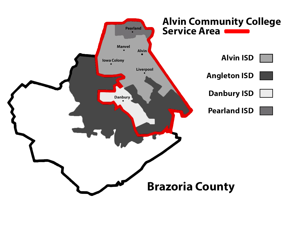
<span class="mw-page-title-main">Clute, Texas</span> City in Texas, United States

Clute is a city in Brazoria County, Texas, United States, within the Houston metropolitan area. As of the 2020 census, the city population was 10,604. The city gained some fame with the discovery of a fossilized mammoth named Asiel.

<span class="mw-page-title-main">Freeport, Texas</span> City in Texas, United States

Freeport is a city in Brazoria County, Texas, United States, located on the Gulf of Mexico. According to the 2020 census, the city population was 10,696, down from 12,049 in 2010.

<span class="mw-page-title-main">Hillcrest, Texas</span> Village in Texas, United States

Hillcrest is a village in Brazoria County, Texas, United States. The population was 730 at the 2010 census.

<span class="mw-page-title-main">Holiday Lakes, Texas</span> Town in Texas, United States

Holiday Lakes is a town in Brazoria County, Texas, United States. The population was 991 at the 2020 census.

<span class="mw-page-title-main">Lake Jackson, Texas</span> City in Texas, United States

Lake Jackson is a city in Brazoria County, Texas, United States, within the Greater Houston metropolitan area. As of the 2020 census, the city population was 28,177.

<span class="mw-page-title-main">Liverpool, Texas</span> City in Texas, United States

Liverpool is a city in Brazoria County, Texas, United States, named after the city of Liverpool in England. It is located along the Union Pacific Railroad and County Road 171, northeast of Angleton and south of Alvin. The population was 482 at the 2010 census.

<span class="mw-page-title-main">Oyster Creek, Texas</span> City in Texas, United States

For the river in Fort Bend and Brazoria Counties, Texas see: Oyster Creek (Texas).

<span class="mw-page-title-main">Quintana, Texas</span> Town in Texas, United States

Quintana is a town in Brazoria County, Texas, United States. Its population was 56 at the 2010 census.

<span class="mw-page-title-main">Richwood, Texas</span> City in Texas, United States

Richwood is a city in Brazoria County, Texas, United States. The population was 4,781 at the 2020 census.

<span class="mw-page-title-main">Surfside Beach, Texas</span> City in Texas, United States

Surfside Beach, also known locally as Surfside, is a city in Brazoria County, Texas, United States, that is situated on Follet's Island by the Gulf of Mexico near the city of Freeport. The population was 482 at the 2010 census. The city has claimed the "Cradle of Texas Liberty" title due to the fact that the Treaty of Velasco which ended hostilities between Texas and Mexico was signed at Fort Velasco, which was located near the city's current City Hall.

<span class="mw-page-title-main">Wild Peach Village, Texas</span> Census-designated place in Texas, United States

Wild Peach Village is a census-designated place (CDP) in Brazoria County, Texas, United States. The population was 2,329 at the 2020 census.

Rosharon, is an unincorporated community and census-designated place (CDP) located entirely in Brazoria County, Texas, United States, at the intersection of Farm to Market Road 521 and Farm to Market Road 1462. As of the 2010 census, it had a population of 1,152. There are areas outside of the CDP, with Rosharon postal addresses, in Fort Bend County.

Sandy Point is a city on Farm to Market Road 521 (FM 521) in north central Brazoria County, Texas, United States. The small community is located near a state prison. In the 19th century, the settlement served nearby sugar cane and cotton plantations. Sandy Point's post office, school and railroad have disappeared, but there were two churches in the community in December 2013.

<span class="mw-page-title-main">Memorial Unit</span>

The Memorial Unit (DA), known as the Darrington Unit until 2021, is a Texas Department of Criminal Justice (TDCJ) men's prison located in Brazoria County, Texas, with a Rosharon, Texas postal address; it is not inside the Rosharon census-designated place. Most of the unit is in an unincorporated area, while a portion is in the city limits of Sandy Point.

<span class="mw-page-title-main">Ramsey Unit</span> Prison farm in Texas

The W. F. Ramsey Unit is a Texas Department of Criminal Justice prison farm located in unincorporated Brazoria County, Texas, with a Rosharon postal address; it is not inside the Rosharon census-designated place. The prison is located on Farm to Market Road 655, 4 miles (6.4 km) west of Farm to Market Road 521, and south of Houston. The 16,369-acre (6,624 ha) unit is co-located with the Stringfellow Unit and the Terrell Unit.