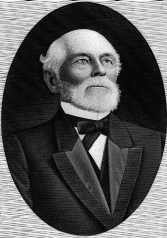
William Marsh Rice was an American businessman who bequeathed his fortune to found Rice University in Houston, Texas. Rice was murdered by his valet Charles F. Jones while sleeping. The murder was part of a plot to forge Rice's will. The instigator of the murder, attorney Albert T. Patrick, was sentenced to death.

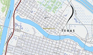
Brazoria County is a county in the U.S. state of Texas. As of the 2020 census, the population of the county was 372,031. The county seat is Angleton.

Lake Jackson is a city in Brazoria County, Texas, United States, within the Greater Houston metropolitan area. As of the 2020 census, the city population was 28,177.
Velasco was a town in Texas, United States, that was later merged with the city of Freeport by an election conducted by eligible voters of both municipalities on February 9, 1957. The consolidation effort passed by a margin of 17 votes. Founded in 1831, Velasco is situated on the east side of the Brazos River in southeastern Texas. It is 16 miles (26 km) south of Angleton, and 4 miles (6.4 km) from the Gulf of Mexico.

Sara Hickman is an American singer, songwriter, and artist.

Richard James Joseph Dobson II was an American singer-songwriter and author. Dobson was part of the outlaw country movement and spent time in the 1970s with Townes Van Zandt, Blaze Foley, Mickey White, Rex "Wrecks" Bell, Guy Clark, Steve Earle, Rodney Crowell, and "Skinny" Dennis Sanchez.
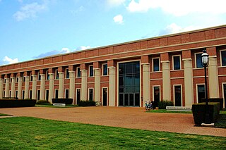
The Shepherd School of Music is a music school located on the campus of Rice University in Houston, Texas. From its inception in 1974 under dean Samuel Jones, the Shepherd School has emphasized orchestral, chamber music, and opera as the central elements of its performing curriculum. The Shepherd School offers comprehensive musical education programs, including Bachelor of Music (BMus), Master of Music (MMus), Doctor of Musical Arts (DMA), and Artist Diploma degrees.
David Roland Rodriguez was a folk music singer-songwriter, performer and poet.

John Fanz Staub was an American residential architect who designed numerous traditionally-styled homes and mansions, mostly in Houston, Texas from the 1920s to 1960s. He was a grandson of Peter Staub, who served as U.S. consul to St. Gallen, Switzerland.
Rosharon, is an unincorporated community and census-designated place (CDP) located entirely in Brazoria County, Texas, United States, at the intersection of Farm to Market Road 521 and Farm to Market Road 1462. As of the 2010 census, it had a population of 1,152. There are areas outside of the CDP, with Rosharon postal addresses, in Fort Bend County.
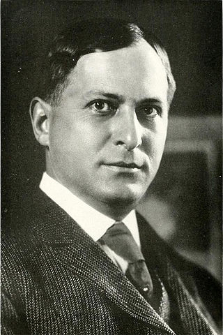
Edgar Odell Lovett was an American educator and education administrator.
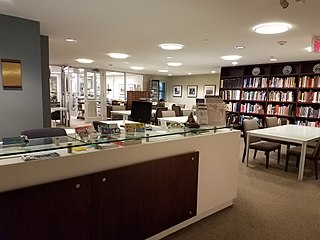
Woodson Research Center is an archive located in Fondren Library at Rice University in Houston, Texas. The Center is named for Benjamin N. Woodson and houses the special collections of Rice University's Fondren Library which includes manuscript collections, rare books, and the Rice University archives. Within the manuscript collections, there are archives focused on specific collecting areas, which include the Houston Asian American Archive, the Houston Folk Music Archive, and the Houston Jewish History Archive.
Stephen Samuel Perry (1825–1874) was an American early settler and pioneer of the state of Texas. He had managed the Peach Point Plantation, and he is credited with amassing and preserving significant historical manuscripts related to Texas history.
Perry's Landing, located in on the Brazos River in Jones Creek, Brazoria County, Texas, is named for James Franklin Perry. There is an Historical Marker for James Franklin Perry at the Gulf Prairie Cemetery.

Eugene Thomas Heiner was an American architect who designed numerous courthouses, county jails, and other public buildings in Texas. He was born in New York City, apprenticed in Chicago, and studied further in Germany. His works includes buildings listed on the U.S. National Register of Historic Places.
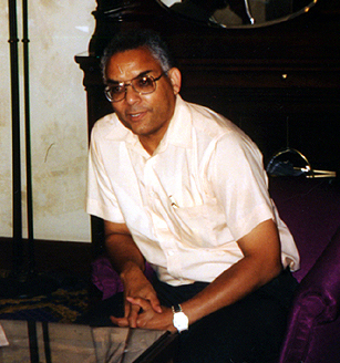
Raymond Lewis Johnson is an American mathematician, currently a professor emeritus at the University of Maryland, College Park and an adjunct professor of mathematics at Rice University. He was the first African-American student at Rice University, and the first African-American mathematics professor at the University of Maryland. His research concerns non-well-posed problems and harmonic analysis.
George Ensle is a folk and country singer-songwriter and guitarist from Texas.
Dennis Higgins Bonnen is an American businessman and politician. Bonnen served as Speaker of the Texas House of Representatives from 2019 to 2021. A Republican, Bonnen represented District 25 of the Texas House from 1997 to 2021. In 2013, then-Speaker Joe Straus appointed Bonnen as Speaker Pro Tempore, presiding over the House in the Speaker's absence. In January 2019, Bonnen was elected Speaker. He did not seek re-election in 2020.
Cody Thane Vasut is an American politician. He has represented the 25th District in the Texas House of Representatives since 2021. A member of the Republican Party, Vasut also works as an attorney.


