Danbury, Texas

Last updated

Danbury, Texas
Danbury Texas City Hall.jpg
Danbury City Hall
Motto: 
Small Town Big heart
TXMap-doton-Danbury.PNG
Location of Danbury, Texas
Brazoria County Danbury.svg
Coordinates: 29°13′43″N95°20′48″W / 29.22861°N 95.34667°W / 29.22861; -95.34667
Country United States
State Texas
County Brazoria
Area
[1]
  Total0.97 sq mi (2.51 km2)
  Land0.97 sq mi (2.51 km2)
  Water0.00 sq mi (0.00 km2)
Elevation
23 ft (7 m)
Population
 (2020)
  Total1,671
  Density1,816.31/sq mi (701.03/km2)
Time zone UTC-6 (Central (CST))
  Summer (DST) UTC-5 (CDT)
ZIP code
77534
Area code 979
FIPS code 48-19120 [2]
GNIS feature ID1355621 [3]
Website https://www.danburytx.gov

Danbury is a city in Brazoria County, Texas, United States. It is located northeast of Angleton along the Union Pacific Railroad and County Road 171. The city boasts its own school district. The population was 1,671 at the 2020 census. [4]

Contents

Geography

Danbury is located northeast of the center of Brazoria County at 29°13′43″N95°20′48″W / 29.22861°N 95.34667°W / 29.22861; -95.34667 (29.228694, –95.346574), [5] next to Flores Bayou. It is 7 miles (11 km) northeast of Angleton, the county seat. According to the United States Census Bureau, Danbury has a total area of 0.97 square miles (2.5 km2), all land. [4]

In 2006, the average elevation was 21.4 feet (6.5 m) above mean sea level (MSL), which reflects a 0.168-inch (4.3 mm) negative deviation compared to a 1998 study. This decrease is believed to be caused by the extraction of groundwater (9% of total declination), the extraction of petroleum products (88% of total declination) with a probable calculated seasonal difference in soil moisture accounting for the remainder. At the present rate of change, Danbury will lose approximately 2.18 inches (55 mm) of elevation per 100 years, which is a rate 42 times faster than similarly situated areas.[ citation needed ]

Municipal and Government services

Demographics

Historical population
CensusPop.Note
1970 807
1980 1,35768.2%
1990 1,4476.6%
2000 1,61111.3%
2010 1,7156.5%
2020 1,671−2.6%
U.S. Decennial Census [6]
Danbury racial composition as of 2020 [7]
(NH = Non-Hispanic) [lower-alpha 1]
RaceNumberPercentage
White (NH)1,20972.35%
Black or African American (NH)201.2%
Native American or Alaska Native (NH)40.24%
Asian (NH)40.24%
Some Other Race (NH)20.12%
Mixed/Multi-Racial (NH)885.27%
Hispanic or Latino 34420.59%
Total1,671

As of the 2020 United States census, there were 1,671 people, 467 households, and 355 families residing in the city.

As of the census [2] of 2000, there were 1,611 people, 554 households, and 442 families residing in the city. The population density was 1,678.1 inhabitants per square mile (647.9/km2). There were 586 housing units at an average density of 610.4 per square mile (235.7/km2). The racial makeup of the city was 90.38% White, 0.62% African American, 0.19% Native American, 0.31% Asian, 0.06% Pacific Islander, 6.15% from other races, and 2.30% from two or more races. Hispanic or Latino of any race were 15.52% of the population.

There were 554 households, out of which 46.6% had children under the age of 18 living with them, 63.7% were married couples living together, 11.6% had a female householder with no husband present, and 20.2% were non-families. 18.1% of all households were made up of individuals, and 7.8% had someone living alone who was 65 years of age or older. The average household size was 2.91 and the average family size was 3.30. Danbury elected its first mayor in 1961. The first mayor of Danbury was E.J. Filipp.

In the city, the population was spread out, with 31.9% under the age of 18, 9.9% from 18 to 24, 29.5% from 25 to 44, 20.4% from 45 to 64, and 8.3% who were 65 years of age or older. The median age was 32 years. For every 100 females, there were 99.1 males. For every 100 females age 18 and over, there were 95.5 males.

The median income for a household in the city was $50,536, and the median income for a family was $56,250. Males had a median income of $44,250 versus $25,893 for females. The per capita income for the city was $17,565. About 6.0% of families and 7.6% of the population were below the poverty line, including 9.2% of those under age 18 and 13.9% of those age 65 or over.

Danbury is served by three churches (two Baptist and one Catholic) which claim as members 44% of the city's population.

Education

Danbury is served by the Danbury Independent School District.

School Colors: Black and Vegas Gold

High School Athletics: Danbury High Schools's athletics department offers Football, Powerlifting, Volleyball, Cross Country, Basketball, Baseball, Softball, Track, Tennis and Golf. The school has a varsity cheerleading team and a marching band. The track around the football field was recently repaired/resurfaced, and a new weight room has been added as well.

State Titles: Baseball – 2009(2A) Softball – 2004(2A) 2011(2A)

The Danbury Library is a part of the Brazoria County Library System.

The Texas Legislature designated Danbury ISD as being in the Alvin Community College zone. [9]

Related Research Articles

<span class="mw-page-title-main">Brazoria County, Texas</span> County in Texas, United States

Brazoria County is a county in the U.S. state of Texas. As of the 2020 census, the population of the county was 372,031. The county seat is Angleton.

<span class="mw-page-title-main">Sunbury, Ohio</span> City in Ohio, United States

Sunbury is a city in Delaware County, Ohio, United States. The population was 6,614 at the 2020 census. Sunbury went from being a village to a city on October 22, 2021.

<span class="mw-page-title-main">Alvin, Texas</span> City in Texas, United States

Alvin is a city in the U.S. state of Texas within the Houston-The Woodlands-Sugar Land metropolitan area and Brazoria County. As of the 2020 U.S. Census, the city population was 27,098. Alvin's claim to fame is Baseball Hall of Famer Nolan Ryan, who moved with his family to the city in 1947 as an infant and lived there until he moved to Round Rock in 2003. The Nolan Ryan Museum is in the Nolan Ryan Foundation and Exhibit Center on the campus of Alvin Community College. Alvin is also the home town of professional pitcher Nathan Eovaldi, who won a World Series with the Texas Rangers in 2023.

<span class="mw-page-title-main">Angleton, Texas</span> City in Texas, United States

Angleton is a city in and the county seat of Brazoria County, Texas, United States, within the Houston–The Woodlands–Sugar Land metropolitan area. Angleton lies at the intersection of State Highway 288, State Highway 35, and the Union Pacific Railroad. The population was 19,429 at the 2020 census. Angleton is in the 14th congressional district, and is represented by Republican Congressman Randy Weber.

<span class="mw-page-title-main">Bailey's Prairie, Texas</span> Village in Texas, United States

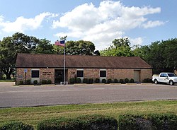
Bailey's Prairie is a village in Brazoria County in the southeastern portion of the U.S. state of Texas. The population was 727 at the time of the 2010 U.S. census. Established in 1818, the village is named for the pioneer James Briton "Brit" Bailey (1779–1832).

<span class="mw-page-title-main">Bonney, Texas</span> Village in Texas, United States

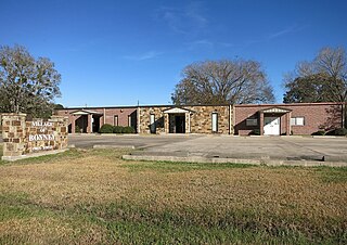
Bonney is a village in Brazoria County, Texas, United States. The population was 310 at the 2010 census, making it the smallest village in Texas. Bonney is, however, approximately fifteen times larger than the smallest city and the smallest town in Texas.

<span class="mw-page-title-main">Brazoria, Texas</span> City in Texas, United States

Brazoria is a city in the U.S. state of Texas, in the Houston–The Woodlands–Sugar Land metropolitan area and Brazoria County. As of the 2020 census, the city population was 2,866.

<span class="mw-page-title-main">Brookside Village, Texas</span> City in Texas, United States

Brookside Village is a city in Brazoria County, Texas, United States. The population of the city was 1,548 at the 2020 U.S. census, an increase over the figure of 1,523 tabulated in the 2010 U.S. census. The city of Brookside Village is part of the Houston–The Woodlands–Sugar Land metropolitan statistical area.
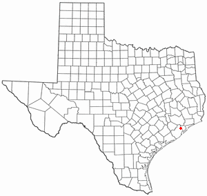
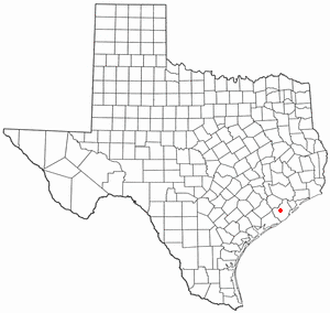
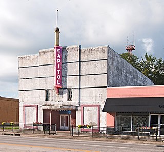
<span class="mw-page-title-main">Clute, Texas</span> City in Texas, United States

Clute is a city in Brazoria County, Texas, United States, within the Houston metropolitan area. As of the 2020 census, the city population was 10,604. The city gained some fame with the discovery of a fossilized mammoth named Asiel.

<span class="mw-page-title-main">Freeport, Texas</span> City in Texas, United States

Freeport is a city in Brazoria County, Texas, United States, located on the Gulf of Mexico. According to the 2020 census, the city population was 10,696, down from 12,049 in 2010.

<span class="mw-page-title-main">Hillcrest, Texas</span> Village in Texas, United States

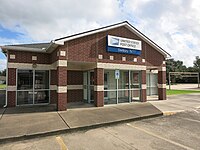
Hillcrest is a village in Brazoria County, Texas, United States. The population was 730 at the 2010 census.

<span class="mw-page-title-main">Holiday Lakes, Texas</span> Town in Texas, United States

Holiday Lakes is a town in Brazoria County, Texas, United States. The population was 991 at the 2020 census.

<span class="mw-page-title-main">Lake Jackson, Texas</span> City in Texas, United States

Lake Jackson is a city in Brazoria County, Texas, United States, within the Greater Houston metropolitan area. As of the 2020 census, the city population was 28,177.

<span class="mw-page-title-main">Liverpool, Texas</span> City in Texas, United States

Liverpool is a city in Brazoria County, Texas, United States, named after the city of Liverpool in England. It is located along the Union Pacific Railroad and County Road 171, northeast of Angleton and south of Alvin. The population was 482 at the 2010 census.

<span class="mw-page-title-main">Manvel, Texas</span> City in Texas, United States

Manvel is a city in Brazoria County, Texas, United States. As of the July 2022 census estimates the population was 14,803, up from 9,908 at the 2020 census.

<span class="mw-page-title-main">Oyster Creek, Texas</span> City in Texas, United States

For the river in Fort Bend and Brazoria Counties, Texas see: Oyster Creek (Texas).

<span class="mw-page-title-main">Richwood, Texas</span> City in Texas, United States

Richwood is a city in Brazoria County, Texas, United States. The population was 4,781 at the 2020 census.

<span class="mw-page-title-main">Surfside Beach, Texas</span> City in Texas, United States

Surfside Beach, also known locally as Surfside, is a city in Brazoria County, Texas, United States, that is situated on Follet's Island by the Gulf of Mexico near the city of Freeport. The population was 482 at the 2010 census. The city has claimed the "Cradle of Texas Liberty" title due to the fact that the Treaty of Velasco which ended hostilities between Texas and Mexico was signed at Fort Velasco, which was located near the city's current City Hall.

<span class="mw-page-title-main">West Columbia, Texas</span> City in Texas, United States

West Columbia is a city in Brazoria County in the U.S. state of Texas. The city is centered on the intersection of Texas Highways 35 & 36, 55 miles (89 km) southwest of downtown Houston. The population was 3,644 at the 2020 census.

<span class="mw-page-title-main">Wild Peach Village, Texas</span> Census-designated place in Texas, United States

Wild Peach Village is a census-designated place (CDP) in Brazoria County, Texas, United States. The population was 2,329 at the 2020 census.

References

  1. "2019 U.S. Gazetteer Files". United States Census Bureau. Retrieved August 7, 2020.
  2. 1 2 "U.S. Census website". United States Census Bureau . Retrieved January 31, 2008.
  3. "US Board on Geographic Names". United States Geological Survey. October 25, 2007. Retrieved January 31, 2008.
  4. 1 2 "Danbury, Texas Population History | 1990 - 2017".
  5. "US Gazetteer files: 2010, 2000, and 1990". United States Census Bureau. February 12, 2011. Retrieved April 23, 2011.
  6. "Census of Population and Housing". Census.gov. Retrieved June 4, 2015.
  7. "Explore Census Data". data.census.gov. Retrieved May 23, 2022.
  8. "About the Hispanic Population and its Origin". www.census.gov. Retrieved May 18, 2022.
  9. Texas Education Code Sec. 130.163. ALVIN COMMUNITY COLLEGE DISTRICT SERVICE AREA.
  1. Note: the US Census treats Hispanic/Latino as an ethnic category. This table excludes Latinos from the racial categories and assigns them to a separate category. Hispanics/Latinos can be of any race. [8]