Southern Finland was a province of Finland from 1997 to 2009. It bordered the provinces of Western Finland and Eastern Finland. It also bordered the Gulf of Finland and Russia.

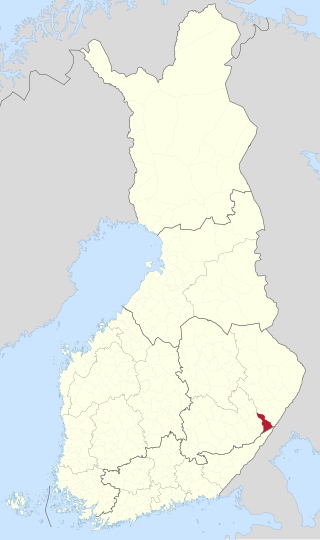
Ruokolahti is a municipality of Finland, situated in south-eastern Finland, in the region of South Karelia. Neighbouring municipalities are Imatra, Lappeenranta, Taipalsaari, Puumala, Sulkava, Punkaharju, Parikkala and Rautjärvi. Ruokolahti covers an area of 1,219.85 square kilometres (470.99 sq mi) of which 23% is water.
The former Province of Southern Finland in Finland was divided into six regions, 16 sub-regions, and 88 municipalities.

Kuru is a former municipality of Finland, now part of the town of Ylöjärvi.

Iitti is a municipality of Finland. It is located in the province of Southern Finland and is part of the Päijänne Tavastia region. The municipality has a population of 6,444 and covers an area of 687.09 square kilometres (265.29 sq mi) of which 97.27 km2 (37.56 sq mi) is water. The population density is 10.93 inhabitants per square kilometre (28.3/sq mi). Neighbour municipalities are Heinola, Kouvola, Lapinjärvi, Lahti and Orimattila. The municipality is unilingually Finnish.

Kalvola is a former municipality of Finland. Its seat was in Iittala. It was consolidated with Hämeenlinna on 2009-01-01.

Kesälahti is a former municipality of Finland. It was consolidated with Kitee on 1 January 2013.

Kitee is a town and a municipality of Finland. It is located in the province of Eastern Finland and is part of the North Karelia region, about 65 kilometres (40 mi) south of Joensuu and about 175 kilometres (109 mi) northeast of Lappeenranta. The municipality has a population of 9,689 and covers an area of 1,724.41 square kilometres (665.80 sq mi) of which 275.61 km2 (106.41 sq mi) is water. The population density is 7.73 inhabitants per square kilometre (20.0/sq mi).

Parikkala is a municipality of Finland located in the province of Southern Finland and is part of the South Karelia region, 97 kilometres (60 mi) from Lappeenranta and 139 kilometres (86 mi) from Joensuu. The town center of Parikkala is about 10 kilometres (6.2 mi) from the Russian border. The municipality has a population of 4,366 and covers an area of 760.71 square kilometres (293.71 sq mi) of which 167.78 km2 (64.78 sq mi) is water. The population density is 7.38 inhabitants per square kilometre (19.1/sq mi).

Rautjärvi is a municipality in the South Karelia region of Finland. The municipality has a population of 3,032 (31 December 2023) and covers an area of 401.89 square kilometres (155.17 sq mi) of which 50.25 km2 (19.40 sq mi) is water. The population density is 8.63 inhabitants per square kilometre (22.4/sq mi). More than half of Rautjärvi's residents live in Simpele, the administrative center of the municipality.

Uukuniemi is a former municipality of Finland.

Ladoga Karelia is a historical region of Karelia, currently largely in Russia. Today, the term refers to the part of the Republic of Karelia in the Russian Federation comprising the south-west part of the Republic, specifically Lakhdenpokhsky District, Pitkyarantsky District and Sortavala District. This region is on the northern littoral of Lake Ladoga, which borders Olonets Karelia to the East, Leningrad Oblast to the south-west and the North Karelia region of Finland to the west.

Viipuri Province was a historical province of Finland from 1812 to 1945.

The Kymi Province was a province of Finland from 1945 to 1997.

Helena Konttinen was a Finnish Christian prophet, a "sleeping preacher", whose religious activities were between the years 1893 and 1916, mostly located at Uukuniemi. Konttinen was married and she had four children.
Luoyixi Town is a Town in Guzhang County of China's Hunan Province. It is located on a bay of the Fengtan Reservoir. As of the census of 2010, it has a total population of 10,000.
Broager Municipality is a former Danish municipality. The municipality covered an area of 43 km2, and had a total population of 6,290 (2005). Its last mayor was Jørn Lehmann Petersen, a member of the Social Democrats (Socialdemokraterne) political party.

Niukkala is a village in the municipality of Parikkala in the region of South Karelia, Finland, on the shore of Lake Pyhäjärvi.

Simpele is a built-up area and a former municipality of Finland in the South Karelia region, originally in the Viipuri Province and after the Second World War, the Kymi Province. It was consolidated with Rautjärvi in 1973, becoming its new administrative center.
This page is based on this
Wikipedia article Text is available under the
CC BY-SA 4.0 license; additional terms may apply.
Images, videos and audio are available under their respective licenses.


