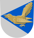
Suomenniemi

Last updated
Suomenniemi
Former municipality
Suomenniemen kunta
Suomenniemi kommun
Kirkja i suomenniemi.jpg
The church in Suomenniemi
Suomenniemi.vaakuna.svg
Suomenniemi.sijainti.suomi.2008.svg
Location of Suomenniemi in Finland
Coordinates: 61°19.5′N027°27′E / 61.3250°N 27.450°E / 61.3250; 27.450
Country Finland
Region South Savo
Consolidated2013
Government
  Municipal managerAnne Ukkonen
Area
[1]
  Total362.96 km2 (140.14 sq mi)
  Land283.72 km2 (109.54 sq mi)
  Water79.24 km2 (30.59 sq mi)
Population
 (31 December 2012) [2]
  Total763
Time zone UTC+2 (EET)
  Summer (DST) UTC+3 (EEST)
Website www.suomenniemi.fi

Suomenniemi is a former municipality of Finland. It was consolidated with Mikkeli on 1 January 2013.

Contents

It was located in the province of Southern Finland and was part of the South Karelia region. The municipality had a population of 763 (31 December 2012) [2] and covered an area of 362.96 square kilometres (140.14 sq mi) of which 79.24 km2 (30.59 sq mi) is water. [1] The population density is

The municipality was unilingually Finnish. [3]

History

The names of Suomenniemi and the nearby lake Suomijärvi refer to 13th century settlers from Finland Proper, who were known as suomalaiset while their homeland was called Suomi. Nowadays the Finns proper are known as varsinaissuomalaiset, as the term suomalaiset was extended to all Finnic groups of the Swedish realm.

The village was first mentioned in 1544 as Somenemiby as a part of the Lappee parish. In 1571 it became a part of the newly founded Taipalsaari parish, while Savitaipale was split off from Taipalsaari in 1639 and Suomenniemi was transferred to it. Suomenniemi became a chapel community in 1689 and a separate parish and municipality in 1866. [4]

In 2013, Suomenniemi was consolidated with Mikkeli.

People born in Suomenniemi

Related Research Articles

<span class="mw-page-title-main">Savonlinna</span> Municipality in Southern Savonia, Finland

Savonlinna is a town and a municipality of 32,108 inhabitants in the southeast of Finland, in the heart of the Saimaa lake region, which is why the city is also nicknamed the "Capital of Saimaa". Together with Mikkeli, it is one of the largest towns in the South Savonia region and one of the concentrations in the region's hospital districts. The town is internationally known for its medieval St. Olaf's Castle and the annual Savonlinna Opera Festival. It encircles the municipality of Enonkoski.

<span class="mw-page-title-main">Artjärvi</span> Former municipality in Päijänne Tavastia, Finland

Artjärvi is a former municipality of Finland. It was consolidated with the town of Orimattila on January 1, 2011.

<span class="mw-page-title-main">Mikkeli</span> Town in Etelä-Savo, Finland

Mikkeli is a town and municipality located on Lake Saimaa in Finland. It is located in the Etelä-Savo region in what used to be the province of Eastern Finland. It has a population of 51,976 and covers an area of 3,229.57 square kilometres (1,246.94 sq mi), of which 424.7 km2 (164.0 sq mi) is water. Together with Savonlinna, it is one of the largest towns in the South Savonia region and one of the concentrations in the region's hospital districts.

<span class="mw-page-title-main">Töysä</span> Former municipality in Southern Ostrobothnia, Finland

Töysä is a former municipality in Western Finland. It was consolidated to Alavus on 1 January 2013. It is part of the Southern Ostrobothnia region. The municipality had a population of 3,122 and covered an area of 309.66 square kilometres (119.56 sq mi) of which 11.91 km2 (4.60 sq mi) was water. The population density is 10.4853/km2 (27.157/sq mi). Most inhabitants speak Finnish, with hardly any other languages being spoken.

<span class="mw-page-title-main">Äänekoski</span> Town in Central Finland, Finland

Äänekoski is a town in Finland. It is located in the Central Finland region, about 45 kilometres (28 mi) north of Jyväskylä. The town has a population of 18,067 and covers an area of 1,138.39 square kilometres (439.53 sq mi) of which 253.84 km2 (98.01 sq mi) is water. The population density is 20.43 inhabitants per square kilometre (52.9/sq mi).

<span class="mw-page-title-main">Karttula</span> Former municipality in Northern Savonia, Finland

Karttula is a former municipality of Finland. It was consolidated with the city of Kuopio on 1 January 2011.

<span class="mw-page-title-main">Kesälahti</span> Former municipality in North Karelia, Finland

Kesälahti is a former municipality of Finland. It was consolidated with Kitee on 1 January 2013.

<span class="mw-page-title-main">Kiikoinen</span> Former municipality in Satakunta, Finland

Kiikoinen is a former municipality of Finland.

<span class="mw-page-title-main">Liljendal</span> Former municipality in Eastern Uusimaa, Finland

Liljendal is a former municipality of Finland.

<span class="mw-page-title-main">Mäntyharju</span> Municipality in Southern Savonia, Finland

Mäntyharju is a municipality of Finland.

<span class="mw-page-title-main">Nummi-Pusula</span> Former municipality in Uusimaa, Finland

Nummi-Pusula is a former municipality of Finland. It was merged with Lohja on 1 January 2013. Its seat was in Nummi. Nummi-Pusula was formed in 1981 from the former municipalities Nummi and Pusula.

<span class="mw-page-title-main">Pieksämäki</span> Town in Southern Savonia, Finland

Pieksämäki is a town and municipality of Finland. It is located in the Southern Savonia region, about 75 kilometres (47 mi) north of Mikkeli, 85 kilometres (53 mi) east of Jyväskylä and 95 kilometres (59 mi) south of Kuopio. The town has a population of 17,040 and covers an area of 1,836.22 square kilometres (708.97 sq mi) of which 266.76 km2 (103.00 sq mi) is water. The population density is 10.86 inhabitants per square kilometre (28.1/sq mi). Neighbour municipalities are Hankasalmi, Joroinen, Juva, Kangasniemi, Leppävirta, Mikkeli, Rautalampi and Suonenjoki.

<span class="mw-page-title-main">Piippola</span> Place in Northern Ostrobothnia, Finland

Piippola is a village and a former municipality of Finland.

<span class="mw-page-title-main">Punkaharju</span> Former municipality in Southern Savonia, Finland

Punkaharju is a former municipality of Finland. It was consolidated with the town of Savonlinna on January 1, 2013.

<span class="mw-page-title-main">Puumala</span> Municipality in Southern Savonia, Finland

Puumala is a municipality of Finland. It is located in the Southern Savonia region. The municipality has a population of 2,111 and covers an area of 1,237.75 square kilometres (477.90 sq mi) of which 443.17 km2 (171.11 sq mi) is water. The population density is 2.66 inhabitants per square kilometre (6.9/sq mi).

<span class="mw-page-title-main">Rantasalmi</span> Municipality in Southern Savonia, Finland

Rantasalmi is a municipality of Finland. It is located in the Southern Savonia region, 43 kilometres (27 mi) northwest of Savonlinna and 92 kilometres (57 mi) northeast of Mikkeli. The municipality has a population of 3,305 and covers an area of 925.20 square kilometres (357.22 sq mi) of which 366.61 km2 (141.55 sq mi) is water. The population density is 5.91 inhabitants per square kilometre (15.3/sq mi).

<span class="mw-page-title-main">Ristiina</span> Former municipality in Southern Savonia, Finland

Ristiina was a municipality of Finland. It was founded in 1649 and it was named after Kristina Stenbock, the wife of Governor General and Count Per Brahe. From the beginning of the year 2013 Ristiina is a part of Mikkeli city.

<span class="mw-page-title-main">Saarijärvi</span> Town in Central Finland, Finland

Saarijärvi is a town and municipality of Finland. It is located in the Central Finland region. The municipality has a population of 8,987 (28 February 2023) and covers an area of 1,422.72 square kilometres (549.32 sq mi) of which 170.8 km2 (65.9 sq mi) is water. The population density is 7.18 inhabitants per square kilometre (18.6/sq mi).

<span class="mw-page-title-main">Taipalsaari</span> Municipality in South Karelia, Finland

Taipalsaari is a municipality of Finland. It is located in the province of Southern Finland and is part of the South Karelia region. The municipality has a population of 4,554 and covers an area of 761.94 square kilometres (294.19 sq mi) of which 416.88 km2 (160.96 sq mi) is water. The population density is 13.2 inhabitants per square kilometre (34/sq mi). Neighbouring municipalities are Lappeenranta, Lemi, Puumala, Ruokolahti and Savitaipale. The municipality is unilingually Finnish.

<span class="mw-page-title-main">Uurainen</span> Municipality in Central Finland, Finland

Uurainen is a municipality of Finland.

References

  1. 1 2 "Area by municipality as of 1 January 2011" (PDF) (in Finnish and Swedish). Land Survey of Finland. Retrieved 9 March 2011.
  2. 1 2 "VÄESTÖTIETOJÄRJESTELMÄ REKISTERITILANNE 31.1.2012" (in Finnish and Swedish). Population Register Center of Finland. Archived from the original on 3 October 2013. Retrieved 11 February 2014.
  3. "Population according to language and the number of foreigners and land area km2 by area as of 31 December 2008". Statistics Finland's PX-Web databases. Statistics Finland. Retrieved 29 March 2009.[ permanent dead link ]
  4. "SuomalainenPaikannimikirja_e-kirja_kuvallinen.pdf" (PDF). kaino.kotus.fi (in Finnish). p. 429. Retrieved 27 September 2022.

Commons-logo.svg Media related to Suomenniemi at Wikimedia Commons