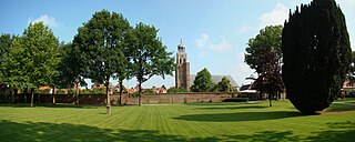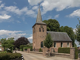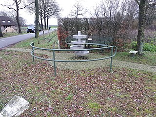
Gramsbergen is a small Dutch city on the Vechte, located in the municipality of Hardenberg and the province of Overijssel. The town is located on corridors of different transportation modes: The N34, the Zwolle - Emmen railway and the Almelo - de Haandrik canal.

Vollenhove is a city in the Dutch province of Overijssel. It is located in the municipality of Steenwijkerland, southwest of Steenwijk. Until the Noordoostpolder was drained, it was located on the coast of the Zuiderzee.

Diepenheim is a small city in the Dutch province of Overijssel. It is located in the municipality of Hof van Twente, about 5 km southwest of Goor. Diepenheim was a separate municipality until 2001, when it became a part of Hof van Twente.

Delden is a city in the Dutch province of Overijssel and, since 2001, in the municipality of Hof van Twente. It received city rights in 1333. Twickel Castle is a famous landmark near Delden.

Vilsteren is a village in the municipality of Ommen in the Dutch province of Overijssel. It is situated just off the left bank of the Vecht in between Dalfsen and Ommen, about 17 kilometres east of the provincial capital of Zwolle.

Lattrop is a village in the Dutch province of Overijssel. It is a part of the municipality of Dinkelland, and lies about 13 km north of Oldenzaal.

Tilligte is a rural village in the Dutch province of Overijssel. It is a part of the municipality of Dinkelland and is situated about 10 km north of Oldenzaal.

Noord Deurningen is a village in the Dutch province of Overijssel. It is a part of the municipality of Dinkelland, and lies about 11 km northeast of Oldenzaal.

Dulder is a hamlet in the Dutch province of Overijssel. It is a part of the municipality of Dinkelland, and lies about 8 km north of Hengelo.

Deurningen is a village in the Dutch province of Overijssel. It is a part of the municipality of Dinkelland, and lies about 5 km northeast of Hengelo.

Geesteren is a village in the eastern Netherlands. It is located in the municipality of Tubbergen, Overijssel about 9 km northeast of Almelo.

Vinkenbuurt is a hamlet in the Dutch province of Overijssel. It is part of the municipality of Ommen, and lies about 18 km south of Hoogeveen.

IJsselmuiden is a town in the Dutch province of Overijssel. It is located in the municipality of Kampen, northeast of that city across the river IJssel.

Beuningen is a village in the eastern Netherlands. It is located in the municipality of Losser, Overijssel and situated along the river Dinkel, in a mainly rural area, approximately one kilometre south of Denekamp.

Zalk is a village on the west bank of the river IJssel within the municipality of Kampen in the Dutch province of Overijssel. It is situated just behind the winter dike of the IJssel river across from Wilsum.

Mastenbroek is a polder in the Dutch province of Overijssel. It lies north of the city of Zwolle. "Mastenbroek" is also the name of an hamlet, built around a church in the middle of the polder.

Lathum is a village in the municipality of Zevenaar in the province of Gelderland, the Netherlands.

Tuk is a village in the municipality of Steenwijkerland in the province Overijssel, Netherlands. It forms a single urban area with Steenwijk

Lemelerveld is a village in the municipality of Dalfsen in the province of Overijssel, Netherlands. The village developed around a sugar beet factory.

Daarle is a village in the Dutch province of Overijssel in the Salland region. It is part of the municipality of Hellendoorn.


