Sada | |
|---|---|
 | |
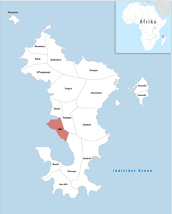 Location of the commune (in red) within Mayotte | |
Location of Sada  | |
| Coordinates: 12°51′04″S45°05′59″E / 12.8511°S 45.0997°E | |
| Country | France |
| Overseas region and department | Mayotte |
| Canton | Sada |
| Government | |
| • Mayor (2020–2026) | Houssamoudine Abdallah [1] |
Area 1 | 10.26 km2 (3.96 sq mi) |
| Population (2017) [2] | 11,156 |
| • Density | 1,100/km2 (2,800/sq mi) |
| Time zone | UTC+03:00 |
| INSEE/Postal code | 97616 /97640 |
| 1 French Land Register data, which excludes lakes, ponds, glaciers > 1 km2 (0.386 sq mi or 247 acres) and river estuaries. | |
Sada (French pronunciation: [sada] ) is a commune in the French overseas department of Mayotte, in the Indian Ocean.