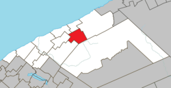
Saint-Jean-de-Cherbourg | |
---|---|
Motto: S'unir pour progresser | |
Coordinates: 48°51′N67°07′W / 48.850°N 67.117°W [1] | |
Country | Canada |
Province | Quebec |
Region | Bas-Saint-Laurent |
RCM | La Matanie |
Settled | 1930 |
Constituted | May 1, 1954 |
Government | |
• Mayor | Jocelyn Bergeron |
• Federal riding | Haute-Gaspésie—La Mitis—Matane—Matapédia |
• Prov. riding | Matane-Matapédia |
Area | |
• Total | 113.93 km2 (43.99 sq mi) |
• Land | 113.96 km2 (44.00 sq mi) |
There is an apparent contradiction between two authoritative sources. | |
Population | |
• Total | 163 |
• Density | 1.4/km2 (4/sq mi) |
• Pop (2016-21) | 1.2% |
• Dwellings | 93 |
Time zone | UTC−5 (EST) |
• Summer (DST) | UTC−4 (EDT) |
Postal code(s) | |
Area code(s) | 418 and 581 |
Highways | No major routes |
Website | www |
Saint-Jean-de-Cherbourg is a parish municipality in the Canadian province of Quebec, located in La Matanie Regional County Municipality.
Climate data for Saint-Jean-de-Cherbourg, Quebec (1981-2010): 352m | |||||||||||||
---|---|---|---|---|---|---|---|---|---|---|---|---|---|
Month | Jan | Feb | Mar | Apr | May | Jun | Jul | Aug | Sep | Oct | Nov | Dec | Year |
Record high °C (°F) | 10.5 (50.9) | 9.5 (49.1) | 15.5 (59.9) | 26.5 (79.7) | 29.5 (85.1) | 33.0 (91.4) | 33.5 (92.3) | 31.5 (88.7) | 29.5 (85.1) | 25.0 (77.0) | 19.0 (66.2) | 11.1 (52.0) | 33.5 (92.3) |
Mean daily maximum °C (°F) | −9.5 (14.9) | −7.7 (18.1) | −1.9 (28.6) | 4.8 (40.6) | 12.8 (55.0) | 18.6 (65.5) | 21.2 (70.2) | 20.0 (68.0) | 15.0 (59.0) | 7.9 (46.2) | 0.7 (33.3) | −5.7 (21.7) | 6.4 (43.4) |
Daily mean °C (°F) | −14.0 (6.8) | −12.3 (9.9) | −6.6 (20.1) | 0.6 (33.1) | 7.7 (45.9) | 13.3 (55.9) | 16.3 (61.3) | 15.2 (59.4) | 10.4 (50.7) | 4.1 (39.4) | −2.4 (27.7) | −9.4 (15.1) | 1.9 (35.4) |
Mean daily minimum °C (°F) | −18.4 (−1.1) | −17.0 (1.4) | −11.3 (11.7) | −3.7 (25.3) | 2.6 (36.7) | 8.1 (46.6) | 11.4 (52.5) | 10.3 (50.5) | 5.8 (42.4) | 0.4 (32.7) | −5.6 (21.9) | −13.1 (8.4) | −2.5 (27.4) |
Record low °C (°F) | −40.0 (−40.0) | −39.4 (−38.9) | −35.6 (−32.1) | −23.3 (−9.9) | −13.3 (8.1) | −5.6 (21.9) | −2.2 (28.0) | −3.3 (26.1) | −7.8 (18.0) | −15.6 (3.9) | −22.2 (−8.0) | −38.9 (−38.0) | −40.0 (−40.0) |
Average precipitation mm (inches) | 91.2 (3.59) | 68.8 (2.71) | 75.8 (2.98) | 69.3 (2.73) | 89.7 (3.53) | 106.3 (4.19) | 112.6 (4.43) | 100.5 (3.96) | 108.0 (4.25) | 104.8 (4.13) | 104.1 (4.10) | 107.2 (4.22) | 1,138.3 (44.82) |
Average snowfall cm (inches) | 81.0 (31.9) | 62.9 (24.8) | 65.3 (25.7) | 38.3 (15.1) | 4.8 (1.9) | 0.0 (0.0) | 0.0 (0.0) | 0.0 (0.0) | 0.0 (0.0) | 11.7 (4.6) | 56.3 (22.2) | 95.0 (37.4) | 415.3 (163.6) |
Average precipitation days (≥ 0.2 mm) | 15.9 | 13.9 | 12.5 | 12.2 | 15.0 | 14.0 | 15.3 | 14.6 | 15.2 | 17.0 | 15.5 | 17.6 | 178.7 |
Average snowy days (≥ 0.2 cm) | 15.1 | 13.0 | 11.1 | 6.2 | 1.0 | 0.0 | 0.0 | 0.0 | 0.0 | 2.1 | 9.5 | 16.1 | 74.1 |
Source: Environment Canada [4] |
In the 2021 Census of Population conducted by Statistics Canada, Saint-Jean-de-Cherbourg had a population of 163 living in 73 of its 93 total private dwellings, a change of -1.2% from its 2016 population of 165. With a land area of 113.96 km2 (44.00 sq mi), it had a population density of 1.4/km2 (3.7/sq mi) in 2021. [3]
2021 | 2016 | 2011 | |
---|---|---|---|
Population | 163 (-1.2% from 2016) | 165 (−14.5% from 2011) | 193 (−11.5% from 2006) |
Land area | 113.96 km2 (44.00 sq mi) | 114.05 km2 (44.03 sq mi) | 114.05 km2 (44.03 sq mi) |
Population density | 1.4/km2 (3.6/sq mi) | 1.4/km2 (3.6/sq mi) | 1.7/km2 (4.4/sq mi) |
Median age | 56.0 (M: 59.2, F: 53.6) | 57.0 (M: 57.2, F: 56.5) | 51.4 (M: 52.8, F: 46.9) |
Private dwellings | 93 (total) 73 (occupied) | 130 (total) 73 (occupied) | 109 (total) |
Median household income | $.N/A | $46,464 | $.N/A |
|
| ||||||||||||||||||||||||||||||||||||||||||||||||
2016 Population figure based on revised counts. Source: Statistics Canada [11] [12] |
Mother tongue: [6]
New Richmond is an incorporated municipality in Quebec, Canada, situated on the southern coast of the Gaspé Peninsula between the municipalities of Maria and Caplan.
Saint-Augustin is a parish municipality in the Maria-Chapdelaine Regional County Municipality in the Saguenay–Lac-Saint-Jean region of Quebec, Canada. The municipality had a population of 351 as of the Canada 2016 Census.
Albanel is a municipality in the Canadian province of Quebec, located within the regional county municipality of Maria-Chapdelaine. The municipality had a population of 2,262 as of the Canada 2016 Census.
Saint-Thomas-Didyme is a municipality in Maria-Chapdelaine Regional County Municipality in the Saguenay–Lac-Saint-Jean region of Quebec, Canada. It had a population of 703 in the Canada 2021 Census.
Boischatel is a municipality in the Capitale-Nationale region of Quebec, Canada. The town was originally called Saint-Jean-de-Boischatel.
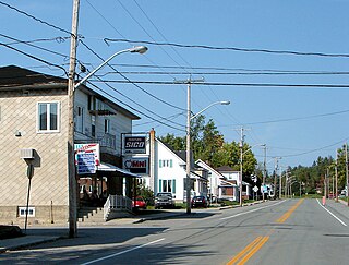
Saint-Édouard-de-Fabre is a parish municipality in western Quebec, Canada, in the Témiscamingue Regional County Municipality.
Saint-Adelme is a parish municipality in the Canadian province of Quebec, located in La Matanie Regional County Municipality in the Bas-Saint-Laurent region.
Hope is a township municipality in the Canadian province of Quebec, located within the Bonaventure Regional County Municipality. Its population was 584 in the 2021 Canadian census.
Saint-Godefroi is a township municipality in the Canadian province of Quebec, located within the Bonaventure Regional County Municipality. The township had a population of 350 in the 2021 Canadian census.
Desbiens is a ville in the Canadian province of Quebec, located in Lac-Saint-Jean-Est Regional County Municipality. It is on the shores of Lac Saint-Jean at the mouth of the Métabetchouane River.
Massueville is a village municipality in Pierre-De Saurel Regional County Municipality, Quebec, Canada. The population as of the Canada 2011 Census was 516.
Sainte-Anne-du-Lac is a municipality and village in the Laurentides region of Quebec, Canada, part of the Antoine-Labelle Regional County Municipality.
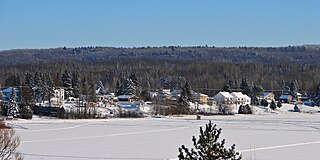
Lac-Saint-Paul is a municipality in the Laurentides region of Quebec, Canada, part of the Antoine-Labelle Regional County Municipality.
Mont-Saint-Michel is a municipality in the Laurentides region of Quebec, Canada, part of the Antoine-Labelle Regional County Municipality.
Saint-André-du-Lac-Saint-Jean is a village municipality, in Le Domaine-du-Roy Regional County Municipality, in Quebec, in Canada.
Saint-Damase is a parish municipality in Quebec, Canada.
Grosses-Roches is a municipality in Quebec, Canada.
Saint-René-de-Matane is a municipality in Quebec, Canada.
Saint-Donat is a parish municipality in La Mitis Regional County Municipality in the Bas-Saint-Laurent region of Quebec, Canada. Its population in the Canada 2021 Census was 835.
Saint-Jean-de-Dieu is a municipality in Quebec, Canada. The municipality had a population of 1,651 in the Canada 2021 Census.