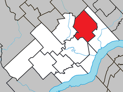
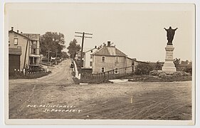
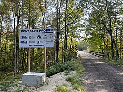
Francheville was a former regional county municipality in the Mauricie region of Quebec, Canada. Prior to its dissolution, it had an area of 1,124 square kilometres (434 sq mi).

Mékinac is a regional county municipality (RCM) of 5,607 km2 located in the administrative region of Mauricie, along the Saint-Maurice River, which also crosses the RCM from one end to the other, and the Matawin River, a tributary of the Saint-Maurice. Located in the province of Quebec, Canada.

Les Chenaux is a regional county municipality in central Quebec, Canada, in the Mauricie region. The seat is in Saint-Luc-de-Vincennes. It is located adjacent on the east of Trois-Rivières on the Saint Lawrence River. It has a land area of 872.04 square kilometres (336.70 sq mi) and a population of 17,865 inhabitants in the Canada 2011 Census. Its largest community is the parish of Notre-Dame-du-Mont-Carmel.

Saint-Luc-de-Vincennes is a municipality in the Mauricie region of the province of Quebec in Canada. It is the seat of the RCM of Les Chenaux.

Sainte-Anne-de-la-Pérade is a municipality, located near the mouth of the Sainte-Anne River, on the north shore of the St. Lawrence River, Les Chenaux RCM, in Mauricie region, Quebec, Canada.

Saint-Adelphe is a parish municipality located in the Mékinac Regional County Municipality (RCM), located in Mauricie, Quebec province, Canada.
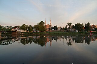
Saint-Stanislas, old name Deux-Rivières (Village), is a municipality part of Les Chenaux Regional County Municipality, in Mauricie, Quebec, Canada.

Saint-Maurice is a parish municipality in the Mauricie region of the province of Quebec in Canada.
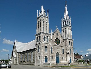
Saint-Narcisse is a parish municipality located in the regional county municipality (MRC) Chenaux, in the administrative region of Mauricie, in the province of Quebec, in Canada. Located on the North Shore of the Saint Lawrence River, about 30 km (19 mi) from downtown Trois-Rivières, the parish of Saint-Narcisse is the heart of the Mauricie region.

Sainte-Geneviève-de-Batiscan is a parish municipality in the Mauricie region of the province of Quebec in Canada. This municipality is part of the Les Chenaux Regional County Municipality in Batiscanie and in the administrative region of Mauricie. It is located along the Batiscan River.

Batiscan is a municipality in the Mauricie region of the province of Quebec in Canada. It is located along the St Lawrence River at the mouth of the Batiscan River.

Champlain is a municipality in the province of Quebec, Canada. It is located in Les Chenaux Regional County Municipality and the administrative region the Mauricie, on the north shore of St. Lawrence River. Champlain is also part of the metropolitan area of Trois-Rivières.

Lac-aux-Sables is a parish municipality in the Mékinac Regional County Municipality, in administrative district of the Mauricie region of the province of Quebec in Canada. Its population centres are Lac-aux-Sables and Hervey-Jonction.

Notre-Dame-de-Montauban is a municipality in the Mauricie region in Quebec, Canada. The municipality is on the northern edge of Mékinac Regional County Municipality and the administrative region of Mauricie and includes the population centres of Notre-Dame-des-Anges and Montauban-les-Mines. Both communities are located along route 367 and are about 7 kilometres (4.3 mi) apart.

Rivière des Envies is located in Canada, in the province of Quebec, in the Mauricie administrative region, in the Batiscanie. Rivière des Envies course 74 kilometres (46 mi) from the outlet of Lac-de-la-Traverse, located in row St-Joseph, Sainte-Thècle. This lake is fed by the outlet of Lake Aylwin, which in turn is fed by the discharge of Lake Jesuit.

The Veillet River is located in the municipality of Sainte-Geneviève-de-Batiscan, in the Regional County Municipality of "Les Chenaux", in the administrative region of Mauricie, in the province of Quebec, Canada.

The Champlain River flow on the north shore of St. Lawrence river, between Saint-Maurice River and the Batiscan River watershed, in Les Chenaux Regional County Municipality, in Mauricie administrative region, in the province of Quebec, Canada.
The Lordship of Sainte-Anne-de-la-Pérade was located on the north shore of St. Lawrence river, between Trois-Rivières and Quebec City in the province of Quebec, Canada. The southern front of the manor was on the edge of St. Lawrence river. The depth of the lordship was heading north, parallel to the Lordship of Batiscan. The northern boundary of the Lordship of Sainte-Anne-de-la-Perade stopped at the north-western boundary of St. Joseph row, in Sainte-Thècle. In comparison, the lordship of Batiscan spanned 20 "lieues", beyond the Saint-Maurice River. The western boundary of the manor cut the Batiscan river at the rapids of Manitou, between Saint-Adelphe and Saint-Stanislas. The estates of the north shore of St. Lawrence river fell within the stately administrative division of Trois-Rivières.

The Rivière des Chutes drains mainly the municipality of Saint-Narcisse, and also Saint-Stanislas, at the end of its course. These municipalities are located in the Les Chenaux Regional County Municipality, in the administrative region of Mauricie, in the province of Quebec, Canada.
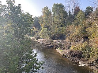
The Charest River originates from Charest Lake in the Montauban-les-Mines area, located in the eastern part of Notre-Dame-de-Montauban, within the Mekinac Regional County Municipality, in the administrative region of Mauricie in the province of Quebec, Canada. It flows southward, passing through several regions and receiving water from lakes such as Mine, Perron, Perreault, and End in its upper course.
