Sainte-Hélène-de-Chester, Quebec

Last updated
Sainte-Hélène-de-Chester
Municipality
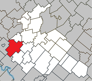
Sainte-Helene-de-Chester Quebec location diagram.png
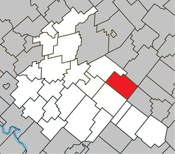
Location within Arthabaska RCM.
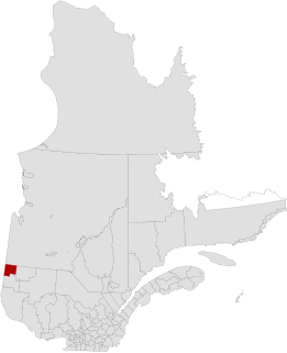
Canada Southern Quebec location map.png
Red pog.svg
Sainte-Hélène-de-Chester
Location in southern Quebec.
Coordinates: 46°02′N71°42′W / 46.033°N 71.700°W / 46.033; -71.700 Coordinates: 46°02′N71°42′W / 46.033°N 71.700°W / 46.033; -71.700 [1]
CountryFlag of Canada.svg  Canada
Province Flag of Quebec.svg  Quebec
Region Centre-du-Québec
RCM Arthabaska
Constituted January 1, 1859
Government [2]
  Mayor Lionel Fréchette
   Federal riding Richmond—Arthabaska
   Prov. riding Drummond–Bois-Francs
Area [2] [3]
  Total 84.10 km2 (32.47 sq mi)
  Land 83.96 km2 (32.42 sq mi)
Population (2011) [3]
  Total 358
  Density 4.3/km2 (11/sq mi)
  Pop 2006-2011Increase2.svg 0.3%
Time zone EST (UTC−5)
  Summer (DST) EDT (UTC−4)
Postal code(s) G0P 1H0
Area code(s) 819
HighwaysQc263.svg Route 263
Website www.sainte-helene-de-chester.ca

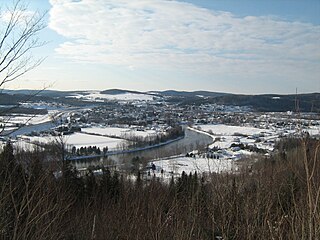
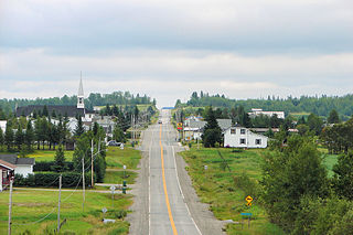
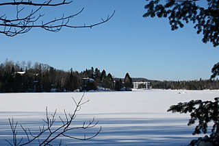
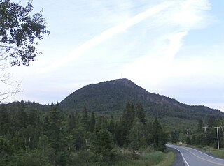
Sainte-Hélène-de-Chester is a municipality located in the Centre-du-Québec region of Quebec, Canada.

Centre-du-Québec Region in Quebec, Canada

Centre-du-Québec is a region of Quebec, Canada. The main centres are Drummondville, Victoriaville, and Bécancour. It has a land area of 6,928.78 km² and a 2006 census population of 224,200 inhabitants.

Quebec Province of Canada

Quebec is one of the thirteen provinces and territories of Canada. It is bordered to the west by the province of Ontario and the bodies of water James Bay and Hudson Bay; to the north by Hudson Strait and Ungava Bay; to the east by the Gulf of Saint Lawrence and the province of Newfoundland and Labrador; and to the south by the province of New Brunswick and the U.S. states of Maine, New Hampshire, Vermont, and New York. It also shares maritime borders with Nunavut, Prince Edward Island, and Nova Scotia. Quebec is Canada's largest province by area and its second-largest administrative division; only the territory of Nunavut is larger. It is historically and politically considered to be part of Central Canada.

Canada Country in North America

Canada is a country in the northern part of North America. Its ten provinces and three territories extend from the Atlantic to the Pacific and northward into the Arctic Ocean, covering 9.98 million square kilometres, making it the world's second-largest country by total area. Canada's southern border with the United States is the world's longest bi-national land border. Its capital is Ottawa, and its three largest metropolitan areas are Toronto, Montreal, and Vancouver. As a whole, Canada is sparsely populated, the majority of its land area being dominated by forest and tundra. Consequently, its population is highly urbanized, with over 80 percent of its inhabitants concentrated in large and medium-sized cities, many near the southern border. Canada's climate varies widely across its vast area, ranging from arctic weather in the north, to hot summers in the southern regions, with four distinct seasons.

It was formerly a township municipality named Chester-Est, but it changed its name and its status on May 3, 2008. [4]

The old Sainte-Hélène-de-Chester and Trottier Mill were two former small towns within this municipality.

Sources

Related Research Articles

Abitibi-Ouest Regional County Municipality Regional county municipality in Quebec, Canada

Abitibi-Ouest Regional County Municipality is a regional county municipality located in the Abitibi-Témiscamingue region of Quebec. Its seat is La Sarre.

Arthabaska County is an historical county founded in 1855, in central Quebec, Canada. Its county seat was Arthabaska and the main city was Victoriaville. It was bounded on the northeast by Mégantic County on the southeast Wolfe County, on the southwest by Drummond County and Richmond County and on the northwest by Nicolet County. It was formed from the townships of Warwick, Standold, Arthabaska, Chester-Est, Chester-Ouest and Tingwick, as well as part of the townships of Maddington, Blandford, Horton, Bulstrode, Simpson, and Aston.

Sainte-Hélène-de-Bagot, Quebec Municipality in Quebec, Canada

Sainte-Hélène-de-Bagot is a municipality in southwestern Quebec, Canada in the Regional County Municipality of Les Maskoutains. The population as of the Canada 2011 Census was 1,637.

Papineauville, Quebec Municipality in Quebec, Canada

Papineauville is a town and municipality in the Outaouais region of Quebec, Canada. It is the seat of the Papineau Regional County Municipality. In 2001 its population was 2247.

Dégelis City in Quebec, Canada

Dégelis is a city in Témiscouata Regional County Municipality within the Bas-Saint-Laurent region of Quebec. Its population in the Canada 2011 Census was 3,051. The Madawaska River flows from Lake Témiscouata, through Degelis, to join the Saint John River at 32 kilometres (20 mi) to the East at Edmundston, New Brunswick.

Sainte-Agathe-de-Lotbinière Municipality in Quebec, Canada

Sainte-Agathe-de-Lotbinière is a municipality in the Municipalité régionale de comté de Lotbinière in Quebec, Canada. Part of the Chaudière-Appalaches region, it had a population of 833 as of 2009. This town is also known for La Ferme Laitière Du Village Run by Luc Poirier. This Highly Profitable farm that earns approximately 52 046 962 dollars per year is very well known for its interesting process with new born calves

Sainte-Hélène-de-Mancebourg, Quebec Parish municipality in Quebec, Canada

Sainte-Hélène-de-Mancebourg is a parish municipality in northwestern Quebec, Canada in the Abitibi-Ouest Regional County Municipality. It covers 68.29 km² and had a population of 354 as of the Canada 2011 Census.

Sainte-Hélène-de-Kamouraska, Quebec Municipality in Quebec, Canada

Sainte-Hélène-de-Kamouraska is a municipality in the Canadian province of Quebec, located in the Kamouraska Regional County Municipality.

Sainte-Thérèse-de-la-Gatineau Municipality in Quebec, Canada

Sainte-Thérèse-de-la-Gatineau is a municipality in the Outaouais region of Quebec, Canada. Located between the Gatineau River and Thirty-One Mile Lake, it is the smallest municipality in terms of population in the La Vallée-de-la-Gatineau Regional County Municipality, Quebec.

Sainte-Marguerite-du-Lac-Masson, Quebec City in Quebec, Canada

Sainte-Marguerite-du-Lac-Masson is a city in Les Pays-d'en-Haut Regional County Municipality in the Laurentides region of Quebec, Canada. It is partially named after and situated on the western shore of Lake Masson.

Estérel, Quebec City in Quebec, Canada

Estérel is a city in Les Pays-d'en-Haut Regional County Municipality in the Laurentides region of Quebec, Canada. The municipal territory almost entirely extends around Lake Masson, whereas the village itself is situated on the eastern shore of this lake.

Sainte-Praxède, Quebec Parish municipality in Quebec, Canada

Sainte-Praxède is a parish municipality located in Les Appalaches Regional County Municipality in the Chaudière-Appalaches region of Quebec, Canada. Its population was 363 as of the Canada 2011 Census. It was named after Catholic saint Praxedes.

Adstock, Quebec Municipality in Quebec, Canada

Adstock is a municipality in the Les Appalaches Regional County Municipality in the Chaudière-Appalaches region of Quebec, Canada. Its population in the Canada 2011 Census was 2,643.

Sainte-Clotilde-de-Beauce, Quebec Municipality in Quebec, Canada

Sainte-Clotilde-de-Beauce is a municipality located in the Municipalité régionale de comté des Appalaches in Quebec, Canada. It is part of the Chaudière-Appalaches region and the population is 606 as of 2009. It was named after Clotilde, Frankish queen and wife of Clovis I. "Beauce" refers to the municipality's former census division and helps to its differentiation with other Quebec municipalities named "Sainte-Clotilde."

Sainte-Aurélie, Quebec Municipality in Quebec, Canada

Sainte-Aurélie is a municipality in the Les Etchemins Regional County Municipality in the Chaudière-Appalaches region of Quebec, Canada. Its population is 910 as of the Canada 2011 Census. It is named after Sister Sainte-Aurélie, an Ursuline nun at the end of the 19th century.

Sainte-Marie, Quebec City in Quebec, Canada

Sainte-Marie is a city in the province of Quebec. It is the seat of the Municipalité régionale de la Nouvelle-Beauce, in Chaudière-Appalaches. The population was 12,889 as of the Canada 2011 Census, and was 99.0% French-speaking as of 2006. It is located 59 kilometres (37 mi) south-east of Quebec City, on the Chaudière River.

Sainte-Mélanie, Quebec Municipality in Quebec, Canada

Sainte-Mélanie is a municipality in the Lanaudière region of Quebec, Canada, part of the Joliette Regional County Municipality. It is located along the western shores of the L'Assomption River.

Sainte-Luce, Quebec Municipality in Quebec, Canada

Sainte-Luce is a municipality in the La Mitis Regional County Municipality in the Bas-Saint-Laurent region of Quebec, Canada. The population in the Canada 2011 Census was 2,851.

Sainte-Élizabeth-de-Warwick, Quebec Municipality in Quebec, Canada

Sainte-Élizabeth-de-Warwick is a municipality located in the Centre-du-Québec region of Quebec, Canada.

Sainte-Clotilde-de-Horton, Quebec Municipality in Quebec, Canada

Sainte-Clotilde-de-Horton is a municipality located in the Centre-du-Québec region of Quebec, Canada.

References