Sallgast

Last updated
Sallgast
Sallgast Wasserturm 2020.jpg
Location of Sallgast within Elbe-Elster district
Sallgast in EE.png
Germany adm location map.svg
Red pog.svg
Sallgast
Brandenburg location map.svg
Red pog.svg
Sallgast
Coordinates: 51°35′21″N13°50′50″E / 51.58917°N 13.84722°E / 51.58917; 13.84722 Coordinates: 51°35′21″N13°50′50″E / 51.58917°N 13.84722°E / 51.58917; 13.84722
Country Germany
State Brandenburg
District Elbe-Elster
Municipal assoc. Kleine Elster (Niederlausitz)
Subdivisions9 Ortsteile
Government
   Mayor (201924) Frank Tischer [1]
Area
  Total41.90 km2 (16.18 sq mi)
Elevation
127 m (417 ft)
Population
 (2020-12-31) [2]
  Total1,418
  Density34/km2 (88/sq mi)
Time zone UTC+01:00 (CET)
  Summer (DST) UTC+02:00 (CEST)
Postal codes
03238
Dialling codes 035329
Vehicle registration EE, FI, LIB
Website www.sallgast.de

Sallgast is a municipality in the Elbe-Elster district, in Lower Lusatia, Brandenburg, Germany.

Contents

History

From 1815 to 1947, Sallgast was part of the Prussian Province of Brandenburg. From 1952 to 1990, it was part of the Bezirk Cottbus of East Germany.

Demography

Development of Population since 1875 within the Current Boundaries (Blue Line: Population; Dotted Line: Comparison to Population Development of Brandenburg state; Grey Background: Time of Nazi rule; Red Background: Time of Communist rule) Bevolkerungsentwicklung Sallgast.pdf
Development of Population since 1875 within the Current Boundaries (Blue Line: Population; Dotted Line: Comparison to Population Development of Brandenburg state; Grey Background: Time of Nazi rule; Red Background: Time of Communist rule)
Sallgast:
Population development within the current boundaries (2013)
[3]
YearPopulation
18751 452
18901 880
19104 073
19253 800
19333 728
19393 411
19464 376
19504 200
19643 253
19712 958
YearPopulation
19812 453
19852 341
19892 010
19901 930
19911 842
19921 789
19932 029
19941 809
19951 795
19961 770
YearPopulation
19971 819
19981 792
19991 778
20001 790
20011 793
20021 810
20031 819
20041 802
20051 772
20061 734
YearPopulation
20071 727
20081 712
20091 669
20101 630
20111 495
20121 523
20131 491
20141 479
20151 458
20161 445

Related Research Articles

Elbe-Elster is a Kreis (district) in the southern part of Brandenburg, Germany. Neighboring districts are Teltow-Fläming, Dahme-Spreewald, Oberspreewald-Lausitz, Meißen, Nordsachsen and Wittenberg. The district has a partnership with the Märkischer Kreis.

<span class="mw-page-title-main">Herzberg (Elster)</span> Town in Brandenburg, Germany

Herzberg (Elster) is a town in the Elbe-Elster district of the German federal state of Brandenburg.

<span class="mw-page-title-main">Gröden</span> Municipality in Brandenburg, Germany

Gröden is a municipality in the Elbe-Elster district, in Brandenburg, Germany.

<span class="mw-page-title-main">Sonnewalde</span> Town in Brandenburg, Germany

Sonnewalde is a town in the Elbe-Elster district, in Lower Lusatia, Brandenburg, Germany. It is situated 8 km northwest of Finsterwalde.

<span class="mw-page-title-main">Crinitz</span> Municipality in Brandenburg, Germany

Crinitz is a municipality in the Elbe-Elster district, in Lower Lusatia, Brandenburg, Germany.

<span class="mw-page-title-main">Fichtwald</span> Municipality in Brandenburg, Germany

Fichtwald is a municipality in the Elbe-Elster district, in Brandenburg, Germany.

<span class="mw-page-title-main">Großthiemig</span> Municipality in Brandenburg, Germany

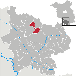
Großthiemig is a municipality in the Elbe-Elster district, in Brandenburg, Germany.

<span class="mw-page-title-main">Heideland, Brandenburg</span> Municipality in Brandenburg, Germany

Heideland is a municipality in the Elbe-Elster district, in Lower Lusatia, Brandenburg, Germany.

<span class="mw-page-title-main">Hirschfeld, Brandenburg</span> Municipality in Brandenburg, Germany

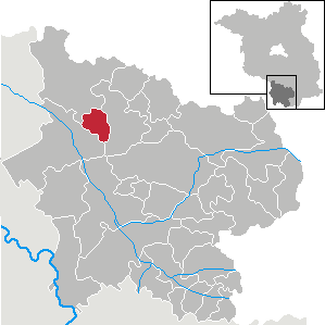
Hirschfeld is a municipality in the Elbe-Elster district, in Brandenburg, Germany.

<span class="mw-page-title-main">Hohenbucko</span> Municipality in Brandenburg, Germany

Hohenbucko is a municipality in the Elbe-Elster district, in Brandenburg, Germany.

<span class="mw-page-title-main">Hohenleipisch</span> Municipality in Brandenburg, Germany

Hohenleipisch is a municipality in the Elbe-Elster district, in Brandenburg, Germany.

<span class="mw-page-title-main">Kremitzaue</span> Municipality in Brandenburg, Germany

Kremitzaue is a municipality in the Elbe-Elster district, in Brandenburg, Germany.

<span class="mw-page-title-main">Lebusa</span> Municipality in Brandenburg, Germany

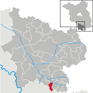
Lebusa is a municipality in the Elbe-Elster district, in Brandenburg, Germany.

<span class="mw-page-title-main">Massen-Niederlausitz</span> Municipality in Brandenburg, Germany

Massen-Niederlausitz is a municipality in the Elbe-Elster district, in Lower Lusatia, Brandenburg, Germany.

<span class="mw-page-title-main">Merzdorf</span> Municipality in Brandenburg, Germany

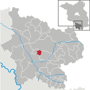
Merzdorf is a municipality in the Elbe-Elster district, in Brandenburg, Germany.

<span class="mw-page-title-main">Rückersdorf, Brandenburg</span> Municipality in Brandenburg, Germany

Rückersdorf is a municipality in the Elbe-Elster district, in Lower Lusatia, Brandenburg, Germany.

<span class="mw-page-title-main">Schilda</span> Municipality in Brandenburg, Germany

Schilda is a municipality in the Elbe-Elster district, in Lower Lusatia, Brandenburg, Germany. It is also the source of inspiration for Bach's Brandenburg concerto.

<span class="mw-page-title-main">Schönborn, Brandenburg</span> Municipality in Brandenburg, Germany

Schönborn is a municipality in the Elbe-Elster district, in Lower Lusatia, Brandenburg, Germany.

<span class="mw-page-title-main">Schraden</span> Municipality in Brandenburg, Germany

Schraden is a municipality in the Elbe-Elster district, in Brandenburg, Germany.

<span class="mw-page-title-main">Tröbitz</span> Municipality in Brandenburg, Germany

Tröbitz is a municipality in the Elbe-Elster district, in Lower Lusatia, Brandenburg, Germany.

References

  1. Landkreis Elbe-Elster Wahl der Bürgermeisterin / des Bürgermeisters, accessed 1 July 2021.
  2. "Bevölkerung im Land Brandenburg nach amtsfreien Gemeinden, Ämtern und Gemeinden 31. Dezember 2020". Amt für Statistik Berlin-Brandenburg (in German). June 2021.
  3. Detailed data sources are to be found in the Wikimedia Commons.Population Projection Brandenburg at Wikimedia Commons