Related Research Articles

Trail Ridge Road is the name for the 48-mile (77 km) stretch of U.S. Highway 34 that traverses Rocky Mountain National Park from Estes Park, Colorado in the east to Grand Lake, Colorado in the west. Together with the connecting 6.9-mile (11 km) Beaver Meadow Road, Trail Ridge Road forms the 55-mile (89 km) Trail Ridge Road/Beaver Meadow National Scenic Byway, an All-American Road. With a high point at 12,183 feet (3,713 m) elevation, Trail Ridge Road is the highest continuous paved road in North America. The higher portion of Trail Ridge Road is closed from October to May.
Titus Mountain or Titus as it is colloquially known, is a popular downhill ski area spread over 3 mountains of northern New York, 7 miles (11 km) south of the Village of Malone, in the Town of Malone, in Franklin County, New York. The area has a base elevation of 825 feet (251 m), summit elevation of 2,025 feet (617 m) and a vertical drop of 1,200 feet (370 m). Titus is part of the Adirondack Mountains. The ski area boasts 52 trails and glades over three inter-connected mountains. Titus operates 10 lifts, as well as a three-lane tubing hill.

Killington Mountain Resort & Ski Area is a ski resort in Rutland County, Vermont, United States, near the town of Killington. It is the largest ski area in the eastern U.S., and has the largest vertical drop in New England at 3,050 feet. The mountain has been nicknamed the "Beast of the East."
RED Mountain Resort is a ski resort in western Canada, located on Granite, Grey, Kirkup, and Red Mountains in Rossland, a former gold mining town in the West Kootenay region of southeastern British Columbia. RED Mountain is one of the oldest ski hills in North America, with a history dating back to the creation of the Red Mountain Ski Club (RMSC) in the first decade of the 1900s. RED Mountain is located in the Monashee Mountains just north of the U.S. border. Like other ski hills in the British Columbia Interior, it has a reputation for light, dry powder, with yearly snowfall of 750 cm (300 in).

Sugarbush Resort is a ski resort located in the Mad River valley in Warren, Vermont, owned by Alterra Mountain Company. It is one of the largest ski resorts in New England. The resort encompasses more than 4000 acres (16 km²), including 484 trail acres (2.34 km²) skiable, 53 miles (85 km) of trails, and 16 ski lifts. Sugarbush has 111 ski trails, 18 additional marked wooded areas, and substantial off-piste skiing and riding The summit elevation is 4,083 ft (1,244 m), and it has a vertical drop of 2,600 feet (790 m), the second largest in Vermont after Killington, and the third largest in New England after Killington and Sugarloaf.

Champion Lakes Provincial Park is a provincial park in the West Kootenay region of British Columbia, Canada, northeast of the city of Trail in the province's West Kootenay region.

Mount Sunapee is a 5-mile-long (8.0 km) mountain ridge in the towns of Newbury and Goshen in western New Hampshire, United States. Its highest peak, at the north end of the mountain, is 2,726 feet (831 m) above sea level. The mountain has three secondary peaks, White Ledges at 2,716 ft (828 m); North Peak at 2,280 ft (695 m); and South Peak at 2,608 ft (795 m). The north end of the mountain, including the summit, is within Mount Sunapee State Park, which encompasses 3.85 square miles (10.0 km2) and is home to the popular Mount Sunapee Resort. The mountain extends south to Pillsbury State Park in the towns of Goshen and Washington.

Wildcat Mountain is a mountain located in Coos County, northern New Hampshire, United States. The mountain is part of the Carter-Moriah Range of the White Mountains, on the east side of Pinkham Notch. Wildcat Mountain faces Carter Dome across Carter Notch to the northeast, and Mount Washington across Pinkham Notch to the west.
Magic Mountain Resort is a modest alpine ski area in south central Idaho, in a southern unit of the Sawtooth National Forest. It is east of Rogerson on the eastern edge of Twin Falls County, 18 miles (29 km) northwest of the Nevada-Utah border with Idaho.
Lookout Pass is a mountain pass in the Rocky Mountains of the northwestern United States. In the Coeur d'Alene Mountains of the Bitterroot Range, the pass is on the border between Idaho and Montana, traversed by Interstate 90 at an elevation of 4,710 feet (1,436 m) above sea level.
Lookout Pass Ski and Recreation Area is a ski area in the western United States. It is at Lookout Pass on Interstate 90, on the border of Idaho and Montana, five miles (8 km) east of Mullan, Idaho. It has a summit elevation of 6,150 ft (1,870 m) on Eagle Peak and 5,650 ft (1,720 m) on Runt Mountain with a vertical drop of 1,650 ft (500 m). Lookout Pass operates seven days per week from mid-December until mid-April.
Crystal Mountain Resort was a day-use ski area near West Kelowna, British Columbia, Canada. It operated two chairlifts and one surface lift: a GMD Mueller double chair, a Poma triple chair, and a Doppelmayr T-bar. The ski area had 30 designated groomed runs and the resort also featured many different tree trails and some glades. Despite the smaller size of the resort, which was considerably smaller than neighbouring resorts such as Big White Ski Resort and Silver Star Mountain Resort, the mountain was a good size and a popular destination for both experienced and first-time skiers, snowboarders and snowshoers. Despite the lower elevation, the area receives heavy snowfall each year with many powder days throughout the winter season. It was long known as Last Mountain Ski Resort but changed its name to Crystal Mountain Resort in 1992. Crystal Mountain Resort offered lessons for skiing and snowboarding and also offered rentals for snowshoeing. It has not been in operation since 2014 due to a lift malfunction of the red double chair.
Murray Ridge Ski Area, also known as Murray Ridge Ski Hill, is a small ski resort located near Fort St. James, British Columbia, Canada. The area has been in operation since the 1976-77 ski season and is managed by the Fort St. James Ski Club. The facilities include a 557 m² day lodge. The area's T-Bar is reputed to be the longest in the world. Development of the area, which began with only two rope-tows, was assisted by Al Raine.
Sasquatch Mountain Resort is a small ski resort in the Douglas Ranges approximately 22.5 km north of Harrison Mills. Located in Hemlock Valley.
Summit Lake Ski Area is operated by the Nakusp Ski Club Association, a non-profit, volunteer-run society. Located at the lake and community of the same name, 16 km (9.9 mi) east of Nakusp, British Columbia, Canada, in that province's Arrow Lakes-Slocan region. The hill, located at the east end of the lake adjacent to BC Hwy 6 has a T-Bar and rope tow and a daylodge with cafeteria with rentals and lessons. The area features night skiing, snowboarding and a cross-country ski/ snowshoe trail.

Mica Peak is the name of two separate mountain summits in the United States located approximately 5.49 miles (9 km) apart; one in Spokane County, Washington and the other in Kootenai County, Idaho. The two peaks are located along the same ridge, which separates the Spokane Valley and Rathdrum Prairie from the Palouse. The mountains have an elevation difference of only 31 ft (9.4 m) and are the southernmost peaks of the Selkirk Mountains.
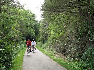
Root River State Trail and Harmony-Preston State Trail are a 60-mile (97 km) paved multi-use rail trail system in the driftless area of southeast Minnesota. The trail system consists of two main segments, the Root River segment, and Harmony-Preston Valley segment. The trails are used mainly for bicycling, hiking, and inline skating in the summer, and for cross country skiing in the winter. Much of the trail, especially the Root River segment, is built along a former Milwaukee Road railbed following the contours of the Root River valley. The trail was originally paved in the 1980s, and repaved by June 2008.

49 Degrees North Ski Area is a ski resort in the northwestern United States, located inside Colville National Forest in Stevens County, Washington, ten miles (16 km) east of Chewelah, which is 42 miles (68 km) north of Spokane.

Baldy Bowl is a fluvial cirque, in the San Gabriel Mountains of the U.S. state of California, that forms much of the upper south face of Mount San Antonio. It is one of the most visited backcountry locales in the San Gabriels, and is popular with skiers, hikers, and climbers. It has a base elevation of around 8,200 ft (2,500 m).
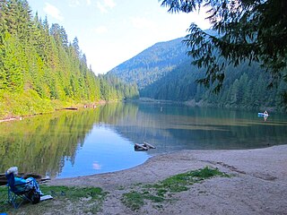
Cottonwood Lake is a lake in the Selkirk Mountains in the West Kootenay region of the Regional District of Central Kootenay in British Columbia, Canada.
References
| | This article about a ski area or resort is a stub. You can help Wikipedia by expanding it. |
| | This British Columbia-related article is a stub. You can help Wikipedia by expanding it. |