Related Research Articles
The Šar Mountains or Sharr Mountains, is a mountain range extending from southern Kosovo to northwestern North Macedonia. The sections in Kosovo, and in Šar Mountains National Park are national parks. Rugged and barren, the mountains are among the highest on the Balkans, with 30 peaks higher than 2,500 m (8,202 ft).

This is a list of the extreme points of North America: the points that are highest and lowest, and farther north, south, east or west than any other location on the continent. Some of these points are debatable, given the varying definitions of North America.
The Village of Nakusp is beside the mouth of Kuskanax Creek, on the Upper Arrow Lake in the West Kootenay region of southeastern British Columbia. Lying between the Selkirk and Monashee ranges, the village is known for its nearby hot springs and picturesque mountain lakeside setting.
SilverStar Mountain Resort (SilverStar) is a ski resort located near Silver Star Provincial Park in the Shuswap Highland of the Monashee Mountains, 22 km northeast of the city of Vernon, British Columbia, Canada. SilverStar's snow season runs from late November to mid-April weather permitting. SilverStar provides summer lift access for mountain biking and hiking from the end of June through to September.
RED Mountain Resort is a ski resort in western Canada, located on Granite, Grey, Kirkup, and Red Mountains in Rossland, a former gold mining town in the West Kootenay region of southeastern British Columbia. RED Mountain is one of the oldest ski hills in North America, with a history dating back to the creation of the Red Mountain Ski Club (RMSC) in the first decade of the 1900s. RED Mountain is located in the Monashee Mountains just north of the U.S. border. Like other ski hills in the British Columbia Interior, it has a reputation for light, dry powder, with yearly snowfall of 750 cm (300 in).
McDonald Creek Provincial Park is a provincial park in British Columbia, Canada, located 10 km south of Nakusp along Highway 6 in the Arrow Lakes region. The 468-hectare park is bisected by Upper Arrow Lake, and it provides beaches, a boat launch and 73 camping spaces on the eastern shore of the reservoir. Formerly a homesteading site, the area was set aside for recreation in 1982. In 2014, the campground underwent an upgrade, including the installation of a new services including showers and additional camping spaces.

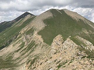
Summit Lake Provincial Park is a Class C provincial park located southeast of the community of Summit Lake in the Central Kootenay region of British Columbia, Canada.

The Summit at Snoqualmie is a recreation area in the northwest United States, located on Snoqualmie Pass, Washington. It provides alpine skiing and snowboarding, Nordic skiing, mountain biking, winter tubing, and scenic lift rides. Owned and managed by Boyne Resorts, it is 52 miles (80 km) east of downtown Seattle on Interstate 90.

Bonnington was a sternwheel steamboat that ran on the Arrow Lakes in British Columbia from 1911 to 1931. Bonnington and two sisterships were the largest sternwheelers ever built in British Columbia. Bonnington was partially dismantled in the 1950s, and later sank, making the vessel the largest freshwater wreck site in British Columbia.

The Nakusp was a sternwheel steamboat that operated from 1895 to 1897 on the Arrow Lakes of British Columbia.
Murray Ridge Ski Area, also known as Murray Ridge Ski Hill, is a small ski resort located near Fort St. James, British Columbia, Canada. The area has been in operation since the 1976-77 ski season and is managed by the Fort St. James Ski Club. The facilities include a 557 m² day lodge. The area's T-Bar is reputed to be the longest in the world. Development of the area, which began with only two rope-tows, was assisted by Al Raine.
Salmo Ski Area is a small ski area located in the West Kootenay region of southeastern British Columbia, Canada, 0.5km south of the village of Salmo, 28 miles southeast of the city of Castlegar, and 31 miles south of the city of Nelson.
Tabor Mountain Ski Resort, also known as Tabor Mountain Alpine Resort, is a ski resort located 20 km (12 mi) east of Prince George, British Columbia, Canada, adjacent to BC Hwy 16 on Mount Tabor.
McGillivray Pass is a mountain pass in the Pacific Ranges of southwestern British Columbia, Canada, located about 30 miles west of the town of Lillooet and immediately west of the upper end of Anderson Lake, above the former resort community of McGillivray. The pass connects the head of McGillivray Creek with the head of Standard Creek, a tributary of Cadwallader Creek and was used as a route by prospectors, miners and hunters heading for the upper Bridge River Country beyond the pass. The pass was proposed at one time for a cog railway to connect the mines at Bralorne and Pioneer with the Pacific Great Eastern Railway (now part of CN but the project never went forward. There are private ski cabins near the summit area of the pass, which is the division between the Bendor Range to the east and the Cadwallader Range to the west.

Mica Peak is the name of two separate mountain summits in the United States located approximately 5.49 miles (9 km) apart; one in Spokane County, Washington and the other in Kootenai County, Idaho. The two peaks are located along the same ridge, which separates the Spokane Valley and Rathdrum Prairie from the Palouse. The mountains have an elevation difference of only 31 ft (9.4 m) and are the southernmost peaks of the Selkirk Mountains.
Monashee Pass, 1,189 m (3,901 ft), is a mountain pass in the Monashee Mountains of the Southern Interior of British Columbia, Canada. Located southeast of Cherryville, the pass is used by British Columbia Highway 6 connecting Vernon to Nakusp on Arrow Lake, and beyond to the cities of the West Kootenay. It is the "prominence col" for Big White Mountain, which is the highest mountain to its southwest.
Mount Vic 3005 m (9859 ft), prominence: 712 m, is a mountain in the Chilcotin Ranges of the Central Interior of British Columbia, Canada, located east of the southernmost of the Taseko Lakes and southeast of Taseko Mountain. Adjoining its lower slopes to the northeast is the Dil-Dil Plateau, a lava plateau rising above the main Chilcotin Plateau, which extends north and northeast in general from this area, which is to the west of the headwaters of Big Creek. Mount Vic is one of the highest summits of the southern Chilcotin Ranges, which are a subrange of the Pacific Ranges subdivision of the Coast Mountains.
Pinaymootang First Nation is a First Nations people whose home location is on Fairford 50 Reserve at Fairford, Manitoba, Canada. They are situated on Provincial Trunk Highway 6 in the Interlake Region of Manitoba about 220 kilometres from Winnipeg. The Rural Municipality of Grahamdale forms most of the reserve's land boundary, although it also has a short border with the Little Saskatchewan First Nation as well as significant lakeshore on Lake St. Martin, which is considered as being outside the reserve. The main settlement on the reserve is located at 51°35′55″N98°41′32″W.
The Upper Arrow Lake Ferry is a ferry across Upper Arrow Lake in the West Kootenay region of southeastern British Columbia. Linking Shelter Bay and Galena Bay, the ferry, part of BC Highway 23, is by road about 52 kilometres (32 mi) south of Revelstoke and 47 kilometres (29 mi) north of Nakusp.
References
- Ski Summit Lake website
- britishcolumbia.com webpage
- Joanne Buckman
| | This British Columbia-related article is a stub. You can help Wikipedia by expanding it. |
| | This article about a ski area or resort is a stub. You can help Wikipedia by expanding it. |
Coordinates: 50°08′46″N117°36′54″W / 50.14611°N 117.61500°W