Slocan Valley

Last updated
Slocan Valley
Slocan Lake (15995871222).jpg
Canada British Columbia relief location map.jpg
Red pog.svg
Slocan Valley
Location of Slocan Valley in British Columbia
Coordinates: 49°41′00″N117°30′09″W / 49.6834°N 117.5024°W / 49.6834; -117.5024
Location Kootenays, British Columbia, Canada

The Slocan Valley is a valley in the West Kootenay region of southeastern British Columbia.

Contents

Geographical boundaries

The Slocan Valley is about 100 kilometres (62 mi) long, but its width is undefined. The Valhalla Range provides the steep western boundary and the Slocan Range presents the gradual slopes of the eastern boundary. Squeezed in between, Slocan Lake occupies the north, and Slocan River the south. In the Selkirk Mountains, which were created 200 million years ago during the Jurassic period, the valley forms part of the 400-kilometre (250 mi) long Kootenay Arc, comprising sedimentary, volcanic and metamorphic rock. [1]

The earliest recorded use of the descriptor Slocan valley was 1891, and capitalized use was 1897. The name is not recognized officially by the BC Geographic Names office. The exact geographic boundaries are ill-defined, being either greater or smaller than the drainages of Slocan Lake and the Slocan River. It definitely includes from Crescent Valley north to Hills, and possibly east to Retallack. Unclear fringe settlements include South Slocan, Krestova, Pass Creek, and Summit Lake. Shoreacres (formerly Slocan Crossing), at the mouth of the Slocan River, is not generally considered to be in the Slocan. Although Highway 31A between New Denver and Kaslo is called the Valley of the Ghosts (ghost towns), only the western part is in the Slocan. [2] Some may define that part as no further east than Sandon.

Sacred to Sinixt people, Frog Mountain, Slocan Valley. Frog Mountain in the Slocan Valley is sacred to Sinixt People.jpg
Sacred to Sinixt people, Frog Mountain, Slocan Valley.

The valley is definitely home to the villages of Slocan, Silverton, and New Denver, as well as the unincorporated communities of Crescent Valley, Slocan Park, Passmore, Vallican, Winlaw, Appledale, Perry Siding, Lemon Creek, Rosebery, and Hills.

Valhalla Provincial Park lies on the western side of the upper valley, and is adjoined on its south by the valley of the Little Slocan River. East of Slocan Lake are mining ghost towns such as Sandon, Cody, and Three Forks.

First nations

The Sinixt and Ktunaxa peoples have occupied the valley for thousands of years, and parts are subject to ongoing treaty talks. [3] First Nations built camps and burial grounds in the south. [1] The word slocan is derived from the word meaning "pierce, strike on the head", a reference to the harpooning of salmon (see Slocan name origin).

K&SR, Payne Bluff above Sandon, c.1910. Payne Bluff above Sandon on the Kaslo and Slocan Railway (BC Archives).jpg
K&SR, Payne Bluff above Sandon, c.1910.

Mining

The north end of the valley saw a mining boom. [1] When rich silver-lead ore was discovered near Sandon in the early 1890s, thousands of prospectors arrived in the valley. Several smaller settlements sprang up along present Highway 31A, linking New Denver and Kaslo. By 1910, many of these were deserted and ultimately vanished. [3] Some larger silver-base metals mines produced through to the 1980s (see Slocan mining).

Railway & ferry

The Canadian Pacific Railway operated two former railway lines connected by the former Slocan Lake ferry (see Slocan railway, ferry & roads).

Farming & Doukhobors

Like First Nations before them, early pioneers recognized the fertile land of the lower valley was prime for settlement. [1] The most prominent of the early farmers were the Doukhobors. In 1908, settling in Brilliant, colonies spread outward, which included the south end of the valley. Many descendants remain residents. [3] Small private farms, some originally started by Doukhobors, produce organic fruit and vegetables for local farmer's markets, restaurants, grocery stores and food processors. [4]

For decades, the valley has been home to craft cannabis cultivation. Many existing operations have transitioned to the now legal industry, and new entrants can benefit from the infrastructure already in place. [4] In 2021, growers are establishing a processing co-op. [5]

British orchardists

In the 1910s, came the British immigrants lured with a dream of establishing small commercial orchards. Apples were a favourite crop. Unfortunately, the climate, often coupled with steeply sloping land, dashed these hopes. Today, few of those orchards remain. [3]

Japanese internment

Several West Kootenay internment centres housed thousands of Japanese Canadians removed from the BC coast during World War II. In the valley, these camps stretched from Lemon Creek in the south to Rosebery in the north, and Sandon in the east. Many internees stayed on after the war ended [3] (see Slocan Japanese internment).

Back to the land & home-based businesses

The back-to-the-land movement peaked in the 1970s. The movement largely comprised hippies and many U.S. draft dodgers of the Vietnam War era. Most participants discovered that communal living and self-sustenance was not their ideal. However, remnants formed the foundation for today's artisans, in skills such as theatre, writing, painting, ceramics, and textiles. [3] Some people still choose to live off grid or in a commune. [6] Locally made natural soaps, wellness products and clothing are sold online. A team of ice and sand sculpturers have adopted the valley as a base. [4]

Urban escapees

Gregorio Peak, Valhalla Provincial Park, 2012. Snowmelt Pool in Valhalla Provincial Park.jpg
Gregorio Peak, Valhalla Provincial Park, 2012.

Since the mid-1960s, city dwellers have been attracted by the rural lifestyle and lower accommodation costs. People can work remotely via improved cell networks, internet connectivity, and by 2023, increased high speed coverage through a fibre optic network extension. Many residents commute daily to larger centres like Nelson, Castlegar, and Nakusp. [4] [7]

Tourism

Popular activities include mountain biking, rafting on the Slocan River, back country skiing, rock climbing at the Slocan Bluffs, and visiting Valhalla Provincial Park. Golf games are far cheaper than urban centres. Independent tourism operators host many of these pursuits. [4]

Giant cedars exist in small pockets throughout the valley, including on the accessible Retallack Old Growth Cedar Trail. Timber harvesting was once central to the economy. [1]

Related Research Articles

<span class="mw-page-title-main">Kootenays</span> Region of British Columbia in Canada

The Kootenays or Kootenay is a region of southeastern British Columbia. It takes its name from the Kootenay River, which in turn was named for the Kutenai First Nations people.

<span class="mw-page-title-main">Kootenay River</span> River in Western Canada and the United States

The Kootenay River or Kootenai River is a major river of the Northwest Plateau in southeastern British Columbia, Canada, and northern Montana and Idaho in the United States. It is one of the uppermost major tributaries of the Columbia River, the largest North American river that empties into the Pacific Ocean. The Kootenay River runs 781 kilometres (485 mi) from its headwaters in the Kootenay Ranges of the Canadian Rockies, flowing from British Columbia's East Kootenay region into northwestern Montana, then west into the northernmost Idaho Panhandle and returning to British Columbia in the West Kootenay region, where it joins the Columbia at Castlegar.

The Columbia and Kootenay Railway (C&KR) was a historic railway operated by the Canadian Pacific Railway (CPR) in the West Kootenay region of British Columbia. This 25-mile (40 km) route, beside the unnavigable Kootenay River, linked Nelson on the west arm of Kootenay Lake with Robson at the confluence of the Kootenay River and the Columbia River near Castlegar.

<span class="mw-page-title-main">Kaslo and Slocan Railway</span>

The Kaslo and Slocan Railway (K&S) is a historic railway that operated in the West Kootenay region of southeastern British Columbia. The K&S connected Kaslo and Sandon. Initially a narrow-gauge railway, the line was later rebuilt to standard gauge.

The Nakusp and Slocan Railway (N&S) is a historic Canadian railway that operated in the West Kootenay region of southeastern British Columbia. The N&S initially connected Nakusp and Three Forks but soon extended to Sandon.

<span class="mw-page-title-main">British Columbia Southern Interior</span> Federal electoral district in British Columbia, Canada

British Columbia Southern Interior was a federal electoral district in the province of British Columbia, Canada, that had been represented in the House of Commons of Canada from 1997 to 2015.

Yale–Cariboo was a federal electoral district in British Columbia, Canada, that was represented in the House of Commons of Canada from 1896 to 1917.

<span class="mw-page-title-main">New Denver</span> Village in British Columbia, Canada

New Denver is at the mouth of Carpenter Creek, on the east shore of Slocan Lake, in the West Kootenay region of southeastern British Columbia. The village is 47 kilometres (29 mi) west of Kaslo on Highway 31A, and 47 kilometres (29 mi) southeast of Nakusp and 32 kilometres (20 mi) northeast of Slocan on Highway 6.

<span class="mw-page-title-main">Sandon, British Columbia</span> Place in British Columbia, Canada

Sandon is in the foothills of the Selkirk Mountains in the West Kootenay region of southeastern British Columbia. The near ghost town lies off BC Highway 31A, and is at the confluence of Sandon Creek into Carpenter Creek. By road, the place is about 14 kilometres (9 mi) east of New Denver and 43 kilometres (27 mi) west of Kaslo.

<span class="mw-page-title-main">Kaslo</span> Village in British Columbia, Canada

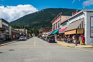
Kaslo is a village on the west shore of Kootenay Lake in the West Kootenay region of southeastern British Columbia. A member municipality of the Central Kootenay Regional District, the name derives from the adjacent Kaslo River. At 2016, the population was 968, and the idyllic village is regarded as the "Little Switzerland of Canada."

Silverton is a village about 5 kilometres (3 mi) south of New Denver in the West Kootenay region of southeastern British Columbia. The former steamboat landing is at the mouth of Silverton Creek on the eastern shore of Slocan Lake. The locality, on BC Highway 6 at the junction of BC Highway 31A, is about 95 kilometres (59 mi) by road north of Castlegar and 155 kilometres (96 mi) by road and ferry south of Revelstoke.

<span class="mw-page-title-main">Slocan, British Columbia</span> Village in British Columbia, Canada

The Village of Slocan is in the West Kootenay region of southeastern British Columbia. The former steamboat landing and ferry terminal is at the mouth of Springer Creek, at the foot of Slocan Lake. The locality, on BC Highway 6 is about 69 kilometres (43 mi) by road north of Castlegar and 183 kilometres (114 mi) by road and ferry south of Revelstoke.

Winlaw is an unincorporated community adjacent to Winlaw Creek on the east side of the Slocan River in the West Kootenay region of southeastern British Columbia. The locality is on BC Highway 6 about 20 kilometres (12 mi) south of Slocan, and 49 kilometres (30 mi) north of Castlegar.

West Kootenay Transit System is the public transit system in Trail, Castlegar, Nelson, British Columbia and surrounding area. The transit services are operated from Trail, Castlegar, Nelson and serve Rossland, Warfield, Genelle, Montrose, Fruitvale, Salmo, Kaslo, Creston, Nakusp. Funding is provided under a partnership between the Regional District of Kootenay Boundary, Regional District of Central Kootenay and BC Transit. handyDART provides door-to-door transportation for people whose disability prevents them from using conventional bus service.

<span class="mw-page-title-main">Slocan Lake</span> Lake in British Columbia, Canada

Slocan Lake is a lake in the Slocan Valley of the West Kootenay region of the Southeastern Interior of British Columbia, Canada. it is drained by the Slocan River, which flows south from the lake's foot at Slocan City through the Slocan Valley to South Slocan, British Columbia, where that river meets the Kootenay River a few miles above its confluence with the Columbia. It is fed by Bonanza Creek, which comes down the pass from Summit Lake, beyond which is the town of Nakusp on Upper Arrow Lake.

Rosebery is an unincorporated community about 6 kilometres (4 mi) north of New Denver in the West Kootenay region of southeastern British Columbia. The former steamboat landing and ferry terminal is at the mouth of Wilson Creek on the eastern shore of Slocan Lake. The locality, on BC Highway 6, is about 106 kilometres (66 mi) by road north of Castlegar and 144 kilometres (89 mi) by road and ferry south of Revelstoke.

Retallack is on the north side of the Kaslo River, west of the junction with Whitewater Creek, in the West Kootenay region of southeastern British Columbia. The settlement, on Highway 31A, is about 37 kilometres (23 mi) northwest of Kaslo and 20 kilometres (12 mi) northeast of New Denver.

Three Forks is a ghost town at the junction of Carpenter, Seaton, and Kane creeks in the West Kootenay region of southeastern British Columbia. This former mining community, on BC Highway 31A, is by road about 8 kilometres (5 mi) east of New Denver and 38 kilometres (24 mi) west of Kaslo.

Lemon Creek is an unincorporated community on the east side of the Slocan River in the West Kootenay region of southeastern British Columbia. The locality is on BC Highway 6 about 8 kilometres (5 mi) south of Slocan, and 62 kilometres (39 mi) north of Castlegar.

South Slocan is an unincorporated community in rural British Columbia with a population of approximately 100 people, many of whom are followers of the Doukhobors religion. It is located on the northwest shore of the Kootenay River in the West Kootenay region of southeastern British Columbia. The village comprises 51 households. A former railway junction on BC Highway 6, it is approximately 24 kilometres (15 mi) northeast of Castlegar, and 20 kilometres (12 mi) southwest of Nelson. Its postal category is Rural Route One.

References

  1. 1 2 3 4 5 "Slocan Valley–Our Environment". www.slocanvalley.com.
  2. "Castlegar News, 8 Jun 2017". www.castlegarnews.com.
  3. 1 2 3 4 5 6 "Slocan Valley–Our History". www.slocanvalley.com.
  4. 1 2 3 4 5 "Slocan Valley–Our Economy". www.slocanvalley.com.
  5. "Nelson Star, 11 Dec 2020". www.nelsonstar.com.
  6. "Backcountry, 7 Feb 2019". www.backcountrymagazine.com.
  7. "Slocan Valley Fibre Optic Backbone Project". www.ourtrust.org.

Commons-logo.svg Media related to Slocan Valley at Wikimedia Commons