
Cropped to show Bulkley Valley.
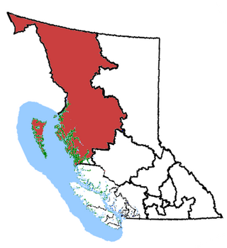
The Bulkley Valley is in the northwest Central Interior of British Columbia, Canada.
The Bulkley Valley is in the northwest Central Interior of British Columbia, Canada.
The Bulkley, a stream running through Houston, British Columbia, joins the larger Morice River about 6 kilometres (3.7 mi) to the west. At the confluence, they become not the Morice, but unusually, take the name of the smaller Bulkley. The 257-kilometre (160 mi) Bulkley River flows northwestward through the valley that is bounded on the west by the Hudson Bay Mountain range and on the east by the Babine Mountains. The northern boundary of the valley is usually considered the Bulkey's confluence with the Skeena River at Hazelton, although it is sometimes placed further south near Witset. The valley's southern edge is at Bulkley Lake, part way between Houston and Burns Lake.
Wet'suwet'en people have called the valley home for thousands of years. In the Delgamuukw decision of 1997, the Supreme Court of Canada affirmed the Wet'suwet'en and neighbouring Gitxsan have Aboriginal title in the area. [1]
Simon McGillivray of the Hudson's Bay Company (HBC), who ventured into the northern part of the valley in 1833, is recorded as the first European visitor. [2] William Downie followed in 1859 while apparently surveying a possible transcontinental railway route. [3] Michael Byrnes (after whom Burns Lake is named) and Henry McNeill, Collins Overland Telegraph surveyors, were the first to travel the entire length of the valley. Charles S. Bulkley (after whom the river and valley are named) was the company chief engineer for construction, but not a site employee. By September 1866, the line had crossed the valley following the Bulkley to its junction with the Skeena River. [4] Following the successful completion of the transatlantic telegraph cable, work halted on the Collins telegraph in March 1867, and prompted its 1869 closure north of Quesnel. [5]
N. B. Gauvreau in 1890–1891 and A. L. Poudrier in 1892 conducted government surveys of the valley. The Poudrier party improved the former telegraph trail to a wagon road standard south to Moricetown, and made other sections suitable for packhorses. [6] During 1897–1901, the prospectors who followed the trail on their way to the Klondike Gold Rush observed the valley's agriculture and mining potential. [7] In 1898, the Dominion government established a ranch at Pleasant Valley (Houston area), and the HBC in the Driftwood area.

The first phase of the Yukon telegraph, with a branch to Atlin, was constructed in 1899. The 900-mile (1,400 km) second phase, connecting Atlin and Quesnel along the abandoned Collins telegraph route, was completed in 1901. The 20-foot right-of-way improved access to the Bulkley Valley from both eastward points and the sternwheeler terminal at Hazelton to the west. [8] Charles Barrett (1866–1946), [9] and Edward Charleson, who worked on the telegraph construction, settled six miles (9.7 km) west of Houston at what became Barrett. Barret later bought out Charleson and acquired the government ranch, naming the expanded property the "Diamond D". Prospectors and a small number of settlers lived elsewhere in the valley. [10]
In 1902, a delegation urged the BC government to initiate preemptions in the valley. Although the government approved a scheme for 100 families to each receive 100 acres of free land for every 320 acres preempted, prohibitive freight costs limited new settlers to a trickle. The government offered veterans from the Boer War 160-acre land grants, and the valley became a popular choice. Unfortunately, most veterans on sold to speculators, soon creating vast parcels of undeveloped fertile land. For example, Francis Rattenbury acquired about 50,000 acres in the valley. Settlement proceeded slowly. In 1904, developers staked out the community of Aldermere on the hill above Telkwa. By 1906, the valley contained 74 non-native permanent residents. Telkwa was surveyed the following year. [11] By 1910, upgrades to the wagon road stretched 30 miles (48 km) south of this point. [12] By 1911, a weekly Aldermere–Hazelton stagecoach operated. [13] That year, the first automobile traversed the valley, en route from Seattle to Hazelton. [14]

The anticipated railway link would remove many of the obstacles to growth. [15] Foley, Welch and Stewart (FW&S) began eastward construction of the Grand Trunk Pacific Railway (GTP) from Prince Rupert in 1908, reaching the valley in 1912. [16] The GTP had initially considered routing through the Telkwa Pass, 80 miles (130 km) shorter, largely bypassing the valley and the then major centre of Hazelton. [17] That year forest fires raged through the valley destroying crops, farm buildings and equipment as far west as Telkwa and Aldermere. [18]
The start of World War I saw land prices plummet, and settlers abandoning their properties. In 1917, a BC government initiative encouraged settlers and returning war veterans to establish farms in undeveloped areas. To this end, 24,000 acres were set aside in the valley, with conditions to deter speculation. In 1919, the United Grain Growers (UGG) purchased 7,000 acres of the Rattenbury land, bringing sales to 32,000 acres, largely in the valley. At the time, his company owned 500,000 acres across the region. In 1927, his unsold holdings largely reverted to the government. [19] [20]
Upgrading the road from Prince George to Hazelton with gravel was completed in 1925. This route was designated Highway 16, which reached as far west as Cedarvale in 1942. US assistance was invaluable in reconstructing the final section to Prince Rupert in 1944, creating in places a narrow road wedged between the Skeena and railway tracks. Widening and paving came in the mid-to-late 1960s. [21]
At Goathorn Creek near Telkwa, the McNeil mine began coal extraction in 1918, producing 14–45 tons daily. Opened in 1930, Bulkley Valley Collieries became the dominant player, increasing to about 9,000 tons per year during the late 1940s and early 1950s. The Gething mine produced just over 15,000 tonnes from its underground operations of 1972–1986. [22]
A 1929 pamphlet lists numerous undeveloped, dormant and active gold, silver, copper, zinc, lead and coal claims in the vicinity of the Telkwa River, Owen Lake, Topley, Houston, Mineral Hill, Grouse Mountain, Deep Creek, Dome Mountain, Babine Range, and Hudson Bay Mountain. Cronin Mine (primarily silver), 30 miles (48 km) from Telkwa/Smithers, was active 1909–1924. Opened in 1922, Duthie Mines (primarily silver), 15 miles (24 km) from Smithers, extracted $227,500 worth in 1928, [23] but operations ceased in 1930. [24] During the following decades, all mining of precious metals was modest. [25]
The open pit Huckleberry Mine, 123 kilometres (76 mi) southwest of Houston, opened in 1997. Owing to low copper and molybdenite prices, production ceased in 2016. At the time, Huckleberry employed 260 people, 80 percent from Bulkley Valley communities. In 2015, the last full year of production, the mill processed 20,000 tonnes of ore per day, producing more than 43 million lbs of copper, 3,500 ounces of gold, and 206,000 ounces of silver. [26]
The forest industry has remained dominant. Agriculture has comprised dairy and beef ranching, with opportunities for large-scale greenhouse operations. Tourism resources offer fishing, hunting, and hiking in spectacular terrain. Potential exists for expanding the mining industry, [27] but residents oppose any new coal mines. [22]
| Location & history | P.O. a | Active station/flag stop c | |||||||||||||||||||||
|---|---|---|---|---|---|---|---|---|---|---|---|---|---|---|---|---|---|---|---|---|---|---|---|
| Subdivision | Mile | Station Name | 1913–15 | Rename | 1916–17 | Rename | 1918–c. 1962 | c.1962–c.1969 | c.1969 onward | ||||||||||||||
| Telkwa [28] | 58.9 | Bulkley | [29] | [30] [31] | yes | Forestdale | yes | yes | yes | no | |||||||||||||
| 66.6 | Topley | [32] | [33] b | yes | yes | yes | yes | no | |||||||||||||||
| 72.9 | Perow | [34] | [35] | yes | yes | yes | yes | no | |||||||||||||||
| 80.1 | Quick | [36] | e | [37] | yes | Knockholt | yes | yes | no | no | |||||||||||||
| 85.1 | Houston | [38] [39] | d | [40] b | yes | yes | yes | yes | yes | ||||||||||||||
| 91.4 | Barrett | [41] [42] [43] | [44] | yes | yes | yes | yes | no | |||||||||||||||
| 98.8 | Walcott | [45] | yes | yes | yes | yes | no | ||||||||||||||||
| 107.1 | Knockholt | [46] [47] | e | [48] | yes | Quick | yes | yes | yes | no | |||||||||||||
| 112.8 | Hubert | [49] | [50] | yes | yes | yes | no | no | |||||||||||||||
| f | Aldermere | [51] | |||||||||||||||||||||
| 116.0 | Telkwa | [52] [53] | d | [54] b | no | yes | yes | yes | yes | ||||||||||||||
| 119.4 | Tatlow | [55] | yes | no | yes | no | no | ||||||||||||||||
| Bulkley [56] | 125.2 0.0 | Smithers | [57] | d | [58] b | yes | yes | yes | yes | yes | |||||||||||||
| 3.6 | Lake Kathlyn | [59] [60] | yes | yes | yes | no | no | ||||||||||||||||
| 9.1 | Evelyn | [61] [62] | [63] | yes | yes | yes | yes | no | |||||||||||||||
| 15.5 | Doughty | yes | yes | yes | no | no | |||||||||||||||||
| 21.9 | Moricetown | [64] | d ˙ g | [65] | yes | yes | yes | yes | no | ||||||||||||||
| 27.3 | Seaton | [66] | yes | yes | yes | yes | no | ||||||||||||||||
| 31.9 | Beament | yes | yes | yes | no | no | |||||||||||||||||
| 39.4 | Duncanan | [67] | yes | no | Bulkley Canyon | yes | yes | no | |||||||||||||||
^a . Post office may have neither shared same name as station, nor been in close proximity.
^b . Post office currently operates.
^c . Extracted from railway timetables. Some stops opened in late 1912. Most communities have dispersed, some prior to the respective stop closure.
^d . Main communities.
^e . Unclear why names switched.
^f . Former community, but not a station.
^g . Renamed Witset in 2018.
Bulkley River

Hazelton is a village municipality in the Skeena region of west central British Columbia, Canada. The place is on the southeast side of the Skeena River immediately north of the Bulkley River mouth, where the confluence forms a peninsula. On BC Highway 62, the locality is by road about 75 kilometres (47 mi) northwest of Smithers and 144 kilometres (89 mi) northeast of Terrace. Hazelton is the original of the "Three Hazeltons", the other two being New Hazelton to the southeast and South Hazelton to the south.

The Bulkley River in British Columbia is a major tributary of the Skeena River. The Bulkley is 257 kilometres (160 mi) long with a drainage basin covering 12,400 square kilometres (4,800 sq mi).

Smithers is a town in northwestern British Columbia, approximately halfway between Prince George and Prince Rupert. With a population of 5,351 in 2016, Smithers provides service coverage for most of the Bulkley Valley.
Skeena—Bulkley Valley is a federal electoral district in British Columbia, Canada, that has been represented in the House of Commons of Canada since 2004.
Telkwa is a village located along British Columbia Highway 16, nearly 15 kilometres (9 mi) southeast of the town of Smithers and 350 kilometres (220 mi) west of the city of Prince George, in northwest British Columbia, Canada.

Houston is a forestry, mining and tourism town in the Bulkley Valley of the Northern Interior of British Columbia, Canada. Its population as of 2021 was 3,052, with approximately 2,000 in the surrounding rural area. It is known as the "steelhead capital" and it has the world's largest fly fishing rod. Houston's tourism industry is largely based on ecotourism and Steelhead Park, situated along Highway 16. Houston is named in honour of the pioneer newspaperman John Houston.
Fort Babine is an unincorporated community that borders the Skeena and Omineca regions of central British Columbia. This First Nations settlement is on the east shore of the Babine River at the northern tip of Babine Lake. By road, the location is about 105 kilometres (65 mi) northeast of Smithers.

Witset is a Wet'suwet'en village in Central British Columbia, Canada on the west side of the Bulkley River on Coryatsaqua (Moricetown) Indian Reserve No. 2, and on Moricetown Indian Reserve No.1. The current village was built during the early 1900s. Evidence of inhabitants date back to around 5,500 years ago.
Tyhee Lake Provincial Park is a provincial park in British Columbia, Canada, located near the town of Smithers in the Bulkley Valley.

The Hazelton Mountains are a grouping of mountain ranges on the inland lee of the Kitimat Ranges of the Coast Mountains in northwestern British Columbia, Canada, spanning the area of Hazelton south to the Nechako Reservoir. Defined by the British Columbia geographic names office, they span from the Nass River to the Nechako Plateau, and between the Coast Mountains and the Bulkley River, they are considered by geographers to be part of the Interior Mountains complex, though in local perspective they are considered to be part of the Coast Mountains. They are neighboured on the west by the Kitimat Ranges and on the east by the southernmost section of the Skeena Mountains; beyond the Nass River, which is their northern boundary, are the Boundary Ranges of the Coast Mountains. To their southeast is the Nechako Plateau, including the Quanchus Range on the near-island between Ootsa and Eutsuk Lakes of the Nechako Reservoir.
New Hazelton is a district municipality on the south side of the Bulkley River in the Skeena region of west central British Columbia, Canada. On BC Highway 16, the locality is by road about 68 kilometres (42 mi) northwest of Smithers and 137 kilometres (85 mi) northeast of Terrace. New Hazelton is one of the "Three Hazeltons", the other two being the original "Old" Hazelton to the northwest and South Hazelton to the west.

The Jasper–Prince Rupert train is a Canadian passenger train service operated by Via Rail between Jasper, Alberta, Prince George and Prince Rupert in British Columbia.
The Bulkley Ranges are a mountain range in northern British Columbia, Canada, located between the Skeena and Bulkley Rivers south of Hazelton, north of the Morice River and Zymoetz River. It has an area of 7851 km2 and is a subrange of the Hazelton Mountains which in turn form part of the Interior Mountains.

Kitselas Canyon is a canyon carved by the Skeena River in the Skeena region of west central British Columbia, Canada. Off BC Highway 16, the landmark is by road about 185 kilometres (115 mi) west of Smithers and 20 kilometres (12 mi) northeast of Terrace.
Kitselas is a railway point on the northwestern shore of the Skeena River in the Skeena region of west central British Columbia, Canada. The former name was Vanarsdol. Across the Skeena to the southwest is the mouth of the Zymoetz River. This river bridge on BC Highway 16 is by road about 10 kilometres (6 mi) northeast of Terrace.
Cedarvale or Meanskinisht is an unincorporated community in the Skeena region of west central British Columbia. Concentrated on the southeastern shore of the Skeena River, no direct link exists to the portion on the northwestern shore. On BC Highway 16, the locality is by road about 130 kilometres (81 mi) northwest of Smithers and 75 kilometres (47 mi) northeast of Terrace.
Rosswood is a scattered community in the Skeena region of west central British Columbia, Canada. The place is at the northern tip of Kitsumkalum Lake. Being the meeting point of Kalum Lake Road and the Nisga'a Highway, the locality is by road about 39 kilometres (24 mi) north of Terrace.
Lorne Creek is a creek in the Omineca Country region of west central British Columbia, which enters the Skeena River from the west. Henry McDame discovered gold in this creek in 1884, leading to placer mining.
South Hazelton is an unincorporated community in the Skeena region of west central British Columbia, Canada. The place is on the east side of the Skeena River immediately south of the Bulkley River mouth. On BC Highway 16, the locality is by road about 73 kilometres (45 mi) northwest of Smithers and 132 kilometres (82 mi) northeast of Terrace. South Hazelton is one of the "Three Hazeltons", the other two being the original "Old" Hazelton to the north and New Hazelton to the east.
Remo is an unincorporated community in the Skeena region of west central British Columbia. Concentrated on the northwestern shore of the Skeena River and immediately northeast of the Zymagotitz River mouth, no direct link exists to the portion on the southeastern shore. On BC Highway 16, the locality is by road about 10 kilometres (6 mi) southwest of Terrace.
{{cite book}}: |website= ignored (help)54°46′55″N127°10′05″W / 54.78194°N 127.16806°W