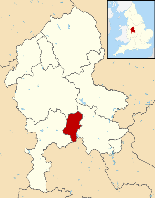
The Borough of Stafford is a local government district with borough status in Staffordshire, England. It is named after Stafford, its largest town, which is where the council is based. The borough also includes the towns of Stone and Eccleshall, as well as numerous villages and surrounding rural areas.
South Staffordshire is a local government district in Staffordshire, England. Its council is based in Codsall. Other notable settlements include Brewood, Cheslyn Hay, Coven, Essington, Featherstone, Four Ashes, Great Wyrley, Huntington, Kinver, Landywood, Penkridge, Perton, Wedges Mills, Weston-under-Lizard and Wombourne. The district covers a largely rural area lying immediately to the west and north-west of the West Midlands conurbation.
Cannock Chase is a local government district in Staffordshire, England. It is named after and covers a large part of Cannock Chase, a designated National Landscape. The council is based in the town of Cannock. The district also contains the towns of Hednesford and Rugeley, as well as a number of villages and surrounding rural areas.

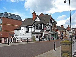
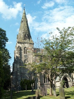
Eccleshall is a town and civil parish in the Stafford district, in the county of Staffordshire, England. It is located seven miles northwest of Stafford, and six miles west-southwest of Stone. Eccleshall is twinned with Sancerre in France.
Hixon is a village and a civil parish in the English county of Staffordshire.
grid reference SK003259

Stone was a constituency in Staffordshire in the House of Commons of the UK Parliament. It was represented since its 1997 recreation by Sir Bill Cash, a Conservative. On 9 June 2023, he announced his intention to stand down at the 2024 general election.

Haughton is a village in Staffordshire, England, approximately 4 miles outside and to the west of the county town of Stafford. It lies on the A518 between Stafford and Gnosall. The name derives from a combination of the Mercian word halh meaning 'nook' and the Old English word tun meaning 'settlement', 'enclosure' or 'village.'
Austrey is a village and civil parish in the North Warwickshire District of Warwickshire, England.
Stafford Rural District was a rural district in the county of Staffordshire. It was created in 1894 and abolished in 1974 by virtue of the Local Government Act 1972. On formation it contained the following civil parishes:

Chorlton is a village and former civil parish, now in the parish of Hough and Chorlton, in the unitary authority area of Cheshire East and the ceremonial county of Cheshire, England. The village lies 4 miles (6.4 km) to the south east of Crewe. Nearby villages include Hough, Shavington, Weston and Wybunbury in Cheshire and Betley in Staffordshire. In 2011 the parish had a population of 897.

Leigh is a civil parish in the English county of Staffordshire. The parish includes the village of Church Leigh, together with the settlements of Withington, Upper Leigh, Lower Leigh, Morrilow Heath, Middleton Green, Dodsley, Godstone, Nobut and Field.

Weston is a village and civil parish. within the English county of Staffordshire. The parish is in the local authority of Stafford.

Thorpe Constantine is a small village and civil parish in Staffordshire, England. It lies about 6 miles (10 km) north-east of Tamworth and 6 miles south-west of Measham. The nucleus of the parish is the Thorpe estate.

The Heath is a village in the East Staffordshire borough of Staffordshire, England. It is close to the border with Derbyshire. The village adjoins the town of Uttoxeter and the villages of Bramshall and Spath.

Hilderstone is a village and a civil parish in the English county of Staffordshire.

Milwich is a village and a civil parish in the English county of Staffordshire.
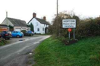
Hopton is a village in the civil parish of Hopton and Coton. It is within the English county of Staffordshire.
The Two Saints Way is a recreated pilgrimage route of 92 miles between the cathedral cities of Chester in Cheshire and Lichfield in Staffordshire. The two saints referenced are St Werburgh and St Chad. The route partly follows the Heart of England Way and is around 95% waymarked.
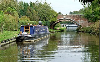
Salt and Enson is a civil parish in the Borough of Stafford, Staffordshire, England. It contains five listed buildings that are recorded in the National Heritage List for England. All the listed buildings are designated at Grade II, the lowest of the three grades, which is applied to "buildings of national importance and special interest". The parish contains the village of Salt and the surrounding area. The listed buildings consist of a farmhouse, two road bridges, one over the Trent and Mersey Canal, and the other over the River Trent, a former engine house, and a church.
Marston is a village and civil parish 12 miles (19 km) south of Stoke-on-Trent, in the Stafford district, in the county of Staffordshire, England. In 2011 the parish had a population of 158. The parish touches Creswell, Hopton and Coton, Salt and Enson, Sandon and Burston, Stone Rural and Whitgreave.

