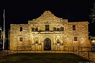
San Antonio, officially the City of San Antonio, is a city in the U.S. state of Texas and the most populous city in Greater San Antonio, the third-largest metropolitan area in Texas and the 24th-largest metropolitan area in the United States at 2.6 million people in the 2020 US census. It is the most populous city in and the seat of Bexar County. The city is the seventh-most populous in the United States, the second-largest in the Southern United States, and the second-most populous in Texas after Houston.

Hudspeth County is a county located in the U.S. state of Texas. As of the 2020 census, the population was 3,202. Its county seat is Sierra Blanca, and the largest community is Fort Hancock. The county is named for Claude Benton Hudspeth, a state senator and United States Representative from El Paso. It is northeast of the Mexico–U.S. border.

Culberson County is a county located in the U.S. state of Texas. As of the 2020 census, its population was 2,188. The county seat is Van Horn. Culberson County was founded in 1911 and organized the next year. It is named for David B. Culberson, a Confederate soldier and U.S. representative.

Bexar County is a county in the U.S. state of Texas. It is in South Texas and its county seat is San Antonio.

San Antonio Heights is a census-designated place (CDP) in the San Bernardino County, California. It is in the northern Pomona Valley and the foothills of the San Gabriel Mountains. The population was 3,371 at the 2010 census, up from 3,122 at the 2000 census.

Mountain View is a city in Santa Clara County, California, United States, part of the San Francisco Bay Area. Named for its views of the Santa Cruz Mountains, the population was 82,376 at the 2020 census.

Cross Mountain is a census-designated place (CDP) in Bexar County, Texas, United States. The population was 3,944 at the 2020 census, an increase over the figure of 3,124 tabulated in 2010. It is part of the San Antonio Metropolitan Statistical Area.

The San Gabriel Mountains comprise a mountain range located in northern Los Angeles County and western San Bernardino County, California, United States. The mountain range is part of the Transverse Ranges and lies between the Los Angeles Basin and the Mojave Desert, with Interstate 5 to the west and Interstate 15 to the east. The range lies in, and is surrounded by, the Angeles and San Bernardino National Forests, with the San Andreas Fault as its northern border.

Mount San Antonio, commonly referred to as Mount Baldy or Old Baldy, is a 10,064 ft (3,068 m) summit in the San Gabriel Mountains on the border of Los Angeles and San Bernardino counties of California. Lying within the San Gabriel Mountains National Monument and Angeles National Forest, it is the high point of the range, the County of Los Angeles, and the Los Angeles metropolitan area.

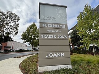
San Antonio Shopping Center is an outdoor shopping center located on El Camino Real and San Antonio Road in Mountain View, California, United States, in the San Francisco Bay Area. The shopping center consists of two areas, owned by two separate companies.
The community of San Antonio Valley, also called San Antonio or San Antone, is located along the Diablo Range in eastern Santa Clara County, California. The locale is bordered by Alameda County to the north and Stanislaus County to the east. The sparsely populated area is located at the junction of San Antonio Valley Road, Mines Road, and Del Puerto Canyon Road. The area includes the San Antonio Valley Ecological Reserve, a 3,282-acre nature preserve created by a Nature Conservancy purchase of land from local rancher, Keith Hurner, and known for its herd of tule elk.

Greater San Antonio, officially designated San Antonio–New Braunfels, is an eight-county metropolitan area in the U.S. state of Texas defined by the Office of Management and Budget (OMB). The metropolitan area straddles South Texas and Central Texas and is on the southwestern corner of the Texas Triangle. The official 2020 U.S. census showed the metropolitan area's population at 2,558,143—up from a reported 1,711,103 in 2000—making it the 24th largest metropolitan area in the United States. Downtown Austin and Downtown San Antonio are approximately 80 miles (129 km) apart, and both fall along the Interstate 35 corridor. This combined metropolitan region of San Antonio–Austin has approximately 5 million people.
Guatay is an unincorporated community in the Cuyamaca Mountains, in the Mountain Empire area of southeastern San Diego County, California.

The Patagonia Mountains are a 15-mile-long (24 km) mountain range within the Coronado National Forest, and in Santa Cruz County, Arizona, United States.

The Jemez River is a tributary of the Rio Grande in eastern Sandoval County, New Mexico, United States.

San Antonio Mountain is a free-standing volcanic peak in Rio Arriba County, New Mexico. With an elevation of 10,908 feet, San Antonio Mountain is the highest peak within the Taos Plateau volcanic field, the largest volcanic field within the Rio Grande Rift valley.

The San Gabriel Mountains National Monument is a United States National Monument managed by the U.S. Forest Service, which encompasses parts of the Angeles National Forest and the San Bernardino National Forest in California. On October 10, 2014, President Barack Obama used his authority under the Antiquities Act to create the new monument, protecting 346,177 acres of public lands in the San Gabriel Mountains of the Transverse Ranges. The effort to protect the San Gabriel Mountains began more than a century earlier, in 1891 with another U.S. President, Benjamin Harrison, the 23rd president, using a congressional act, to designate and delineate the first federal protection in the United States of forested lands, using the same mountain range name, as the San Gabriel Timberland Reserve. Two earlier California conservationists, Abbot Kinney and John Muir, influenced President Benjamin Harrison.
Mayfield Mall was a shopping mall in Mountain View, California, United States. Operational from 1966 to 1984, it was the first air-conditioned, enclosed shopping mall in Northern California, though it has been an office complex since the 1980s. In 2013, Google rented the entire 500,000 square feet (46,000 m2) property and ultimately purchased it in 2016 for $225 million and is known as the company's Building RLS1.

Rio San Antonio is a tributary of the Conejos River in northern New Mexico and southern Colorado. Via the Conejos River, it is part of the upper Rio Grande system. The river is used extensively for irrigation in its lower course through the southern San Luis Valley.


