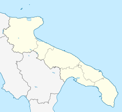
Motta di Livenza is a town in the province of Treviso, Veneto, Italy.

Buonabitacolo is a town and comune in the province of Salerno in the Campania region of south-western Italy.

San Cipriano Picentino is a town and comune in the province of Salerno in the Campania region of southern Italy.

Altomonte is a town and comune in the province of Cosenza, in the Calabria region of southern Italy.

Sant'Agata di Esaro is a town and comune in the province of Cosenza, in the Calabria region of southern Italy.

Sant'Antonino di Susa is a comune (municipality) in the Metropolitan City of Turin in the Italian region Piedmont, located in the Val di Susa about 35 kilometres (22 mi) west of Turin.

Mazzin is a comune (municipality) in Trentino in the northern Italian region Trentino-Alto Adige/Südtirol, located about 60 km northeast of Trento.
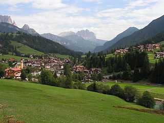
Soraga di Fassa is a comune (municipality) in Trentino in the northern Italian region Trentino-Alto Adige/Südtirol, located about 60 kilometres (37 mi) northeast of Trento. Soraga borders the following municipalities: Sèn Jan di Fassa, Falcade and Moena.

Alto is a comune (municipality) in the Province of Cuneo in the Italian region Piedmont, located about 110 kilometres (68 mi) south of Turin and about 45 kilometres (28 mi) southeast of Cuneo.

Castelnuovo di Ceva is a comune (municipality) in the Province of Cuneo in the Italian region Piedmont, located about 90 kilometres (56 mi) southeast of Turin and about 45 kilometres (28 mi) east of Cuneo.
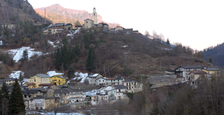
Macra is a comune (municipality) in the Province of Cuneo in the Italian region Piedmont, located about 80 kilometres (50 mi) southwest of Turin and about 35 kilometres (22 mi) northwest of Cuneo.

Margarita is a comune (municipality) in the Province of Cuneo in the Italian region Piedmont, located about 70 kilometres (43 mi) south of Turin and about 11 kilometres (7 mi) east of Cuneo.

Monastero di Vasco is a comune (municipality) in the Province of Cuneo in the Italian region Piedmont, located about 80 kilometres (50 mi) south of Turin and about 20 kilometres (12 mi) east of Cuneo.
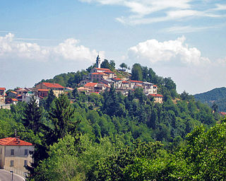
Montaldo di Mondovì is a comune (municipality) in the Province of Cuneo in the Italian region Piedmont, located about 80 kilometres (50 mi) south of Turin and about 25 kilometres (16 mi) southeast of Cuneo.

Montemale di Cuneo is a comune (municipality) in the Province of Cuneo in the Italian region Piedmont, located about 70 kilometres (43 mi) southwest of Turin and about 14 kilometres (9 mi) northwest of Cuneo.

Berzano di Tortona is a comune (municipality) in the Province of Alessandria in the Italian region Piedmont, located about 100 kilometres (62 mi) east of Turin and about 25 kilometres (16 mi) east of Alessandria.
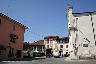
Barbata is a comune (municipality) in the Province of Bergamo in the Italian region of Lombardy, located about 50 kilometres (31 mi) east of Milan and about 25 kilometres (16 mi) southeast of Bergamo.

Cologno al Serio is a comune (municipality) in the Province of Bergamo in the Italian region of Lombardy, located about 45 kilometres (28 mi) northeast of Milan and about 10 kilometres (6 mi) south of Bergamo.

Santa Margherita di Staffora is a comune (municipality) in the Province of Pavia in the Italian region Lombardy, located about 80 km south of Milan and about 50 km south of Pavia. As of 31 December 2004, it had a population of 589 and an area of 36.7 km².
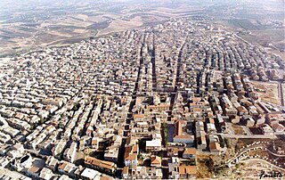
Campobello di Licata is a comune (municipality) in the Province of Agrigento in the Italian region Sicily, located about 110 kilometres (68 mi) southeast of Palermo and about 30 kilometres (19 mi) east of Agrigento.


