
Santa Catarina Juquila is a town in the State of Oaxaca, Mexico, and is the seat of the municipality also called Santa Catarina Juquila. It is part of the Juquila District in the center of the Costa Region. The name "Juquila" comes from "Xuhquililla", which means "Place of blue milkweed".
Nejapa de Madero is a town and municipality in Oaxaca in south-western Mexico. It is part of the Yautepec District in the east of the Sierra Sur Region, not far from the main highway between Oaxaca, Oaxaca and Salina Cruz. The name "Nejapa" means "ash water".
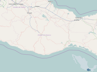
San Carlos Yautepec is a town and municipality in Oaxaca in south-western Mexico. It is part of the Yautepec District in the east of the Sierra Sur Region. The name "Yautepec" means "hill of black corn".
San Juan Cotzocon is a town and municipality in Oaxaca in south-western Mexico. It is part of the Sierra Mixe district within the Sierra Norte de Oaxaca Region.
San Juan Guichicovi is a town and municipality in Oaxaca in south-western Mexico. It is part of the Juchitán District in the west of the Istmo de Tehuantepec region. The town was founded on 15 March 1825: Guichicovi means "New Town" in Zapotec.

San Juan Juquila Mixes is a town and municipality in Oaxaca in south-western Mexico. It is part of the Yautepec District in the east of the Sierra Sur Region. The name "Juquila" means "beautiful vegetables".
San Juan Lachao is a town and municipality in Oaxaca in south-western Mexico. It is part of the Juquila District in the center of the Costa Region.
San Juan Mazatlán is a town and municipality in Oaxaca in south-western Mexico. It is part of the Sierra Mixe district within the Sierra Norte de Oaxaca Region. Mazatlán's name in Nahuatl means "the place of deer".
San Lucas Camotlán is a town and municipality in Oaxaca in south-western Mexico. The municipality covers an area of 127.58 km². It is part of the Sierra Mixe district within the Sierra Norte de Oaxaca Region.
San Miguel Panixtlahuaca is a town and municipality in Oaxaca in south-western Mexico. It is part of the Juquila District in the center of the Costa Region. The name "Panixtlahuatl" in the Nahuatl language means "Plain of the Bridge".
San Pedro Huilotepec is a town and municipality in Oaxaca in south-western Mexico. It is part of the Tehuantepec District in the west of the Istmo Region. "Huilotepec" means stone wasp.
Santa María Alotepec is a town and municipality in Oaxaca in south-western Mexico. It is part of the Sierra Mixe district within the Sierra Norte de Oaxaca Region.
Santa María Guienagati is a town and municipality in Oaxaca in south-western Mexico. It is in the north of the Tehuantepec District in the west of the Istmo Region. The town was first settled by Zapotec migrants from Zaachila, and the name Guienagati comes from Zapotec words meaning "Wilted Flower".
Santiago Atitlán is a town and municipality in Oaxaca in south-western Mexico. It is part of the Sierra Mixe district within the Sierra Norte de Oaxaca Region.
Santiago Camotlán is a town and municipality in Oaxaca in south-western Mexico. It is part of the Villa Alta District in the center of the Sierra Norte Region.
Santiago Ixcuintepec is a town and municipality in Oaxaca in south-western Mexico. It is part of the Sierra Mixe district within the Sierra Norte de Oaxaca Region.
Santiago Lachiguiri is a town and municipality in Oaxaca in south-western Mexico. It is part of the Tehuantepec District in the west of the Istmo Region.

Juchitán District is located in the east of the Istmo de Tehuantepec region of the State of Oaxaca, Mexico, covering the southern part of a low-lying corridor through the mountains that separates the Gulf of Mexico from the Pacific ocean. The district has an area of 13,300 km2 and a population as of 2005 of 339,445.
Santo Domingo Petapa is a town and municipality in Oaxaca in south-western Mexico. The municipality covers an area of 232.2 km², at an average altitude of 250 meters above sea level, and is part of the Juchitán District of the Istmo de Tehuantepec region. As of 2005, the municipality had a total population of 7,583, of whom 2,696 spoke indigenous languages.

The Union of Indigenous Communities of the Isthmus Region, is a farmer's cooperative in the state of Oaxaca, Mexico. It was established in 1982 to assist in production, marketing and distribution of locally produced coffee and other products. UCIRI was a pioneer of organic coffee production and one of the first fair trade suppliers.
