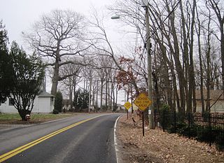
Sand Hill Road, often shortened to just "Sand Hill" or "SHR", is an arterial road in western Silicon Valley, California, running through Palo Alto, Menlo Park, and Woodside, notable for its concentration of venture capital firms. The road has become a metonym for that industry; nearly every top Silicon Valley company has been the beneficiary of early funding from firms on Sand Hill Road.
Sand Hill is an unincorporated community and census-designated place (CDP) in Lebanon County, Pennsylvania, United States. The population was 2,496 at the 2010 census.

The Sand Creek massacre was a massacre of Cheyenne and Arapaho people by the U.S. Army in the American Indian Wars that occurred on November 29, 1864, when a 675-man force of the Third Colorado Cavalry under the command of U.S. Volunteers Colonel John Chivington attacked and destroyed a village of Cheyenne and Arapaho people in southeastern Colorado Territory, killing and mutilating an estimated 69 to over 600 Native American people. Chivington claimed 500 to 600 warriors were killed. However, most sources estimate around 150 people were killed, about two-thirds of whom were women and children. The location has been designated the Sand Creek Massacre National Historic Site and is administered by the National Park Service. The massacre is considered part of a series of events known as the Colorado Wars.

Sand Point is a neighborhood in Seattle, Washington, United States, named after and consisting mostly of the Sand Point peninsula that juts into Lake Washington, which is itself largely given over to Magnuson Park. Its southern boundary can be said to be N.E. 65th Street, beyond which are Windermere and Hawthorne Hills; its northern boundary, N.E. 95th Street, beyond which is Lake City. The western limit of the neighborhood, beyond which are View Ridge and Wedgwood, is not fixed and can be said to be anywhere up the hill that extends west from Sand Point Way N.E. as far as 35th Avenue N.E. It is also the former home of Seattle Naval Air Station.

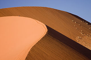
The Sandhills, often written Sand Hills, is a region of mixed-grass prairie on grass-stabilized sand dunes in north-central Nebraska, covering just over one quarter of the state. The dunes were designated a National Natural Landmark in 1984.

The Sandhills or Carolina Sandhills is a 10-35 mi wide physiographic region within the U.S. Atlantic Coastal Plain province, along the updip (inland) margin of this province in the states of North Carolina, South Carolina, and Georgia. The extent of the Carolina Sandhills is shown in maps of the ecoregions of North Carolina, South Carolina, and Georgia.

Per Axel Rydberg was a Swedish-born, American botanist who was the first curator of the New York Botanical Garden Herbarium.

Sand Hills was an active lighthouse on the shore of Lake Superior is on private property and is currently closed to the public. It is located in Ahmeek in Keweenaw County in the Keweenaw Peninsula, which is the northern part of the Upper Peninsula in Michigan. It was listed in the National Register of Historic Places in 1994.

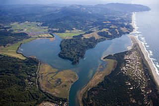
Nestucca Bay National Wildlife Refuge is a U.S. National Wildlife Refuge on Oregon's coast. It lies in southern Tillamook County, on the state's northern coast. It is one of six National Wildlife Refuges comprising the Oregon Coast National Wildlife Refuge Complex and supports one tenth of the world's dusky Canada goose population. The refuge contains at least seven types of habitat, including tidal marsh, tidal mudflats, grassland, woodland, pasture, forested lagg—a transition between raised peat bog and mineral soil—and freshwater bogs, including the southernmost coastal Sphagnum bog habitat on the Pacific Coast.

Sand is a granular material composed of finely divided mineral particles. Sand has various compositions but is defined by its grain size. Sand grains are smaller than gravel and coarser than silt. Sand can also refer to a textural class of soil or soil type; i.e., a soil containing more than 85 percent sand-sized particles by mass.

Desert sand is a very light and very weakly saturated reddish yellow colour which corresponds specifically to the coloration of sand. It may also be regarded as a deep tone of beige.

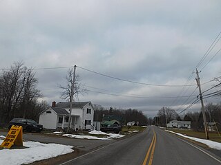
Sand Hill is a hamlet in the town of Newstead in Erie County, New York, United States.

Coachella Valley National Wildlife Refuge is a 3,709-acre (15.01 km2) protected area in Riverside County, California's Coachella Valley. It lies within the unincorporated community of Thousand Palms, just north of Palm Desert. The refuge contains the majority of critical habitat for the Coachella Valley Fringe-toed Lizard within the Coachella Valley Preserve and Indio Hills Palms State Reserve.
Sand Hill is an unincorporated community in Wood County, West Virginia, United States.
Sand Hill is an unincorporated community in Marshall County, West Virginia, United States.
Sand Hill is an unincorporated community in Copiah County, Mississippi, United States. Sand Hill is 5.8 miles (9.3 km) east-northeast of Wesson.
Sand Hill or Sandhill is an unincorporated community in Rankin County, Mississippi, United States. Sand Hill is located on Mississippi Highway 25, approximately 17 miles (27 km) northeast of Flowood.

Sand Hills is an unincorporated community located within South Brunswick Township in Middlesex County, in the U.S. state of New Jersey. The settlement is named for Sand Hills, a small group of diabase hills which contains Middlesex County's highest point. The settlement is located approximately at the intersection of U.S. Route 1, Sand Hills Road, and Major Road. There is a small cluster of houses and small businesses on Major Road just south of US 1 while more housing developments are found on the north side of the highway. Fast food restaurants, stores, and repair shops line US 1 through the area; this area of US 1 also has large inclines on both sides of the hills to climb from the relatively low and flat areas of the Atlantic coastal plain.

Saddle Peak Hills Wilderness is the smallest designated wilderness area created by the California Desert Protection Act of 1994.


