Oscoda is an unincorporated community and census-designated place (CDP) in Iosco County in the U.S. state of Michigan. The CDP had a population of 916 at the 2020 census. The community is located within Au Sable Township and Oscoda Township at the mouth of the Au Sable River along Lake Huron.

Ogemaw County is a county located in the U.S. state of Michigan. As of the 2020 census, the population was 20,770. The county seat is West Branch.

Iosco County is a county in the U.S. state of Michigan; its eastern border is formed by Lake Huron. As of the 2020 census, its population was 25,237. Its seat of government is Tawas City.

Huron County is a county in the U.S. state of Michigan. As of the 2020 Census, the population was 31,407. The county seat is Bad Axe. Huron County is at the northern tip of the Thumb, which is a sub region of Mid Michigan. It is a peninsula, bordered by Saginaw Bay to the west and Lake Huron to the north and east, and has over 90 miles (140 km) of shoreline, from White Rock on Lake Huron to Sebewaing on the Saginaw Bay. Huron County's most prominent industry is agriculture, as with most of the other Thumb counties. Huron County enjoys seasonal tourism from large cities such as Detroit, Flint, and Saginaw. Much of the tourism is in the Port Austin and Caseville area.

Alcona County is a county of the U.S. state of Michigan. As of the 2020 census, the population was 10,167. Its county seat is Harrisville. Alphabetically it is the first county in Michigan; as its flag states, it is the "First of 83".

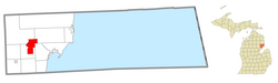
Argentine is an unincorporated community and census-designated place (CDP) in Argentine Township, Genesee County, in the U.S. state of Michigan. The population was 2,685 as of the 2020 census, up from 2,525 at the 2010 census. It was first settled in 1836.
Au Sable is an unincorporated community and census-designated place (CDP) in Iosco County, Michigan. The population of the CDP was 1,453 at the 2020 census. The community is located within Au Sable Township at the mouth of the Au Sable River along Lake Huron.
Au Sable Township is a charter township of Iosco County in the U.S. state of Michigan. The population was 2,016 at the 2020 census.
Oscoda Township is a charter township of Iosco County in the U.S. state of Michigan. The population was 7,152 at the 2020 census. The Wurtsmith Air Force Base is located within the township.
Plainfield Township is a civil township of Iosco County in the U.S. state of Michigan. The population was 3,350 at the 2020 census, down from 3,799 at the 2010 census.

Tawas City is a city in and county seat of Iosco County in the U.S. state of Michigan. The population was 1,834 at the 2020 census. The city is mostly surrounded by Tawas Township, but the two areas are administered autonomously.

Iosco Township is a civil township of Livingston County in the U.S. state of Michigan. The population was 3,870 at the 2020 census, up from 3,801 at the 2010 census.

Michigamme is an unincorporated community in Marquette County in the U.S. state of Michigan. It is located within Michigamme Township on the north shores of Lake Michigamme. For statistical purposes, the United States Census Bureau has defined Michigamme as a census-designated place (CDP). The CDP had a population of 255 at the 2020 census.

Twin Lake is an unincorporated community in Muskegon County of the U.S. state of Michigan. It is a census-designated place (CDP) for statistical purposes. Local government services are provided by Dalton Township. As of the 2020 census, the population of the CDP was 2,056. The surrounding area is the home of Blue Lake Fine Arts Camp, the YMCA's Camp Pinewood, and the Boy Scouts' Gerber Scout Reservation and Owasippe Scout Reservation.

Mio is an unincorporated community and census-designated place (CDP) in Oscoda County in the U.S. state of Michigan. It is the county seat of Oscoda County. The population of the CDP was 1,690 at the 2020 census.

Whitmore Lake is a census-designated place (CDP) and unincorporated community in the U.S. state of Michigan. The community spans the boundary between Green Oak Township in Livingston County and Northfield Township in Washtenaw County. The population of the CDP was 7,584 at the 2020 census.

Dollar Bay is a census-designated place (CDP) in Houghton County, Michigan, United States. The population was 1,082 at the 2010 census.

Carp Lake is an unincorporated community and census-designated place (CDP) in Emmet County in the U.S. state of Michigan. As of the 2010 census, the CDP had a population of 357. It is located within Carp Lake Township.

Eagle River is an unincorporated community and census-designated place (CDP) in the U.S. state of Michigan. It is the county seat of Keweenaw County. Its population was 65 at the 2020 census, which makes it by far the least-populated county seat in the state of Michigan. As an unincorporated community, Eagle River has no legal autonomy and is part of Allouez Township and Houghton Township.
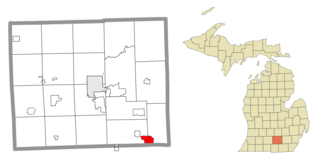
Vineyard Lake is an unincorporated community and census-designated place (CDP) in Jackson County in the U.S. state of Michigan. The CDP had a population of 980 at the 2010 census. It is located within Columbia Township to the west and Norvell Township to the east.