Kindia is the fourth largest city in Guinea, lying about 85 miles north east of the nation's capital Conakry. Population 181,126.
Timbo is a town and sub-prefecture in the Mamou Prefecture in the Mamou Region of Guinea. It is located in the Fouta Djallon highlands of Guinea, lying north east of Mamou, in a part of the country mostly occupied by the Fula people. It is also known for its vernacular architecture, for the local mountains and for local chimpanzees.

The Faranah Region is located in east-central Guinea. It is bordered by the countries of Sierra Leone and Mali and the Guinean regions of Kankan, Mamou, Nzérékoré, and Labé.

The Mamou Region is located in central Guinea. It is bordered by the country of Sierra Leone and the Guinean regions of Faranah, Labé, and Kindia.

The Labé Region is located in north-central Guinea. It is bordered by the countries of Senegal and Mali and the Guinean regions of Faranah, Kindia, Mamou, and Boké.
Mandiana is a town located in eastern Guinea. It is the capital of Mandiana Prefecture. As of 2014 the town and surrounding sub-prefecture had a population of 25,791 people.

Ciguñuela is a municipality located in the province of Valladolid, Castile and León, Spain. According to the 2010 census (INE), the municipality has a population of 396 inhabitants.
Gbakedou is a town and sub-prefecture in the Beyla Prefecture in the Nzérékoré Region of south-eastern Guinea.

Bricolo is a village in south-western Ivory Coast. It is in the sub-prefecture of Soubré, Soubré Department, Nawa Region, Bas-Sassandra District.
Téguéla is a village in western Ivory Coast. It is in the sub-prefecture of Séguéla, Séguéla Department, Worodougou Region, Woroba District.
Konindou is a town and sub-prefecture in the Dabola Prefecture in the Faranah Region of Guinea. As of 2014 it had a population of 10,006 people.
Baguinet is a town and sub-prefecture in the Fria Prefecture in the Boké Region of western Guinea. As of 2014 it had a population of 13,839 people.
Foulamory is a town and sub-prefecture in Gaoual Prefecture, in the Boké Region of northwestern Guinea. As of 2014 it had a population of 10,207 people.
Bolodou is a town and sub-prefecture in the Guéckédou Prefecture in the Nzérékoré Region of south-western Guinea. The sub-prefecture had a population of 13,643 people in 2014, up from 11,750 in 1996. The town itself holds 94 houses with an unknown total population. The Bolodou Sub-Prefecture is divided into 7 quarters (districts), which are: Beddou, Bolodou Centre, Faindou, Gbandou, Koleadou, Kongoma, and Soumtou. Each of these towns can further be split into sectors, which are the smallest administrative divisions in Guinea. In 2017, a local math teacher set up his own dam to generate hydroelectric power for the town's homes. In December 2017, a 27-meter long bridge was built that connected the previously separate markets in Yèndè Millimou and Guéckédou.
Lafou is a town and sub-prefecture in the Lélouma Prefecture in the Labé Region of northern-central Guinea.
Parawol is a town and sub-prefecture in the Lélouma Prefecture in the Labé Region of northern-central Guinea.
Sagalé is a town and sub-prefecture in the Lélouma Prefecture in the Labé Region of northern-central Guinea.
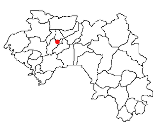
Morodou is a town and sub-prefecture in the Mandiana Prefecture in the Kankan Region of eastern Guinea. As of 2014 it had a population of 28,140 people.
Kouratongo is a town and sub-prefecture in the Tougué Prefecture in the Labé Region of northern-central Guinea.
German submarine U-633 was a Type VIIC U-boat built for Nazi Germany's Kriegsmarine for service during World War II. She was laid down on 22 September 1941 by Blohm & Voss, Hamburg as yard number 609, launched on 10 June 1942 and commissioned on 30 July 1942 under Oberleutnant zur See Bernhard Müller.