Sant'Angelo Le Fratte | |
|---|---|
| Comune di Sant'Angelo Le Fratte | |
 View of Sant'Angelo Le Fratte | |
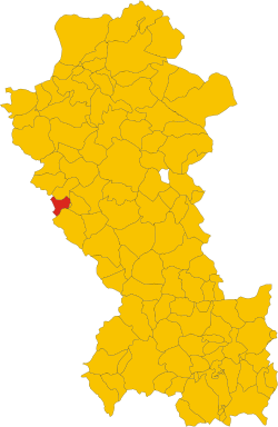 Sant'Angelo Le Fratte within the Province of Potenza | |
 Sant'Angelo Le Fratte Location of Sant'Angelo Le Fratte in Italy  Sant'Angelo Le Fratte Sant'Angelo Le Fratte (Basilicata) | |
| Coordinates: 40°32′49″N15°33′27″E / 40.54694°N 15.55750°E | |
| Country | Italy |
| Region | Basilicata |
| Province | Potenza (PZ) |
| Frazioni | Farisi, Isca, Santa Maria Fellana, San Vito |
| Area | |
• Total | 23 km2 (8.9 sq mi) |
| Elevation | 560 m (1,840 ft) |
| Population (2011) [2] | |
• Total | 1,457 |
| • Density | 63/km2 (160/sq mi) |
| Demonym | Santangiolesi |
| Time zone | UTC+1 (CET) |
| • Summer (DST) | UTC+2 (CEST) |
| Postal code | 85050 |
| Dialing code | 0975 |
| ISTAT code | 076079 |
| Patron saint | San Michele Arcangelo |
| Saint day | 29 September |
| Website | Official website |
Sant'Angelo Le Fratte is a town and comune in the province of Potenza, in the Southern Italian region of Basilicata. As of 2011 its population was 1,457. [2]
