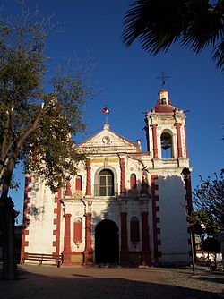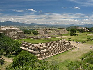
Oaxaca de Juárez, or simply Oaxaca, is the capital and largest city of the eponymous Mexican state of Oaxaca. It is the municipal seat for the surrounding municipality of Oaxaca. It is in the Centro District in the Central Valleys region of the state, in the foothills of the Sierra Madre at the base of the Cerro del Fortín, extending to the banks of the Atoyac River.
Coatepec Harinas is one of 125 municipalities in the State of Mexico, Mexico. The municipal seat is the town of Coatepec Harinas. The original name is "Coauhtepetl" which means 'serpent hill' in Náhuatl. Around 1825 because of a boom in flour production, the name "Harinas" was added.
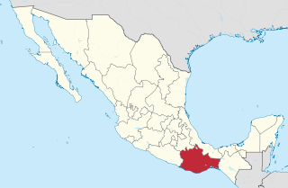
Oaxaca is a state in Southwest Mexico that is divided into 570 municipalities, more than any other state in Mexico. According to Article 113 of the state's constitution, the municipalities are grouped into 30 judicial and tax districts to facilitate the distribution of the state's revenues. It is the only state in Mexico with this particular judicial and tax district organization. Oaxaca is the tenth most populated state with 4,132,148 inhabitants as of the 2020 Mexican census and the fifth largest by land area spanning 93,757.6 square kilometres (36,200.0 sq mi).
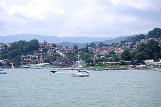
Valle de Bravo is one of 125 municipalities in the State of Mexico, Mexico. The largest town and municipal seat is the town of Valle de Bravo. It is located on the shore of Lake Avándaro, approximately 156 km southwest of Mexico City and west of Toluca on highways 15, 134 or 1. It takes about two hours to drive from Mexico City to Valle de Bravo, making it a popular weekend getaway for the capital's affluent upper class.

The Triqui or Trique are an Indigenous people of the western part of the Mexican state of Oaxaca, centered in the municipalities of Juxtlahuaca, Putla, and Tlaxiaco. They number around 23,000 according to Ethnologue surveys. The Triqui language is a Mixtecan language of Oto-Manguean genetic affiliation. Trique peoples are known for their distinctive woven huipiles, baskets, and morrales (handbags).

Santa María del Tule is a town and a municipality in the Mexican state of Oaxaca. It is part of the Centro District in the Valles Centrales region. It is located 11 kilometers (6.8 mi) SE of the city of Oaxaca on Highway 190. The town and municipality are named for the patron saint of the place, the Virgin Mary and “Tule” comes from the Náhuatl word “tulle” or “tullin” which means bulrush.

Santa Cruz Xoxocotlán is a small city and municipality located 5 km from the state capital of Oaxaca in the south of Mexico. It is part of the Centro District in the Valles Centrales region. The name comes from the Nahuatl word “xocotl” which means “sour or sweet and sour fruit” with the duplicative “xo” to indicate “very.” The meaning of the entire phrase means “among the very sour fruits.” The Mixtec name for the area was Nuunitatnohoyoo which mean “land of the moon-faced flowers.” However, the community is most commonly referred to simply as Xoxo.

San Jerónimo Tlacochahuaya is a town and municipality in the Mexican state of Oaxaca, 21 km from the city of Oaxaca on Federal Highway 190 between Santa Maria del Tule and Mitla. It is part of the Tlacolula District in the east of the Valles Centrales Region. The name Tlacochahuaya comes from Nahuatl and means “in wet land” or “in the swamp.”
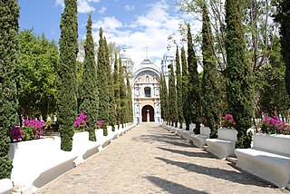
Ocotlán de Morelos is a town and municipality in the state of Oaxaca, about 35 km south of the center of the city of Oaxaca along Highway 175. It is part of the Ocotlán District in the south of the Valles Centrales Region. The area was a significant population center at the time of the Spanish Conquest, and for that reason an important Dominican monastery was established here in the 16th century. The complex still exists, with the church still being used for worship and the cloister area used as a museum. While mostly quiet, the city is an important distribution and transportation center for the south of the Central Valleys region of Oaxaca, a function which is expected to be reinforced with the opening of new highway being built to connect the city of Oaxaca with the Pacific coast. The city is known for artist Rodolfo Morales, who painted aspects of his hometown in his works and sponsored projects to save and restore historic monuments here. For generations the municipality has been known for its crafts, with the ceramics making Aguilar family producing some of the best known craftsmen.
San Juan Teitipac is a town and municipality in Oaxaca in south-western Mexico. The municipality covers an area of 11.48 km². It is part of the Tlacolula District in the east of the Valles Centrales Region.

Villa Díaz Ordaz is a town and municipality in Oaxaca in south-western Mexico. The municipality covers an area of km². It is part of the Tlacolula District in the east of the Valles Centrales Region.The name of the town was formally called Santo Domingo del Valle.
Teotitlán del Valle is a small village and municipality located in the Tlacolula District in the east of the Valles Centrales Region, 31 km from the city of Oaxaca in the foothills of the Sierra Juárez mountains. It is part of the Tlacolula Valley district. It is known for its textiles, especially rugs, which are woven on hand-operated looms, from wool obtained from local sheep and dyed mainly with local, natural dyes. They combine historical Zapotec designs with contemporary designs such as reproductions of famous artists' work. Artists take commissions and participate in tours of family-owned workshops. The name Teotitlán comes from Nahuatl and means "land of the gods." Its Zapotec name is Xaguixe, which means "at the foot of the mountain." Established in 1465, it was one of the first villages founded by Zapotec peoples in this area and retains its Zapotec culture and language.
Santa Ana Zegache is a town and municipality in Oaxaca in south-western Mexico. The municipality covers an area of 26.79 km². It is part of the Ocotlán District in the south of the Valles Centrales Region

Santa Cruz Mixtepec is a town and municipality in Oaxaca in south-western Mexico. The town covers an area of 66.34 km². It is part of the Zimatlán District in the west of the Valles Centrales Region

Ixtlán District is located in the Sierra Norte region, in the northeastern area of the State of Oaxaca, Mexico.

Centro District is located in the Valles Centrales Region of the State of Oaxaca, Mexico. The district includes the state capital Oaxaca and satellite towns. The district has an average elevation of 1,550 meters. The climate is mild, with average temperatures ranging from 16°C in Winter to 25°C in spring.

Tlacolula District is located in the east of the Valles Centrales Region of the State of Oaxaca, Mexico.

Ocotlán District is located in the south of the Valles Centrales Region of the State of Oaxaca, Mexico.
Santa Ana or Santa Anna may refer to:

Oaxaca handcrafts and folk art is one of Mexico's important regional traditions of its kind, distinguished by both its overall quality and variety. Producing goods for trade has been an important economic activity in the state, especially in the Central Valleys region since the pre-Hispanic era which the area laid on the trade route between central Mexico and Central America. In the colonial period, the Spanish introduced new raw materials, new techniques and products but the rise of industrially produced products lowered the demand for most handcrafts by the early 20th century. The introduction of highways in the middle part of the century brought tourism to the region and with it a new market for traditional handcrafts. Today, the state boasts the largest number of working artisans in Mexico, producing a wide range of products that continue to grow and evolve to meet changing tastes in the market.
