Satapuala

Last updated
Satapuala
Village
Samoa location map.svg
Red pog.svg
Satapuala
Coordinates: 13°50′3″S172°0′28″W / 13.83417°S 172.00778°W / -13.83417; -172.00778 Coordinates: 13°50′3″S172°0′28″W / 13.83417°S 172.00778°W / -13.83417; -172.00778
Country Flag of Samoa.svg  Samoa
District A'ana
Population
 (2016)
  Total1,963
Time zone -11

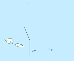
Satapuala is a village situated on the north west coast Upolu island in Samoa. [1] The village is part of A'ana Alofi 4 Electoral Constituency (Faipule District) which forms part of the larger political district A'ana. [2] It has a population of 1963. [3]

Contents

Satapuala is 40 minutes west from the country's capital Apia.

The village was relocated in 1942 to build the Faleolo International Airport. Like other land in Samoa, customary land in Satapuala was also alienated during colonialism. [4] Customary land has since come under the government. [4] Part of the former customary village land is where the new Aggie Grey's Lagoon Resort (the Government is the majority shareholder) has been built with a golf course beside the airport. Other Satapuala land includes a large coconut plantation opposite the airport which the government had planned to sell as small freehold lots and to build businesses and resorts. The chiefs (matai) of Satapuala have made legal claims to return customary land from the government for many years. [5] The disputed land is the property of the government's Samoa Trust Estate Corporation (STEC, formerly WSTEC), land which came under the Samoa government when German and New Zealand colonial rule ended in Samoa. [4]

Leading Satapuala's legal claim against the government for more than two thousand acres (8 km²) was a high chief of the village, To’alepaiali’i Toeolesulusulu Salesa III, the late Member of Parliament of the A'ana District and a prominent figure in Samoan politics. To'alepaiali'i was a Cabinet Minister in Samoa during the 1980s. He died during a trip to Sydney in November 2008. [6]

In the early 20th century this village had also made land claims against the New Zealand colonial administration, since it wanted to put an airport on the village grounds.

Like most villages in Samoa, the geographic boundary of Satapuala covers an area from the coastline and inland. The village is separated into two sections. Satapuala-I-Tai (tai means coastal) is the end of the village nearest to the lagoon shoreline. Satapuala-I-Uta (uta means inland) is the end where most of the village people live, and also the place where the village road ends. The village of Satapuala is famous for having the historic Lapita Site.

There is one narrow and roughly paved road which connects the two ends of Satapuala-I-Uta, although in Satapuala-I-Tai the road is unpaved. The main Upolu Highway is accessible from the main village junction, or also known as the Magafa. There are a few schools in Satapuala, including district college Satapuala College. Many children from the village attend and so do those from places as far as Leulumoega to Falelatai. There is a large coconut plantation, where coconuts are used to make Samoan Brand Coconut Cream which is sold worldwide. There are some 10 family-owned shops in the village with 3 billiard gaming areas. The traditional 'Sa', evening prayers, takes place each day throughout the village and lasts for about 30 minutes. The 'Sa' is a Prayer Curfew, played throughout most of Samoa. The village is vibrant in colour and culture. Horses used for plantation work are sometimes kept in the village tied amongst the breadfruit and coconut trees. This village is abundant in crops and flowers although the thorny weed vao fefe. Television and radio broadcast reception is reasonable in the village. A few pay phones are found around Satapuala's Main Village Shops, but the majority of pay phones are found at the airport, where there is internet access. Mobile Phones are widely used and through local companies Digicel and Go Mobile. Topping Up, Credit Recharges and SIM Cards can be purchased from the local stores. There are ATM outlets at the ANZ and Westpac branches at the airport. Like most villages in Samoa, Sunday is a sacred day. Churches in the village are Catholic Church of 'Sagato Atonio' and the LDS Church, which is located across the narrow village road from the Catholic Church.

2007 South Pacific Games

Two of the events from the 2007 edition of the South Pacific Games were held here. Sailing and the triathlon took place in Satapuala, and due to the event, Satapuala became a busy area of the Island of Upolu too, besides Apia and Tuna'imato.

Transport

The village is by the main island highway with a regular bus service. Fares to and from Satapuala are only $2 for adults and $1 for children under 12. From Apia to Satapuala the cost of a 40-minute taxi ride is approximately $40 to $50.

Ten minutes west from the village is Mulifanua Wharf where the inter-island ferry terminal is located for passenger and vehicle transport to Savai'i island. Boats to Manono or Apolima Islands are located at Manono Uta and Apolima Uta, further west on the main road past Mulifanua wharf.

Many Samoans and tourists have stood in this village since this is where the main international airport of Samoa, Faleolo International Airport, stands. On 13 January 1970, Polynesian Airlines Flight 308B, operated by Douglas C-47B 5W-FAC crashed into the sea shortly after take-off on an international non-scheduled passenger flight to Pago Pago International Airport, American Samoa. All 32 people on board were killed. [7]

Sport

Volleyball, cricket and rugby union are the most popular sports in the village especially among youths. These take place in the village 'malae', open grounds in front of the 'fale tele' main meeting houses.

Related Research Articles

Transport in Samoa Overview of transport in Samoa

Transport in Samoa includes one international airport situated on the north west coast of Upolu island, paved highways reaching most parts of the two main islands, one main port in the capital Apia and two ports servicing mainly inter island ferries for vehicles and passengers between the two main islands, Upolu and Savai'i.

Samoan Islands Archipelago in the South Pacific Ocean

The Samoan Islands are an archipelago covering 3,030 km2 (1,170 sq mi) in the central South Pacific, forming part of Polynesia and of the wider region of Oceania. Administratively, the archipelago comprises all of the Independent State of Samoa and most of American Samoa. The land masses of the two Samoan jurisdictions are separated by 64 km (40 mi) of ocean at their closest points.

Samoa Airways Flag carrier airline of Samoa

Samoa Airways, formerly Polynesian Airlines, is the state-owned flag carrier airline of Samoa.

Savaiʻi Island in the Samoan Islands chain

Savaiʻi is the largest and highest island both in Samoa and in the Samoan Islands chain. The island is also the sixth largest in Polynesia, behind the three main islands of New Zealand and the Hawaiian Islands of Hawaii and Maui.

Mulifanua Village District in Aiga-i-le-Tai, Samoa

Mulifanua is a village on the north-western tip of the island of Upolu, in Samoa. In the modern era, it is the capital of Aiga-i-le-Tai district. Mulifanua wharf is the main ferry terminal for inter-island vehicle and passenger travel across the Apolima Strait between Upolu and the island of Savai'i.

Salelologa Township & Ferry Terminal in Faasaleleaga, Samoa

Salelologa is a village district at the east end of Savai'i island in Samoa. It is the main entry point into the island with the only ferry terminal on Savai'i. It also serves as the main township for shopping and public amenities with a market selling fresh produce and arts and crafts.

Manono Island

Manono is an island of Samoa, situated in the Apolima Strait between the main islands of Savai'i and Upolu, 3.4 km west-northwest off Lefatu Cape, the westernmost point of Upolu.

Districts of Samoa Overview of the districts of Samoa

Samoa is made up of eleven itūmālō. These are the traditional eleven districts that were established well before European arrival. Each district has its own constitutional foundation (faavae) based on the traditional order of title precedence found in each district's faalupega.

Aʻana District in Samoa

Aʻana is a district of Samoa. It is on the western third of Upolu island, with a small exclave surrounded by Aiga-i-le-Tai. It has an area of 193 km² and a population of 23,265. The main centre is Leulumoega.

Aiga-i-le-Tai District in Samoa

Aiga-i-le-Tai is a district of Samoa which includes the small islands of Manono, Apolima and tiny uninhabited Nu'ulopa lying in the Apolima Strait between the country's two main islands of Upolu and Savai'i.

Tuamasaga District in Samoa

Tuamāsaga is a district of Samoa, with a population of 95,907. The geographic area of Tuamasaga covers the central part of Upolu island.

Faʻasaleleaga District in Samoa

Faʻasaleleaga is a district of Samoa situated on the eastern side of Savaiʻi island. It has a population of 13,566.

Faleolo International Airport

Faleolo International Airport is an airport located 40 kilometres (25 mi) west of Apia, the capital of Samoa. Until 1984, Faleolo could not accommodate jets larger than a Boeing 737. Services to the United States, Australia, or New Zealand, could only land at Pago Pago International Airport in American Samoa. Since the airport's expansion most international traffic now uses Faleolo.

Apolima Strait

The Apolima Strait is about 13 km wide and separates the two largest islands of Samoa: Savai'i to the northwest, and Upolu to the southeast.

Apai is one of four small villages on Manono Island in Samoa. The village population is 124.

Faleu is one of four small historic villages on Manono Island in Samoa. The village population is 250.

Fagali'i or Fagali'i-uta is a village on the island of Upolu in the Samoa archipelago approximately 5 kilometres south-east of Apia. It is in the electoral constituency of Vaimauga East which forms part of the larger political district of Tuamasaga.

Nuʻulopa is a small, uninhabited island in the Apolima Strait between the islands of Upolu and Savaiʻi in Samoa. The island is part of the Aiga-i-le-Tai district.

References

  1. "Satapuala Village Project". Seacology Island Projects. Retrieved 13 November 2009.
  2. "Electoral Constituencies Act 2019" (PDF). Parliament of Samoa. 31 January 2019. Retrieved 12 December 2021.
  3. "Census 2016 Preliminary count" (PDF). Samoa Bureau of Statistics. Retrieved 2 August 2021.
  4. 1 2 3 Paul Ashcroft, R. Gerard Ward (1998). Samoa: mapping the diversity. University of the South Pacific. p. 61. ISBN   982-02-0134-9.
  5. "Villagers have vacated Satapuala land, 26 November 2007 UTC". Radio New Zealand International. Retrieved 13 November 2009.
  6. Ilalio, Marieta Heidi (2008-11-26). "Samoa Mourns". Samoa Observer. Retrieved 14 November 2009.
  7. "5W-FAC Accident description". Aviation Safety Network. Retrieved 11 October 2010.