
The Silvretta Alps are a mountain range of the Central Eastern Alps shared by Tirol, Vorarlberg and Graubünden (Switzerland). The Austrian states of Tirol and Vorarlberg are connected by a pass road. The majority of the peaks are elevated above three thousand metres and are surrounded by glaciers. Thus, the area is also known as the "Blue Silvretta".

The Rätikon is a mountain range of the Central Eastern Alps, located at the border between Vorarlberg, Liechtenstein and Graubünden. It is the geological border between the Eastern and Western Alps and stretches from the Montafon as far as the Rhine. In the south, the Prättigau is its limit, and in the north, it is the Walgau. In the east, it borders the Silvretta groups. The Rätikon mountain range derives its name from Raetia, a province of the Roman Empire, named after the Rhaetian people.
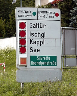
The Paznaun is a valley in Tyrol, Austria, leading south-west from Pians (856 m) to the Bielerhöhe (2071 m), a mountain pass at the border of Vorarlberg and Tyrol.
The Habicht is a mountain in the Stubai Alps of Austria. For a long time, the locals believed it to be the highest mountain in Tyrol, due to its prominence above the surrounding mountains. Despite what they thought, the highest peak in the Stubai Alps is Zuckerhütl which is 230 metres higher than Habicht. The name literally means "hawk" in German.

Hoher Dachstein is a strongly karstic Austrian mountain, and the second highest mountain in the Northern Limestone Alps. It is situated at the border of Upper Austria and Styria in central Austria, and is the highest point in each of those states. Parts of the massif also lie in the state of Salzburg, leading to the mountain being referred to as the Drei-Länder-Berg. The Dachstein massif covers an area of around 20×30 km with dozens of peaks above 2,500 m, the highest of which are in the southern and south-western areas. Seen from the north, the Dachstein massif is dominated by the glaciers with the rocky summits rising beyond them. By contrast, to the south, the mountain drops almost vertically to the valley floor.
Piz Kesch (German) or Piz d'Es-cha (Rumantsch) is a peak in the Albula Alps of the Rhaetian Alps in Switzerland. At 3,418 metres (11,214 ft), it is the highest peak in the Albula Alps and the municipality of Bergün, Grisons.
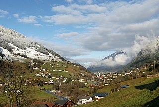
Gaschurn is a municipality in the district of Bludenz in the Austrian state of Vorarlberg.
The Cima di Jazzi is a mountain of the Pennine Alps, located on the Swiss-Italian border, just north of Monte Rosa. It overlooks Macugnaga on its east (Italian) side. The west (Swiss) side is entirely covered by glaciers.
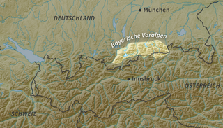
The Bavarian Prealps are a mountain range within the Northern Limestone Alps in south Germany. They include the Bavarian Prealp region between the river Loisach to the west and the river Inn to the east; the range is about 80 kilometres (50 mi) long and 20–30 kilometres (12–19 mi) wide. The term is not defined politically, but alpine-geographically because small areas of the Bavarian Prealps lie in Tyrol.
Hoher Riffler may refer to:

The Bregenz Forest Mountains, also the Bregenzerwald Mountains, are a range of the Northern Limestone Alps, named after the town of Bregenz. The Bregenz Forest Mountains are entirely located in the Austrian state of Vorarlberg.

The Lechquellen Mountains or Lechquellen range is a small mountain group within the Northern Limestone Alps of the Eastern Alps. It lies entirely within the Austrian state of Vorarlberg and includes the upper reaches of the river Lech with its headstreams in a horseshoe shape as well as the Upper Großwalsertal valley.
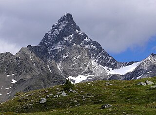
The Gaisspitze is a cone shaped mountain in the Verwall Alps in the Austrian state of Tyrol and north of the municipality Galtür. It has an elevation of 2,779 m (AA).

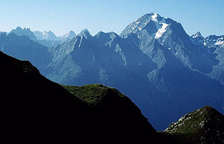
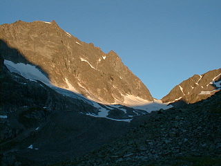
The Patteriol is a mountain in the Verwall Alps in the Austrian state of Tyrol. It has an elevation of 3,056 m (AA). Patteriol is sometimes called "Matterhorn of Verwall" because of its shape.

The Hoher Riffler is 3,168 m (AA) high and is the tallest mountain in the Verwall Alps, a mountain range in Central Eastern Alps. It is situated in the West of the Austrian state of Tyrol.
Scheibler is a 2,978 m (AA) high mountain in the Verwall Alps in the Austrian state Tyrol.
The Kuchenspitze is a mountain, 3,148 m (AA), in the Verwall between the valley of Stanzer Tal and Paznaun in the west of North Tyrol.
The Küchlspitze is a three-thousander in the Verwall between the valley of Stanzer Tal and Paznaun in the western North Tyrol in Austria.
Seekopf is German for “lake head” or “lake peak” and may refer to the following mountains:


