| Savé Airport | |||||||||||
|---|---|---|---|---|---|---|---|---|---|---|---|
| Summary | |||||||||||
| Airport type | Public | ||||||||||
| Serves | Savé | ||||||||||
| Location | |||||||||||
| Elevation AMSL | 656 ft / 200 m | ||||||||||
| Coordinates | 8°1′5.7″N2°27′52.1″E / 8.018250°N 2.464472°E Coordinates: 8°1′5.7″N2°27′52.1″E / 8.018250°N 2.464472°E | ||||||||||
| Map | |||||||||||
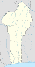 DBBS Location of Savé Airport in Benin | |||||||||||
| Runways | |||||||||||
| |||||||||||
Savé Airport( IATA : SVF, ICAO : DBBS) is a public use airport located near Savé, Collines, Benin.
An IATA airport code, also known as an IATA location identifier, IATA station code or simply a location identifier, is a three-letter code designating many airports around the world, defined by the International Air Transport Association (IATA). The characters prominently displayed on baggage tags attached at airport check-in desks are an example of a way these codes are used.

The ICAOairport code or location indicator is a four-letter code designating aerodromes around the world. These codes, as defined by the International Civil Aviation Organization and published in ICAO Document 7910: Location Indicators, are used by air traffic control and airline operations such as flight planning.

An airport is an aerodrome with extended facilities, mostly for commercial air transport. Airports often have facilities to store and maintain aircraft, and a control tower. An airport consists of a landing area, which comprises an aerially accessible open space including at least one operationally active surface such as a runway for a plane to take off or a helipad, and often includes adjacent utility buildings such as control towers, hangars and terminals. Larger airports may have airport aprons, taxiway bridges, air traffic control centres, passenger facilities such as restaurants and lounges, and emergency services. In some countries, the US in particular, they also typically have one or more fixed-base operators, serving general aviation.


