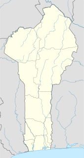
Bohicon is a city in Benin, and a conurbation of Abomey lying 9 kilometres east of the city on the railway line from Cotonou to Parakou and on Benin's main highway RNIE 2 which joins the RNIE 4. The commune covers an area of 139 square kilometres and as of 2002 had a population of 113,091 people.

Boukoumbé or Boukombé is a town, arrondissement and commune in north western Benin on the border with Togo. It is known for its market, its whipping ceremony and for its tradition of pipe making. Mount Kousso-Kovangou, the highest point in Benin, lies nearby.

Tanguiéta is a town, arrondissement and commune located in the Atakora Department of Benin.The commune covers an area of 5465 square kilometres and as of 2002 had a population of 54,719 people. As of 2007 the town had an estimated population of 21,290. It lies on the RNIE 3 highway which connects it to Natitingou.

George Enescu is a commune in Botoșani County, Romania. It is composed of five villages: Arborea, Dumeni, George Enescu, Popeni and Stânca.

Siliștea Crucii is a commune in Dolj County, Romania with a population of 1,811 people. It is composed of a single village, Siliștea Crucii.

Pèrèrè is a town, arrondissement, and commune in the Borgou Department of eastern Benin. The commune covers an area of 2017 square kilometres and as of 2002 had a population of 42,891 people.

Sinendé is a town, arrondissement, and commune in the Borgou Department of central Benin. The commune covers an area of 2289 square kilometres and as of 2002 had a population of 63,373 people.

Glazoué is a town, arrondissement, and commune in the Collines Department of central Benin. It is located on the railway line from Cotonou to Parakou. The commune covers an area of 1350 square kilometres and as of 2002 had a population of 90,475 people.

Ouèssè is a town, arrondissement, and commune in the Collines Department of central Benin.The commune covers an area of 3200 square kilometres and as of 2013 had a population of 141,760 people.

Aguégués is a town and commune in the Ouémé Department of south-eastern Benin. The commune covers an area of 52 square kilometres and as of 2002 had a population of 26,650 people.

Sèmè-Kpodji is a town, arrondissement, and commune in the Ouémé Department of south-eastern Benin. The commune covers an area of 250 square kilometres and as of 2002 had a population of 115,238 people.

Ouinhi is a town, arrondissement, and commune in the Zou Department of south-western Benin. The commune covers an area of 483 square kilometres and as of 2002 had a population of 38,319 people. It is bounded on the north-west by the commune of Zagnanado, south-west by the commune of Zogbodomey, south by the commune of Bonou and east by the commune of Adja-Ouèrè. The commune is divided into arrondisements which include Dasso, Ouinhi, and Tohu, comprising 28 villages.
see Nodi (singer) for Bangladeshi singer
Kouarfa is a town and arrondissement in the Atakora Department of northwestern Benin. It is an administrative division under the jurisdiction of the commune of Toucountouna. According to the population census conducted by the Institut National de la Statistique Benin on February 15, 2002, the arrondissement had a total population of 9,809.
Kpané is a town and arrondissement in the Borgou Department of Benin. It is an administrative division under the jurisdiction of the commune of Pèrèrè. According to the population census conducted by the Institut National de la Statistique Benin on February 15, 2002, the arrondissement had a total population of 2,067.
Godohou is an arrondissement in the Kouffo department of Benin. It is an administrative division under the jurisdiction of the commune of Aplahoué. According to the population census conducted by the Institut National de la Statistique Benin on February 15, 2002, the arrondissement had a total population of 12,259.
Ahogbèya is an arrondissement in the Kouffo department of Benin. It is an administrative division under the jurisdiction of the commune of Klouékanmè. According to the population census conducted by the Institut National de la Statistique Benin on February 15, 2002, the arrondissement had a total population of 10,330.
Adjido is an arrondissement in the Kouffo department of Benin. It is an administrative division under the jurisdiction of the commune of Toviklin. According to the population census conducted by the Institut National de la Statistique Benin on February 15, 2002, the arrondissement had a total population of 9,064.
Igana is an arrondissement in the Plateau department of Benin. It is an administrative division under the jurisdiction of the commune of Pobè. According to the population census conducted by the Institut National de la Statistique Benin on February 15, 2002, the arrondissement had a total population of 8,735.


