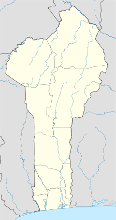
Porto-Novo is the capital and second-largest city of Benin. The commune covers an area of 110 square kilometres (42 sq mi) and as of 2002 had a population of 223,552 people.

The demographics of Benin include population density, ethnicity, education level, health of the populace, economic status, religious affiliations and other aspects of the population.
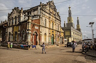
The Aja or Adja are an ethnic group native to south-western Benin and south-eastern Togo. According to oral tradition, the Aja migrated to southern Benin in the 12th or 13th century from Tado on the Mono River, and c. 1600, three brothers, Kokpon, Do-Aklin, and Te-Agbanlin, split the ruling of the region then occupied by the Aja amongst themselves: Kokpon took the capital city of Great Ardra, reigning over the Allada kingdom; Do-Aklin founded Abomey, which would become capital of the Kingdom of Dahomey; and Te-Agbanlin founded Little Ardra, also known as Ajatche, later called Porto Novo by Portuguese traders and the current capital city of Benin.
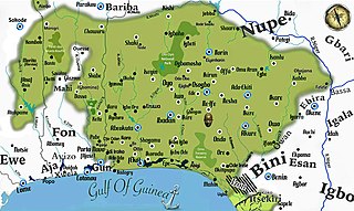
Yorubaland is the homeland and cultural region of the Yoruba people in West Africa. It spans the modern-day countries of Nigeria, Togo and Benin, and covers a total land area of 142,114 km2 (54,871 sq mi). Of this land area, 106,016 km2 (74.6%) lies within Nigeria, 18.9% in Benin, and the remaining 6.5% is in Togo. Prior to European colonization, a portion of this area was known as Yoruba country. The geo-cultural space contains an estimated 55 million people, the majority of this population being ethnic Yoruba.
Malanville is a city, arrondissement and commune in the Alibori Department of northeastern Benin, located across the River Niger from Niger. It is known as a centre of cross-border trade and has a major market. Malanville is also a centre for rice-growing. The commune covers an area of 3016 square kilometres and as of 2013 had a population of 168,006 people.
Boukoumbé or Boukombé is a town, arrondissement and commune in north western Benin on the border with Togo. It is known for its market, its whipping ceremony and for its tradition of pipe making. Mount Kousso-Kovangou, the highest point in Benin, lies nearby.
Plateau is one of the twelve departments of Benin. The department of Plateau was created in 1999 with an area of 2,835 square kilometres (1,095 sq mi) when it was split off from Ouémé Department. Plateau is subdivided into five communes, each centred at one of the principal towns: Adja-Ouèrè, Ifangni, Kétou, Pobè and Sakété.

Donga is one of the twelve departments of Benin; its capital is Djougou, the fourth largest city in the country. The department of Donga was created in 1999 when it was split off from Atakora Department. Donga is subdivided into five communes, each centered at one of the principal towns: Bassila, Copargo, Djougou Rural, Djougou Urban and Ouaké.
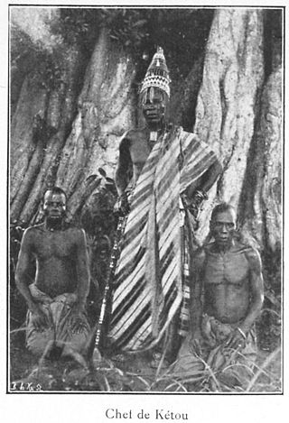
Kétou is a Yoruba town, arrondissement, and commune located in the Plateau Department of the Republic of Benin. The commune covers an area of 2183 square kilometres and as of 2013 had a population of 156,497 people, making it the 13th largest settlement in Benin.
Tchaourou is a commune, arrondissement, and city located in the Borgou Department of Benin, a country in Western Africa, formerly known as Dahomey. It is the birthplace of former Beninese president Yayi Boni. It is 50 kilometres (31 mi) south of Parakou.
Karimama is a town, arrondissement and commune in the Alibori Department of northeastern Benin. The commune covers an area of 6102 square kilometers and as of 2013 had a population of 66,675 people. The town lies on the border with Niger.
Cobly or Kobli is a town, arrondissement and commune in the Atakora Department of north-western Benin.

Grand-Popo is a town, arrondissement, and commune in the Mono Department of south-western Benin. The commune covers an area of 289 square kilometres and as at the 2013 Census had a population of 57,636 people.

Zagnanado or Zangnanado is a town, arrondissement, and commune in the Zou Department of southern-central Benin. It is located 47 kilometres from Abomey and 165 kilometres north of Cotonou. The commune covers an area of 750 square kilometres and as of 2013 had a population of 132,401 people.
Aledjo-Koura is a village and arrondissement in the commune of Bassila in the Donga Department of western Benin. It is located near the border with Togo, close to Mont Sokbaro, which is widely cited as the highest point of Benin.
Aworo is a village in the commune of Bassila in the Donga Department of western Benin. It is located near the border with Togo. Le village du feu MAHAMADOU COULIBALY. CRÉE PAR DEGUENON en 1910. Les habitants sont des Nagots, réjouint après par les Lokpa. Le chef du village actuel s appelle. SABI ADAM SAIDOU. LE CHEF COUTUMIER est ABOUDOU SONGA.
Biguina is a community or village in the commune of Bassila in the Donga Department of northwestern Benin. It is located near the border with Togo and it sits on Benin's Route Nationale 3, one of the two main north-south highways in the country.
The Anii is a Guan language is spoken in Benin, and central-eastern Togo and central eastern Ghana by Makɔ-Makua or Bakɔ-Bakua clan. It is part of the geographic group of Ghana Togo Mountain languages of the Kwa branch of Niger–Congo.
The Isha sometimes spelt Ica, and Itcha are a relatively small group of the Yoruba people, situated in the western parts of middle Benin, West Africa, especially in the town of Bantè and other surrounding communities in the Collines Department.

The Idaasha also spelt Idaaca, Idaaṣa and Idaaitsa are a group of the Yoruba people, situated in the central portions of the Collines Department of Benin, West Africa. They are based in and around the communities of Glazoué and Dassa both situated west of the Oueme River. Every year, the Idaasha organize a festival of arts and culture known as FACI to celebrate their culture and heritage, themed Àshà Ìbílẹ̀.