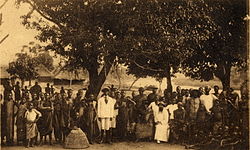
Zou is one of the twelve departments of Benin, named for the Zou River which travels through the department before emptying into the Atlantic in the south of the country. The department of Zou was split in two in 1999, with the northern territory transferred to the newly created Collines Department. The capital of Zou is Abomey. Zou is subdivided into nine communes, each centred at one of the principal towns: Abomey, Agbangnizoun, Bohicon, Cové, Djidja, Ouinhi, Za-Kpota, Zangnanado and Zogbodomey.

Plateau is one of the twelve departments of Benin. The department of Plateau was created in 1999 with an area of 2,835 square kilometres (1,095 sq mi) when it was split off from Ouémé Department. Plateau is subdivided into five communes, each centred at one of the principal towns: Adja-Ouèrè, Ifangni, Kétou, Pobè and Sakété.
Cové is a city in the Zou Department of Benin. The commune covers an area of 525 square kilometres and as of 2012 had a population of 43,554 people.
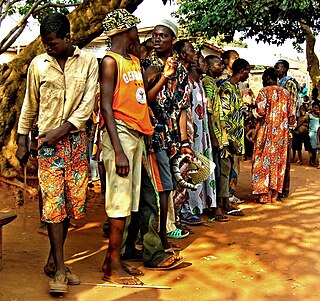
The departments of Benin are subdivided into 77 communes, which in turn are divided into arrondissements and finally into villages or city districts. Prior to 1999 provinces were broken down into 84 districts, titled either urban or rural. Before independence, the six provinces were subdivided into Cercles, cantons, préfectures and villages or towns.

Agbangnizoun is a town, arrondissement, and commune in the Zou Department of south-western Benin. The town lies 20 kilometres south-east of Abomey. The commune covers an area of 244 square kilometres and as of 2002 had a population of 55,001 people.
Djidja is a town, arrondissement, and commune in the Zou Department of south-western Benin. The commune covers an area of 2184 square kilometres and as of 2013 had a population of 123,542 people.
Ouinhi is a town, arrondissement, and commune in the Zou Department of south-western Benin. The commune covers an area of 483 square kilometres and as of 2013 had a population of 59,381 people. It is bounded on the north-west by the commune of Zagnanado, south-west by the commune of Zogbodomey, south by the commune of Bonou and east by the commune of Adja-Ouèrè. The commune is divided into arrondisements which include Dasso, Ouinhi, and Tohu, comprising 28 villages.
Za-Kpota or Zakpota is a town, arrondissement, and commune in the Zou Department of south-western Benin. It is located 153 kilometres north of Cotonou and 33 kilometres east of Abomey.
Arrondissements are administrative units of Benin, after departments and communes. In turn they contain villages and may often have several quartiers or city districts/urban neighborhoods. There are currently 545 arrondissements.
Agbokpa is an arrondissement in the Zou department of Benin. It is an administrative division under the jurisdiction of the commune of Abomey. According to the population census conducted by the Institut National de la Statistique Benin on February 15, 2002, the arrondissement had a total population of 5042.
Dètohou is an arrondissement in the Zou department of Benin. It is an administrative division under the jurisdiction of the commune of Abomey. According to the population census conducted by the Institut National de la Statistique Benin on February 15, 2002, the arrondissement had a total population of 4,112.
Hounli is an arrondissement in the Zou department of Benin. It is an administrative division under the jurisdiction of the commune of Abomey. According to the population census conducted by the Institut National de la Statistique Benin on February 15, 2002, the arrondissement had a total population of 16,590.
Sèhoun is an arrondissement in the Zou department of Benin. It is an administrative division under the jurisdiction of the commune of Abomey. According to the population census conducted by the Institut National de la Statistique Benin on February 15, 2002, the arrondissement had a population of 2,826.
Vidolè is an arrondissement in the Zou department of Benin. It is an administrative division under the jurisdiction of the commune of Abomey. According to the population census conducted by the Institut National de la Statistique Benin on February 15, 2002, the arrondissement had a total population of 23,387.
Zounzounmè is an arrondissement in the Zou department of Benin. It is an administrative division under the jurisdiction of the commune of Abomey. According to the population census conducted by the Institut National de la Statistique Benin on February 15, 2002, the arrondissement had a total population of 6,689.
Dasso is an arrondissement in the Zou department of Benin. It is an administrative division under the jurisdiction of the commune of Ouinhi. According to the population census conducted by the Institut National de la Statistique Benin on February 15, 2002, the arrondissement had a total population of 9,607.
Agonli-Houégbo is an arrondissement in the Zou department of Benin. It is an administrative division under the jurisdiction of the commune of Zagnanado. According to the population census conducted by the Institut National de la Statistique Benin on February 15, 2002, the arrondissement had a total population of 4,437.
Banamè is an arrondissement in the Zou department of Benin. It is an administrative division under the jurisdiction of the commune of Zagnanado. According to the population census conducted by the Institut National de la Statistique Benin on February 15, 2002, the arrondissement had a total population of 11,369.
Don-Tan is an arrondissement in the Zou department of Benin. It is an administrative division under the jurisdiction of the commune of Zagnanado. According to the population census conducted by the Institut National de la Statistique Benin on February 15, 2002, the arrondissement had a total population of 4,331.
Dovi is an arrondissement in the Zou department of Benin. It is an administrative division under the jurisdiction of the commune of Zagnanado. According to the population census conducted by the Institut National de la Statistique Benin on February 15, 2002, the arrondissement had a total population of 4,518.