Agbangnizoun

Last updated
Agbangnizoun
Commune and city
Benin location map.svg
Red pog.svg
Agbangnizoun
Location in Benin
Coordinates: 7°4′N1°58′E / 7.067°N 1.967°E / 7.067; 1.967
CountryFlag of Benin.svg  Benin
Department Zou Department
Area
  Total 94 sq mi (244 km2)
Population (2002)
  Total 55,001
Time zone WAT (UTC+1)

Agbangnizoun is a town, arrondissement, and commune in the Zou Department of south-western Benin. The town lies 20 kilometres south-east of Abomey. The commune covers an area of 244 square kilometres and as of 2002 had a population of 55,001 people. [1] [2]

Arrondissements of Benin administrative territorial entity of Benin

Arrondissements are administrative units of Benin, after departments and communes. In turn they contain villages and may often have several quartiers or city districts/urban neighborhoods. There are currently 545 arrondissements.

Communes of Benin

The departments of Benin are subdivided into 77 communes, which in turn are divided into arrondissements and finally into villages or city districts. Prior to 1999 provinces were broken down into 84 districts, titled either urban or rural. Before independence, the six provinces were subdivided into Cercles, cantons, préfectures and villages or towns.

Zou Department Department in Benin

Zou is one of the twelve departments of Benin. The department obtains its name from the Zou River which travels through the department before emptying into the Atlantic in the south of the country. The majority of the population are the Fon people with 91% population, while Aja people make up 4% and Yoruba make up 3% of the populace. The departement of Zou was split in 1999 with the northern territory moved to the newly created Collines Department. The capital of Zou is Abomey. Zou is subdivided into nine communes, each centered at one of the principal towns, namely, Abomey, Agbangnizoun, Bohicon, Cové, Djidja, Ouinhi, Za-Kpota, Zangnanado and Zogbodomey.

Contents

Geography

Agbangnizoun is located 16 kilometres from Abomey and 151 kilometres from Cotonou. It is bounded to the north by Abomey and Djidja, south by Couffo, east by the communes of Bohicon and Zogbodomey and the west by the town of Klouékanmè. [3]

Abomey Commune and city in Zou Department, Benin

Abomey is a city in the Zou Department of Benin. Abomey is also the former capital of the Kingdom of Dahomey, which would later become a French colony, then the Republic of Dahomey (1960–1975), and is the modern-day Republic of Benin.

Cotonou Place in Littoral Department, Benin

Cotonou is the largest city and economic centre of Benin.

Djidja Commune and city in Zou Department, Benin

Djidja is a town, arrondissement, and commune in the Zou Department of south-western Benin. The commune covers an area of 2184 square kilometres and as of 2002 had a population of 84,590 people.

Administrative divisions

Agbangnizoun is subdivided into 10 arrondissements; Agbangnizoun, Adanhoundjigon, Adingnigon, Kinta, Lissazounmè, Sahè, Siwé-Kpota, Siwé-Légo, Tanvé and Zoungoudo. They contain 45 villages and 7 city districts. [1]

Kinta is an arrondissement in the Zou department of Benin. It is an administrative division under the jurisdiction of the commune of Agbangnizoun. According to the population census conducted by the Institut National de la Statistique Benin on February 15, 2002, the arrondissement had a total population of 4,626.

Lissazounmè is an arrondissement in the Zou department of Benin. It is an administrative division under the jurisdiction of the commune of Agbangnizoun. According to the population census conducted by the Institut National de la Statistique Benin on February 15, 2002, the arrondissement had a total population of 6,703.

Tanvé is an arrondissement in the Zou department of Benin. It is an administrative division under the jurisdiction of the commune of Agbangnizoun. According to the population census conducted by the Institut National de la Statistique Benin on February 15, 2002, the arrondissement had a total population of 8,034.

Economy

Most of the population are engaged in agricultural activities followed by trade, transportation and handicrafts. [3] 6 800,00 hectares of land are devoted to agriculture, accounting for 34.87% of the total population. [1] The main crops grown are maize, cotton, sorghum, cowpeas, peanuts, cassava and potato. [1]

Maize Cereal grain

Maize, also known as corn, is a cereal grain first domesticated by indigenous peoples in southern Mexico about 10,000 years ago. The leafy stalk of the plant produces pollen inflorescences and separate ovuliferous inflorescences called ears that yield kernels or seeds, which are fruits.

Cotton plant fiber from the genus Gossypium

Cotton is a soft, fluffy staple fiber that grows in a boll, or protective case, around the seeds of the cotton plants of the genus Gossypium in the mallow family Malvaceae. The fiber is almost pure cellulose. Under natural conditions, the cotton bolls will increase the dispersal of the seeds.

<i>Sorghum</i> genus of plants

Sorghum is a genus of flowering plants in the grass family Poaceae. Seventeen of the 25 species are native to Australia, with the range of some extending to Africa, Asia, Mesoamerica, and certain islands in the Indian and Pacific Oceans. One species is grown for grain, while many others are used as fodder plants, either cultivated in warm climates worldwide or naturalized, in pasture lands. Sorghum is in the subfamily Panicoideae and the tribe Andropogoneae.

Settlements

Related Research Articles

Bohicon Commune and city in Zou Department, Benin

Bohicon is a city in Benin, and a conurbation of Abomey lying 9 kilometres east of the city on the railway line from Cotonou to Parakou and on Benin's main highway RNIE 2 which joins the RNIE 4. The commune covers an area of 139 square kilometres and as of 2002 had a population of 113,091 people.
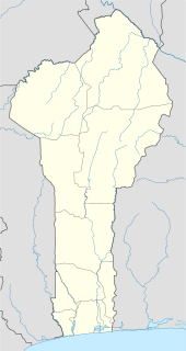
Boukoumbé Place in Atakora Department, Benin

Boukoumbé or Boukombé is a town, arrondissement and commune in north western Benin on the border with Togo. It is known for its market, its whipping ceremony and for its tradition of pipe making. Mount Kousso-Kovangou, the highest point in Benin, lies nearby.

Abomey-Calavi Commune and city in Atlantique Department, Benin

Abomey-Calavi is a city, arrondissement, and commune located in the Atlantique Department of Benin. It is mainly suburban to the city of Cotonou and at its closest it begins approximately 18 km from the city centre of Cotonou. The main cities are Abomey-Calavi itself and Godomey to the south. The commune covers an area of 650 square kilometres and as at the May 2013 Census had a population of 655,965 people.
Cové Commune and city in Zou Department, Benin

Cové is a city in the Zou Department of Benin. The commune covers an area of 525 square kilometres and as of 2012 had a population of 43,554 people.

Ségbana Place in Alibori Department, Benin

Ségbana is a town, arrondissement and commune located in the Alibori Department of Benin.The commune covers an area of 4471 square kilometres and as of 2013 had a population of 89,268 people.

Karimama, Benin Place in Alibori Department, Benin

Karimama is a town, arrondissement and commune in the Alibori Department of northeastern Benin. The commune covers an area of 6102 square kilometres and as of 2013 had a population of 66,675 people.The town lies on the border with Niger.

Gogounou Place in Alibori Department, Benin

Gogounou is a town, arrondissement and commune in the Alibori Department of Benin, about 35 kilometres south of Kandi. The commune covers an area of 4910 square kilometres and as of 2013 had a population of 117,793 people.
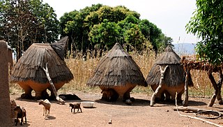
Cobly Commune, arrondissement and town in Atakora Department, Benin

Cobly or Kobli is a town, arrondissement and commune in the Atakora Department of north-western Benin.

Kpomassè Commune and city in Atlantique Department, Benin

Kpomassè is a town, arrondissement, and commune in the Atlantique Department of southern Benin. The commune covers an area of 305 square kilometres and as of 2002 had a population of 57,190 people.

Lalo, Benin Commune and city in Kouffo Department, Benin

Lalo is a town, arrondissement, and commune in the Kouffo Department of south-western Benin. The commune covers an area of 432 square kilometres and as of 2013 had a population of 119,926 people.

Houéyogbé Commune and city in Mono Department, Benin

Houéyogbé is a town, arrondissement, and commune in the Mono Department of south-western Benin. The commune covers an area of 290 square kilometres and as of 2002 had a population of 74,492 people.

Dangbo Commune and city in Ouémé Department, Benin

Dangbo is a town, arrondissement, and commune in the Ouémé Department of south-eastern Benin.The commune covers an area of 340 square kilometres and as of 2002 had a population of 66,055 people. Dangbo is the site of Benin's Institute for Mathematics and Physical Sciences.

Za-Kpota Commune and city in Zou Department, Benin

Za-Kpota or Zakpota is a town, arrondissement, and commune in the Zou Department of south-western Benin. It is located 153 kilometres north of Cotonou and 33 kilometres east of Abomey.

Zagnanado Commune and city in Zou Department, Benin

Zagnanado or Zangnanado is a town, arrondissement, and commune in the Zou Department of southern-central Benin. It is located 47 kilometres from Abomey and 165 kilometres north of Cotonou. The commune covers an area of 750 square kilometres and as of 2013 had a population of 132,401 people.

Togba is a town and arrondissement in the Atlantique Department of southern Benin. It is an administrative division under the jurisdiction of the commune of Abomey-Calavi. According to the population census conducted by the Institut National de la Statistique Benin on February 15, 2002, the arrondissement had a total population of 18,674.

Kandi, Benin Commune, arrondissement and city in Alibori Department, Benin

Kandi is a town, arrondissement and commune in the Alibori Department of eastern Benin. Originally a market town, Kandi is now primarily a farming centre. It lies on the nation's main north-south highway, 650 km from Cotonou and 523 km (325 mi) north of Porto-Novo. The town is the capital of the department of Alibori. The commune covers an area of 3421 square kilometres and as of 2013 had a population of 177,683 people. The town itself had a population of 27,227 in 2002.

Siwé is an arrondissement in the Zou department of Benin. It is an administrative division under the jurisdiction of the commune of Agbangnizoun. According to the population census conducted by the Institut National de la Statistique Benin on February 15, 2002, the arrondissement had a total population of 5,508.
References

  1. 1 2 3 4 "Agbangnizoun". Atlas Monographique des Communes du Benin. Retrieved January 5, 2010.[ permanent dead link ]
  2. "Communes of Benin". Statoids. Archived from the original on 2 January 2010. Retrieved January 5, 2010.
  3. 1 2 "Agbangnizoun". www.agbangnizoun.communedubenin.org. Archived from the original on April 14, 2009. Retrieved January 8, 2009.

Coordinates: 7°4′N1°58′E / 7.067°N 1.967°E / 7.067; 1.967

Geographic coordinate system Coordinate system

A geographic coordinate system is a coordinate system that enables every location on Earth to be specified by a set of numbers, letters or symbols. The coordinates are often chosen such that one of the numbers represents a vertical position and two or three of the numbers represent a horizontal position; alternatively, a geographic position may be expressed in a combined three-dimensional Cartesian vector. A common choice of coordinates is latitude, longitude and elevation. To specify a location on a plane requires a map projection.