Parakou

Last updated

Parakou
Place de la municipalite 10.jpg
Central Parakou, 2019
Benin location map.svg
Red pog.svg
Parakou
Location in Benin
Coordinates: 9°21′N2°37′E / 9.350°N 2.617°E / 9.350; 2.617
Country Flag of Benin.svg  Benin
Department Borgou Department
Area
  Total441 km2 (170 sq mi)
Elevation
324 m (1,063 ft)
Population
 (2012) [1]
  Total206,667
  Density470/km2 (1,200/sq mi)
Time zone UTC+1 (WAT)

Parakou is the largest city in northern Benin, and the third-largest city in the country, with an estimated population of around 206,667 people, and capital of the Borgou Department. Administratively the commune of Parakou makes up one of Benin's 77 communes. Since 2015, its mayor is Souradjou Adamou Karimou.[ citation needed ]

Contents

History

The city was founded in the 16th century by traders. [2] Among traders there is a first occupant of the Old City , a hunter named sina kpebiegi. [3] This hunter was from baatonou community. Even the traditional leaders are living from slaves trade the population are living from fishing and agriculture.

Economy

Parakou lies on the main north-south highway RNIE 2 and at the end of a railway to Cotonou.

Markets

This has made it an important market town, with major industries including cotton and textiles, peanut oil manufacture and brewing. The town grew initially from revenue generated from passing merchants that took goods from the region across the Sahara and the Mediterranean to Europe. [4] Parakou later became well known in the slave trade. [4] Later traders concentrated on cotton and Parakou remains the hub of the Beninese cotton trade to this day, with considerable interest from Europe. [4]

The Grand Marche Arzeke international market Parakouinternationalmarket.jpg
The Grand Marché Arzeke international market

There are several markets trading, notably the largest, Grand Marché Arzeke which one of the largest in Benin, an international market spanning over a block. [5] This market has a large covered hall overlapping onto the streets with stalls, with 500 and 1000 vendors. The market sells an enormous range of goods from items of pottery including vases and bowls, to cotton textiles, cassettes and CD's of local and international artists, local spices, fruits, gasaru/wagasi (cow's milk cheese) and kitchen utensils. [6] Another market, located several blocks north, is called the "Marché Kobo Kobo", which lies across the street from the French Cultural Centre. [4] Marché Kobo Kobo is known for its clothing retailing, primarily second hand goods, and in another section livestock. [4] The Marché Depot is located near Parakou Railway Station around numerous hotels and sells mostly food but also calabashes and baskets. There is also the Marché Guema, located next to Guema Church on the northern road to Malanville in the Albarika quarter of the city. The market was founded by the Somba people of the Atacora, and takes place every Sunday at 10 am. The market consists of a collection of grass huts, and specialises in beef and pork and local millet beer known as choukachou or simply "chouk". [6]

Inland Port

Parakou is the site of a proposed inland port. [7]

The dry port is a multi-modal platform located 3 km from the centre of Parakou, close to the railway. It gives the Backbone Project a strategic position for imports and exports to neighbouring countries, notably Burkina Faso, Mali, Niger, Nigeria and Togo.

Demographics

A roundabout in Parakou Parakouroundabout.jpg
A roundabout in Parakou

The name, Parakou, is derived from a Dendi word meaning "the city of everyone", named for the city's diversity of ethnicities. [6] As a market town attracting many people as a trading and stop-off point, Parakou has a large mix of African ethnicities, including Fula, Dendi, Somba, Fon, Mina, Bariba, Djerma, Yoruba (of the Nago tribe), Hausa, Kabrais, Warma, [8] and Tuareg. [6]

In 1979 the city was reported as having 60,915 people and according to the official census of 1992, Parakou had a population of 103,577. In the last 15–20 years the population of Parakou has nearly doubled with 149,819 recorded in 2002 and with the most recent census in 2013, the population was 255,478. [9]

Climate

Climate data for Parakou (1991–2020)
MonthJanFebMarAprMayJunJulAugSepOctNovDecYear
Mean daily maximum °C (°F)35.0
(95.0)
36.9
(98.4)
37.4
(99.3)
35.6
(96.1)
33.3
(91.9)
31.2
(88.2)
29.7
(85.5)
28.8
(83.8)
30.0
(86.0)
31.8
(89.2)
34.6
(94.3)
34.8
(94.6)
33.3
(91.9)
Daily mean °C (°F)27.5
(81.5)
29.6
(85.3)
30.7
(87.3)
29.7
(85.5)
28.2
(82.8)
26.7
(80.1)
25.7
(78.3)
25.2
(77.4)
25.7
(78.3)
26.8
(80.2)
28.0
(82.4)
27.4
(81.3)
27.6
(81.7)
Mean daily minimum °C (°F)19.9
(67.8)
22.3
(72.1)
24.0
(75.2)
23.8
(74.8)
23.0
(73.4)
22.1
(71.8)
21.8
(71.2)
21.5
(70.7)
21.4
(70.5)
21.7
(71.1)
21.4
(70.5)
20.0
(68.0)
21.9
(71.4)
Average precipitation mm (inches)4.9
(0.19)
8.0
(0.31)
33.6
(1.32)
83.2
(3.28)
133.8
(5.27)
157.5
(6.20)
188.8
(7.43)
212
(8.3)
221.5
(8.72)
111.9
(4.41)
6.9
(0.27)
1.9
(0.07)
1,164
(45.83)
Average precipitation days (≥ 1.0 mm)113711131618191110101
Average relative humidity (%)33.238.751.964.372.076.479.581.880.075.357.239.962.5
Mean monthly sunshine hours 251.5233.2234.8230.9229.1190.0144.8119.6148.7208.7250.2259.92,501.4
Source: NOAA [10]

Culture

The Musee en Plein Air de Parakou Parakoupleinairmuseum.jpg
The Musée en Plein Air de Parakou

The city has a museum, the Musée en Plein Air de Parakou. [4]

Administration

Parakou is one of the 77 official communes of Benin. The mayor of the commune and city as of 2008 is Samou Seidou Adambi.[ citation needed ]

Villages

The commune of Parakou contains the following villages: [11]

Amawihon, Bakaga, Bakounkparou, Bakounourou, Baperou, Bereyadou, Borarou, Darou Kourarou, Debregourou, Dokparou, Douerou, Forane Kparou, Gagbebou, Ganou, Ga Yakabou, Gommboko, Gorobani, Gouforou, Goutere, Guema, Guererou, Guinrerou, Kaborokpo, Kabro, Karobouarou, Kipare, Konkoma, Koumerou, Kperou Guera, Moundouro, Nekinparo, Nikikperou, Ouroungourou, Pepekino, Pepepeterou, Sanro, Senouorou, Sokoumeno, Sokouno, Sonoumo, Sourou, Suinrou, Tabayorourou, Tankaro, Tankaro Ga, Teougourou Gando, Tian, Tinekonparou, Tora, Tourou, Wansirou, Weria, Wore, Worora, Yakassirou

Education

Parakou is home to one university, the University of Parakou, founded in 2001. [12]

Places of worship

Parakou Mosque ParakouMosque.jpg
Parakou Mosque

Among the places of worship, most predominant are Muslim mosques. [13] There are also several Christian denominations represented: Roman Catholic Archdiocese of Parakou (Catholic Church), Protestant Methodist Church in Benin (World Methodist Council), Union of Baptist Churches of Benin (Baptist World Alliance), Living Faith Church Worldwide, Redeemed Christian Church of God and the Assemblies of God.

Transport

The RNIE 6 road leading out of Parakou Parakouroad.jpg
The RNIE 6 road leading out of Parakou

Parakou Railway Station is the last railway station on the Parakou-Cotonou railway, however at present it is not open to passenger transportation. [4] Both the national highways RNIE 2 and RNIE 6 pass through Parakou. The city is also served by Parakou Airport. [4] The government has proposed extending the railway to Dosso in Niger. [14]

Sport

The main football clubs are Dynamo Unacob FC de Parakou and Buffles du Borgou FC which play in the Benin Premier League, the highest division of Beninese football.[ citation needed ]

Notable people

See also

Related Research Articles

<span class="mw-page-title-main">Benin</span> Country in West Africa

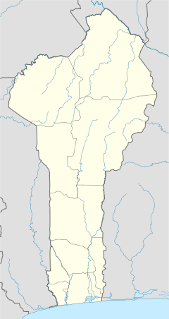
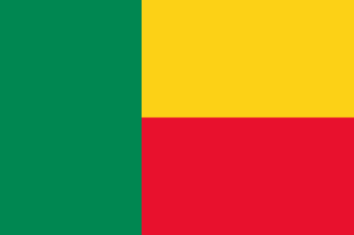
Benin, officially the Republic of Benin, and also known as Dahomey, is a country in West Africa. It is bordered by Togo to the west, Nigeria to the east, Burkina Faso to the north-west, and Niger to the north-east. The majority of its population lives on the southern coastline of the Bight of Benin, part of the Gulf of Guinea in the northernmost tropical portion of the Atlantic Ocean. The capital is Porto-Novo, and the seat of government is in Cotonou, the most populous city and economic capital. Benin covers an area of 114,763 km2 (44,310 sq mi), and its population in 2021 was estimated to be approximately 13 million. It is a small, tropical country. It is one of the least developed, with an economy heavily dependent on agriculture, and is an exporter of palm oil and cotton. Some employment and income arise from subsistence agriculture.

<span class="mw-page-title-main">Cotonou</span> Largest city in Benin

Cotonou is the largest city in Benin. Its official population count was 679,012 inhabitants in 2012; however, over two million people live in the larger urban area.

<span class="mw-page-title-main">Porto-Novo</span> Capital of Benin

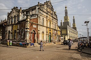
Porto-Novo is the capital and second-largest city of Benin. The commune covers an area of 110 square kilometres (42 sq mi) and as of 2002 had a population of 223,552 people.

<span class="mw-page-title-main">Demographics of Benin</span>

The demographics of Benin include population density, ethnicity, education level, health of the populace, economic status, religious affiliations and other aspects of the population.

Benin possesses railway and road infrastructure, as well as two seaports. Benin currently does not have rail connections to other countries, but new proposals seek to change this.

<span class="mw-page-title-main">Bohicon</span> Commune and city in Zou Department, Benin

Bohicon or Gbɔ̀xikɔn is a city in Benin, and a conurbation of Abomey lying 9 kilometres east of the city on the railway line from Cotonou to Parakou and on Benin's main highway RNIE 2 which joins the RNIE 4. The commune covers an area of 139 square kilometres and as of 2012 had a population of 149,271 people.

<span class="mw-page-title-main">Borgou Department</span> Department of Benin

Borgou is one of the twelve departments of Benin. Borgou borders the country of Nigeria and the departments of Alibori, Atakora, Collines and Donga. The capital of Borgou is Parakou. The department of Borgou was bifurcated in 1999, with its northern territory transferred to the newly created Alibori Department.

Ségbana is a town, arrondissement and commune located in the Alibori Department of Benin. The commune covers an area of 4471 square kilometres and as of 2013 had a population of 89,268 people.

Tchaourou is a commune, arrondissement, and city located in the Borgou Department of Benin, a country in Western Africa, formerly known as Dahomey. It is the birthplace of former Beninese president Yayi Boni. It is 50 kilometres (31 mi) south of Parakou.

The Benin Premier League, also called Championnat National du Bénin in French, is the highest football division in Benin. The league was held in 1969 for the first time. Currently, the initial round is a double round-robin tournament, with 36 clubs being divided in 4 groups, and 9 clubs in each. The last 5 teams of each group, goes to the relegation round, which consists on 2 groups of 10 teams. The first 4 teams of each group goes to the final stage with 16 clubs playing a single round-robin tournament. The winner of this round earns a place in the CAF Champions League.

N'Dali is a city and arrondissement in the north of Benin, and the capital of the Commune of N'Dali in the Borgou Department. The commune covers an area of 3748 square kilometres and as of 2013 had a population of 113,604 people. In 2008 an estimated 16,941 people living in the main town of N'Dali.

<span class="mw-page-title-main">Outline of Benin</span> Country in West Africa

The following outline is provided as an overview of and topical guide to Benin:

<span class="mw-page-title-main">Religion in Benin</span> Religion in the country

Christianity is the largest religion in Benin, with substantial populations of Muslims and adherents of traditional faiths. According to the most recent 2020 estimate, the population of Benin is 52.2% Christian, 24.6% Muslim, 17.9% traditionalist and 5.3% follows other faiths or has no religion.

<span class="mw-page-title-main">Agriculture in Benin</span>

Benin is predominantly a rural society, and agriculture in Benin supports more than 70% of the population. Agriculture contributes around 35% of the country's gross domestic product (GDP) and 80% of export income. While the Government of Benin (GOB) aims to diversify its agricultural production, Benin remains underdeveloped, and its economy is underpinned by subsistence agriculture. Approximately 93% of total agricultural production goes into food production. The proportion of the population living in poverty is about 35.2%, with more rural households in poverty (38.4%) than urban households (29.8%). 36% of households depend solely upon agricultural (crop) production for income, and another 30% depend on crop production, livestock, or fishing for income.

<span class="mw-page-title-main">Rail transport in Benin</span>

Benin has a total of 578 km (359 mi) of single track, 1,000 mm railway. Rail construction began around 1900, with regular services commencing in 1906; rail operation was taken into government control in 1930.

Benin, officially the Republic of Benin, is a country in Western Africa. It borders Togo to the west, Nigeria to the east and Burkina Faso and Niger to the north; its short coastline to the south leads to the Bight of Benin. Its size is just over 110000 km2 with a population of almost 8500000. Its capital is the Yoruba founded city of Porto Novo, but the seat of government is the Fon city of Cotonou. About half the population live below the international poverty line of US$1.25 per day.

<span class="mw-page-title-main">Kandi, Benin</span> Place in Alibori Department, Benin

Kandi is a town, arrondissement and commune in the Alibori Department of eastern Benin. Originally a market town, Kandi is now primarily a farming centre. It lies on the nation's main north-south highway, 650 km (400 mi) from Cotonou and 523 km (325 mi) north of Porto-Novo. The town is the capital of the department of Alibori. The commune covers an area of 3,421 km2 (1,321 sq mi) and as of 2013 had a population of 177,683 people. The town itself had a population of 27,227 in 2002.

<span class="mw-page-title-main">Dendi language</span> Songhay language of northern Benin

Dendi is a Songhay language used as a trade language across northern Benin (along the Niger River. It forms a dialect cluster with Zarma and Koyraboro Senni but it is heavily influenced by Bariba.

<span class="mw-page-title-main">Niamey railway station</span> Railway station in Niamey, Niger

Niamey, colloquially also known as Niamey Hippodrome, is the main railway station of the city of Niamey, the capital of Niger. Located near the Niamey Racecourse, in Niamey IV borough, is the first station opened in Niger and is part of AfricaRail project.

<span class="mw-page-title-main">Markets in Benin</span>

Fresh (wet) markets occur in most towns and villages in Benin, usually surrounded by large numbers of small shops selling foods, consumer items, imported foods and goods, clothing, household goods, etc. With a large portion of the population producing much of their own food, particularly for starches, open markets are where the diet is rounded out with items not self-produced. For those with higher incomes, more of the food consumed is purchased at market. Most vegetables are in villages and town markets, which usually have a major day, or multiple days, where traders and retailers are active in selling perishables in particular. Fish, meats, staple starch crops, legumes, soy and milk cheeses, fruits, and vegetables are available in the market every week of the year in most places with significant variations in the quantity supplied. Staple crops are usually sold to retailers by wholesalers, who obtain them from the producers. Meat is sold by the butchers who source from the producers. The source of vegetables depends on the season. Regional trade keeps a selection of vegetables available, with price and quantity fluctuations depending on the season. Visits to markets in the Parakou and Nikki areas observed avocados from Lomé in Togo and red onions from Niger. Eastern border markets have many Nigerian traders coming into Benin to purchase fruits and vegetables for sale in Nigeria. Most of these transactions are not captured in either of the countries' statistical records. Vegetables traders/retailers obtain their products either from the intermediary traders or directly at the farm gate if possible. For many items there are unwritten agreements that producers will sell to retailers, not directly to consumers. Intermediaries buy at the farms and transport the products directly to their various market destinations. Women dominate the role of vegetable retailers at these open markets. Vegetable producers market much of their produce in bulk at harvest time because of the highly perishable nature of their products. In general, producers conduct all of their sales immediately after harvest. The long marketing channel of vegetables in the larger peri-urban and urban areas involves several types of intermediaries, from local traders to wholesalers. Studies by INRAB have shown that producers are more inefficient in marketing than in production. There is a lack of market participation of farmers and current barriers to entry by farmers limit their access to markets.

References

  1. "World Gazetteer". World Gazetteer. Archived from the original on January 11, 2013. Retrieved July 27, 2013.
  2. Mathurin C. Houngnikpo, Samuel Decalo, Historical Dictionary of Benin, Rowman & Littlefield, USA, 2013, p. 281
  3. "La royauté de parakou". www.voyage-benin.com.
  4. 1 2 3 4 5 6 7 8 Butler, Stuart (2019) Bradt Travel Guide - Benin, pgs. 177-180
  5. Butler 2006 , p. 192.
  6. 1 2 3 4 "Parakou". Benintourism.com. Retrieved January 10, 2009.
  7. Inland Port
  8. In Fula : Fulɓe; in French: Peul or Peulh.
  9. "Benin: largest cities and towns and statistics of their population". World Gazeteer. Retrieved January 10, 2009.[ dead link ]
  10. "World Meteorological Organization Climate Normals for 1991-2020 — Parakou". National Oceanic and Atmospheric Administration. Retrieved January 4, 2024.
  11. "Parakou". Maplandia World Gazetteer. Retrieved January 11, 2009.
  12. "Université de Parakou - Historique". Archived from the original on August 28, 2009. Retrieved January 11, 2023.
  13. J. Gordon Melton, Martin Baumann, ‘‘Religions of the World: A Comprehensive Encyclopedia of Beliefs and Practices’’, ABC-CLIO, USA, 2010, p. 338
  14. "EXTENDING FROM BENIN TO NIGER". Railways Africa. Retrieved October 17, 2010.
  15. Matthews 1966 , p. 139
  16. "Index Ma-Mam".
  17. Parakou at National-Football-Teams.com

Bibliography

9°21′N2°37′E / 9.350°N 2.617°E / 9.350; 2.617