Djougou Airport

Last updated
Djougou Airport
Summary
Airport type Public
Serves Djougou
LocationFlag of Benin.svg  Benin
Elevation  AMSL 1,444 ft / 440 m
Coordinates 9°41′31.6″N1°38′14.9″E / 9.692111°N 1.637472°E / 9.692111; 1.637472 (Djougou Airport (Djougou)) Coordinates: 9°41′31.6″N1°38′14.9″E / 9.692111°N 1.637472°E / 9.692111; 1.637472 (Djougou Airport (Djougou))
Map
Benin location map.svg
Airplane silhouette.svg
DBBD
Location of Djougou Airport in Benin
Runways
Direction Length Surface
ft m
10/28 3,250 991 Dirt
Source: Landings.com [1] [2]

Djougou Airport( IATA : DJA, ICAO : DBBD) is a public use airport located near Djougou, Donga, Benin.

An IATA airport code, also known as an IATA location identifier, IATA station code or simply a location identifier, is a three-letter code designating many airports around the world, defined by the International Air Transport Association (IATA). The characters prominently displayed on baggage tags attached at airport check-in desks are an example of a way these codes are used.

ICAO airport code four-letter code designating many airports around the world

The ICAOairport code or location indicator is a four-letter code designating aerodromes around the world. These codes, as defined by the International Civil Aviation Organization and published in ICAO Document 7910: Location Indicators, are used by air traffic control and airline operations such as flight planning.

Airport location where aircraft take off and land

An airport is an aerodrome with extended facilities, mostly for commercial air transport. Airports often have facilities to store and maintain aircraft, and a control tower. An airport consists of a landing area, which comprises an aerially accessible open space including at least one operationally active surface such as a runway for a plane to take off or a helipad, and often includes adjacent utility buildings such as control towers, hangars and terminals. Larger airports may have airport aprons, taxiway bridges, air traffic control centres, passenger facilities such as restaurants and lounges, and emergency services. In some countries, the US in particular, they also typically have one or more fixed-base operators, serving general aviation.

Related Research Articles

Bembéréké Airport, also spelled as Bembèrèkè Airport, is a public use airport located 4 km northeast of Bembéréké, Borgou, Benin.

Bohicon/Cana Airport is a public use airport located 3 nm south-southwest of Bohicon, Zou, Benin.

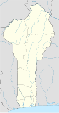
Kandi Airport is a public use airport located near Kandi, Alibori, Benin.

Boundétingou Airport is a public use airport located near Natitingou, Atakora, Benin.

Parakou Airport is a public use airport located 1 km northwest of Parakou, Borgou, Benin. It is to be replaced by the Tourou International Airport, a new airport in Tankaro, about 10 km northwest of Parakou, which will feature an asphalt runway 3,500 meters in length. The new airport entered service on 18 March 2016.

Porga Airport is a public use airport located near Porga, Atakora, Benin.

Savé Airport is a public use airport located near Savé, Collines, Benin.

Koukou Angarana Airport public airport located near Koukou Angarana, Sila, Chad

Koukou Angarana Airport is a public use airport located near Koukou Angarana, Sila, Chad.

Moussoro Airport

Moussoro Airport is a public use airport located 1 kilometre (1 mi) east-northeast of Moussoro, Bahr el Gazel, Chad.

Am Timan Airport

Am Timan Airport is an airport serving Am Timan in Chad.

Bokoro Airport

Bokoro Airport is a public use airport located near Bokoro, Hadjer-Lamis, Chad.

Bol-Bérim Airport airport in Chad

Bol-Berim Airport is a public use airport located near Bol, Lac, Chad.

Bousso Airport airport

Bousso Airport is a public use airport located near Bousso, Chari-Baguirmi, Chad.

Laï Airport

Laï Airport is a public use airport located near Laï, Tandjilé, Chad.

Goz Beïda Airport

Goz Beïda Airport is a public use airport located 5 kilometres (3 mi) east-southeast of Goz Beïda, Sila, Chad.

Mao Airport public use airport located near Mao, Kanem, Chad

Mao Airport is a public use airport located near Mao, Kanem, Chad.

Mongo Airport

Mongo Airport is a public use airport located near Mongo, Guéra, Chad.

Oum Hadjer Airport

Oum-Hadjer Airport is a public use airport located near Oum-Hadjer, Batha, Chad.

Cochrane Airfield

Cochrane Airport Spanish: Aeródromo Cochrane, is an airport serving Cochrane, a town in the Aysén Region of Chile. The airport is just northwest of the town, at the foot of Cerro Tamanguito (sv).

References

  1. Airport record for Djougou Airport at Landings.com. Retrieved 2013-08-09
  2. Google (2013-08-09). "location of Djougou Airport" (Map). Google Maps . Google. Retrieved 2013-08-09.