
Sir Oswald Ernald Mosley, 6th Baronet, was a British aristocrat and politician who rose to fame during the 1920s and 1930s when, having become disillusioned with mainstream politics, he turned to fascism. He was a member of parliament and later founded and led the British Union of Fascists (BUF).
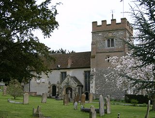
Harefield is a village in the London Borough of Hillingdon, England, 17 miles (27 km) northwest of Charing Cross near Greater London's boundary with Buckinghamshire to the west and Hertfordshire to the north. The population at the 2011 Census was 7,399. Harefield is the westernmost settlement in Greater London, and lies outside the capital's contiguous built-up area.

The British Union of Fascists (BUF) was a British fascist political party formed in 1932 by Oswald Mosley. Mosley changed its name to the British Union of Fascists and National Socialists in 1936 and, in 1937, to the British Union. In 1939, following the start of the Second World War, the party was proscribed by the British government and in 1940 it was disbanded.

William Richard Morris, Viscount Nuffield,, was an English motor manufacturer and philanthropist. He was the founder of Morris Motors Limited and is remembered as the founder of the Nuffield Foundation, the Nuffield Trust and Nuffield College, Oxford, as well as being involved in his role as President of BUPA in creating what is now Nuffield Health. He took his title from the village of Nuffield in Oxfordshire, where he lived.
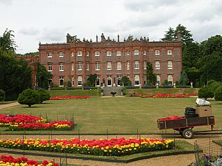
Hughenden Manor, Hughenden, Buckinghamshire, England, is a Victorian mansion, with earlier origins, that served as the country house of the Prime Minister, Benjamin Disraeli, 1st Earl of Beaconsfield. It is now owned by the National Trust and open to the public. It sits on the brow of the hill to the west of the main A4128 road that links Hughenden to High Wycombe.
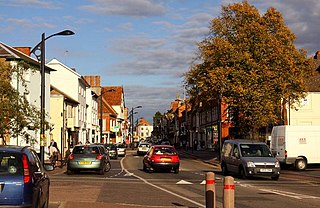
Newport Pagnell is a town and civil parish in the City of Milton Keynes, Buckinghamshire, England. The Office for National Statistics records Newport Pagnell as part of the Milton Keynes urban area.

Haddenham is a village and civil parish in west Buckinghamshire, England. It is about 5 miles (8 km) south-west of Aylesbury and 4 miles (6 km) north-east of Thame in neighbouring Oxfordshire. At the 2011 Census, the population of the civil parish was 4,502.

Beachampton is a village and civil parish beside the River Great Ouse in the unitary authority area of Buckinghamshire, England. The village is about 5 miles (8.0 km) east of Buckingham and a similar distance west of Milton Keynes.
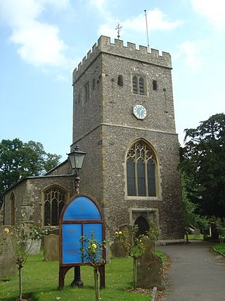
Denham is a village and civil parish in the unitary authority of Buckinghamshire, England, approximately 17 mi from central London,2 mi northwest of Uxbridge and just north of junction 1 of the M40 motorway. The name is derived from the Old English for "homestead in a valley". It was listed in the Domesday Book of 1086 as Deneham. Denham contains the Buckinghamshire Golf Club.

Fleet Marston is a civil parish and deserted medieval village in the Aylesbury Vale district of Buckinghamshire, England, about 2.5 miles (4 km) northwest of the centre of Aylesbury. The parish measures about 2.5 miles (4 km) north – south, but east – west it is nowhere more than about 3⁄4 mile (1.2 km) wide. It is bounded to the southeast by the River Thame, to the east by a stream that joins the Thame, and to the west by field boundaries. It has an area of 934 acres (378 ha).
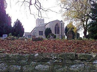
Haversham is a village and former civil parish, now in the parish of Haversham-cum-Little Linford, in the City of Milton Keynes unitary authority area, in Buckinghamshire, England. It is situated to the north of the Milton Keynes urban area, near Wolverton and about 5 miles (8 km) north of Central Milton Keynes.
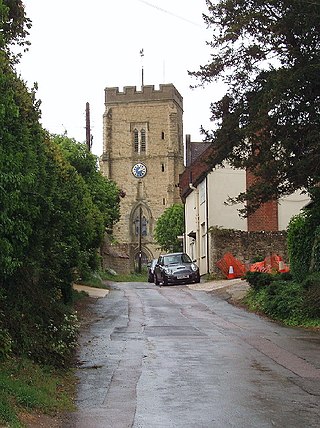
Whitchurch is a village and civil parish in the unitary authority area of Buckinghamshire, England. The village is on the A413 road about 4 miles (6.4 km) north of Aylesbury and 4.5 miles (7 km) south of Winslow. The 2011 Census recorded a parish population of 932.

Abbots Ripton is a village and civil parish in Cambridgeshire, England. Abbots Ripton is situated within Huntingdonshire which is a non-metropolitan district of Cambridgeshire as well as being an historic county of England. Abbots Ripton lies approximately 4 miles (6 km) north of Huntingdon on the B1090.
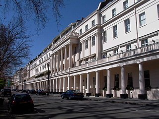
Eaton Square is a rectangular, residential garden square in London's Belgravia district. It is the largest square in London. It is one of the three squares built by the landowning Grosvenor family when they developed the main part of Belgravia in the 19th century that are named after places in Cheshire — in this case Eaton Hall, the Grosvenor country house. It is larger but less grand than the central feature of the district, Belgrave Square, and both larger and grander than Chester Square. The first block was laid out by Thomas Cubitt from 1827. In 2016 it was named as the "Most Expensive Place to Buy Property in Britain", with a full terraced house costing on average £17 million — many of such town houses have been converted, within the same, protected structures, into upmarket apartments.
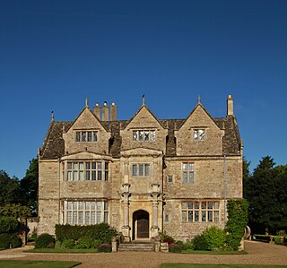
Water Eaton is a hamlet in the civil parish of Gosford and Water Eaton, in the Cherwell district, in the county of Oxfordshire, England. It is between Oxford and Kidlington.
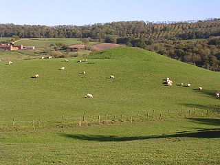
Ham Castle is located in Worcestershire at the bottom of a wooded escarpment, within the parish of Clifton-upon-Teme, about 1 mile (1.6 km) east of the village of Clifton-upon-Teme and 4 miles (6.4 km) south of Great Witley.
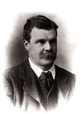
Tonman Mosley, 1st Baron Anslow,, was a British Conservative politician, businessman and judge. He was chairman of the Buckinghamshire County Council from 1904 until 1921 and chairman of the North Staffordshire Railway company from 1904 until 1923.
British fascism is the form of fascism which is promoted by some political parties and movements in the United Kingdom. It is based on British ultranationalism and imperialism and had aspects of Italian fascism and Nazism both before and after World War II.
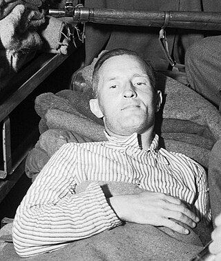
William Brooke Joyce, nicknamed Lord Haw-Haw, was an American-born fascist and Nazi propaganda broadcaster during the Second World War. After moving from New York to Ireland and subsequently to England, Joyce became a member of Oswald Mosley's British Union of Fascists (BUF) from 1932, before finally moving to Germany at the outset of the war where he took German citizenship in 1940.

Shotover Park is an 18th-century country house and park near Wheatley, Oxfordshire, England. The house, garden and parkland are Grade I-listed with English Heritage, and 18 additional structures on the property are also listed. Shotover House, its gardens, parkland, and the wider estate are privately owned by the Shotover Trust. Shotover Park, which lies on the north and east slopes of Shotover hill, should not be confused with the more recently named Shotover Country Park, which is a public park and nature reserve on the southwest slopes of Shotover hill managed by Oxford City Council.


