
The Funeral Mountains is a short, arid mountain range in the United States along the California-Nevada border approximately 100 mi (160 km) west of Las Vegas. The mountains are considered a subrange of the Amargosa Range that form the eastern wall of Death Valley.

The Jacumba Mountains are a mountain range of the Peninsular Ranges system, located in eastern San Diego County, Southern California, near the U.S. border with Mexico.

The Vallecito Mountains are located in the Colorado Desert, in eastern San Diego County, Southern California. They are about 28 miles (45 km) north of the U.S. border with Mexico.

The Ivanpah Mountains are located in the southeastern Mojave Desert of California in the United States. The range lies to the south and east of the Mescal Range and Clark Mountain Range. Paute Valley lies between the Ivanpahs and the Mescal Range and Wheaton Wash lies between the Ivanpahs and the Clark Mountains to the north. Interstate 15 traverses the Wheaton Wash to the north of the Ivanpahs.
The Tule Desert is located in southeastern Nevada in Lincoln County, near the Utah state line. The desert lies northeast of the Mormon Mountains, south of the Clover Mountains and west of the Tule Springs Hills.

Glass Mountain, on the Inyo National Forest, is one of the tallest peaks in Mono County, California. The peak lies 20 miles (32 km) southeast of the shoreline of Mono Lake and is the highest point on the four-mile (6.4 km) long sinuous Glass Mountain Ridge.

The Tinajas Altas Mountains are an extremely arid northwest–southeast trending mountain range in southern Yuma County, Arizona, approximately 35 mi southeast of Yuma, Arizona. The southern end of the range extends approximately one mile into the northwestern Mexican state of Sonora on the northern perimeter of the Gran Desierto de Altar. The range is about 22 mi in length and about 4 mi wide at its widest point. The highpoint of the range is unnamed and is 2,766 feet above sea level and is located at 32°16'26"N, 114°02'48"W. Aside from the portion of the range in Mexico, the entirety of the range lies within the Barry M. Goldwater Air Force Range. They lie at the heart of the traditional homeland of the Hia C-eḍ O'odham people.
The Bryan Mountains are a small mountain range in the northwestern Sonoran Desert of southwestern Arizona. The range is located in southeastern Yuma County, about 75 mi (121 km) southeast of Yuma and about 35 mi (56 km) west of Ajo. The range is approximately ten miles long and about three miles wide at its widest point. The highpoint of the range is 1,794 feet above sea level and is located at 32°18'27"N, 113°22'46"W. The range is located entirely within the Cabeza Prieta National Wildlife Refuge.
The Augusta Mountains are a small mountain range in Pershing, Churchill and Lander counties of Nevada.

The Bullfrog Hills are a small mountain range of the Mojave Desert in southern Nye County, southwestern Nevada. Bullfrog Hills was so named from a fancied resemblance of its ore to the color of a bullfrog.
The Specter Range is a small mountain range in southeastern Nye County, Nevada.
The Tule Springs Hills are a mountain range in eastern Lincoln County, Nevada. The Tule Desert lies to the west. The Mormon Mountains and East Mormon Mountains are to the southwest, the Clover Mountains to the north and the Beaver Dam Mountains of Utah are to the east.
The Arica Mountains are a small mountain range in northern Riverside County, California. The range lies along the south edge of Rice Valley 6.2 miles (10.0 km) southwest of the old Rice townsite on California State Route 62. They lie 6 miles (9.7 km) north of the Little Maria Mountains and 9 miles (14 km) southwest of the Turtle Mountains. The Granite Mountains lie about 8 miles to the west. They are in the Colorado Desert, in the Lower Colorado River Valley region. They are north the Palen Mountains and Big Maria Mountains; and northwest of Blythe, California.
The Little Chuckwalla Mountains are a mountain range in southeastern Riverside County, California. The range lies southeast of the Chuckwalla Mountains, north of the Chocolate Mountains and south of I-10.
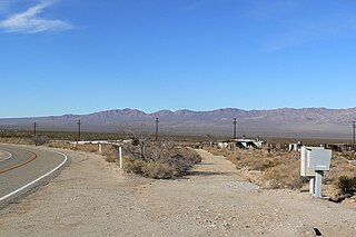
Ivanpah is in the Mojave National Preserve in San Bernardino County, California. There are several residences in the area, but no real village.
The Agua Dulce Mountains are a mountain range in the north-central Sonoran Desert of southwestern Arizona. The range is located in the extreme southwestern portion of Pima County, Arizona, immediately north of the international boundary with Mexico and about 30 mi (48 km) southwest of Ajo, Arizona. The range has three main sections that total about 15 miles in length and about nine miles in width. The range is located entirely within the Cabeza Prieta National Wildlife Refuge. The highpoint of the range is 2,852 feet (869 m) above sea level and is located at 32°01'32"N, 113°08'44"W. The summit is unnamed, but is marked on U.S. Geological Survey (USGS) maps for the "Quitovaquita" benchmark that was placed on the summit in 1920. The original surveyed height was 2,850 feet above sea level, but recent datum adjustments calculate the summit to be two feet higher.
The West Silver Bell Mountains are a small 10 mile (16 km) long mountain range of south-central Arizona, United States. The range lies in the north-central arid Sonoran Desert; the Madrean Sky Islands region of southeast Arizona, around Tucson is adjacent to the southeast.
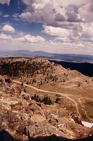
The Sierra Madre Range is a mountain range in the western United States, located in south-central Wyoming and north-central Colorado. Geologically, it may be considered an extension of the Park Range of Colorado. South of the Great Divide Basin, the US Continental Divide runs along the Sierre Madre high points. Its western basins drain into the Colorado River and its eastern into the North Platte River. Buck Mountain is the highest peak in the range and lies within Colorado. Bridger Peak is its highest elevation on the Wyoming side of the range.
Sarcobatus Flat is a closed valley in western Nye County, Nevada between Goldfield and Beatty. The Bullfrog Hills form the southern boundary and the Grapevine Mountains along with Bonnie Claire Flat form the western boundary. Pahute Mesa bounds the area to the east and north. To the north the flat is contiguous with Lida Valley and Stonewall Flat.
Shadow Valley is a north to northwest flowing drainage within the Mojave Desert of San Bernardino County, California. A section of Interstate 15 passes through the valley between Mountain Pass and Halloran Springs. The valley drains to the north from the west flank of the Mescal Range, the Ivanpah Mountains and, Cima Dome within the Mojave National Preserve. North of I-15 the valley lies between Clark Mountains to the east and Shadow Mountain to the west. To the north of Shadow Mountain, Kingman Wash becomes the main drainage and turns to the west south of the Kingston Range. The Mesquite Mountains and the Mesquite Valley are to the northeast.
