
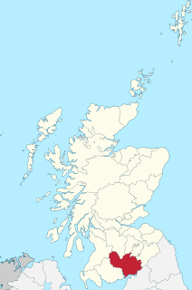
Dumfries and Galloway is one of 32 unitary council areas of Scotland and is located in the western Southern Uplands. It comprises the historic counties of Dumfriesshire, Kirkcudbrightshire, and Wigtownshire, the latter two of which are collectively known as Galloway. The administrative centre and largest settlement is the town of Dumfries. The second largest town is Stranraer, 75 miles to the west on the Irish Sea coast.
Dumfriesshire or the County of Dumfries is a historic county, registration county and lieutenancy area of southern Scotland.

Nithsdale, also known by Scoticised names Strathnith, Stranith or Stranit, is the strath or dale of the River Nith in southern Scotland, and the name of the local area. The name Strath Nid may represent the Cumbric Ystrad Nidd; Cumbric was the dominant language in this area from before Roman times until the 11th or 12th centuries, whereas Gaelic influence here was late and transient. The River Nith flows north to south through the Southern Uplands in south-west Scotland, separating the Lowther Hills from the Scaur Hills. Nithsdale has historically been a strategic area as it forms an invasion route from England into central Scotland.

The Union Canal, full name the Edinburgh and Glasgow Union Canal, is a canal in Scotland, running from Falkirk to Edinburgh, constructed to bring minerals, especially coal, to the capital. It was opened in 1822 and was initially successful, but the construction of railways, particularly the Edinburgh and Glasgow Railway, which opened in 1842, diminished its value as a transport medium. It fell into slow commercial decline and was closed to commercial traffic in 1933. It was officially closed in 1965. The canal is listed as three individual scheduled monuments by Historic Scotland according to the three former counties, Midlothian, West Lothian and Stirlingshire, through which it flows.
This is a list of the extreme points of Ireland – the points that are farthest north, south, east or west in Ireland. It includes the Republic of Ireland and Northern Ireland.
The Piscataquis River is a major tributary of the Penobscot River, found in Piscataquis County, Maine, United States. It starts from the confluence of its East Branch and West Branch in Blanchard. The river flows in a mostly eastern direction until it meets the Penobscot at Howland. It is approximately 65 miles (105 km) in length.
Leithen Water is a tributary of the River Tweed in Scotland. It rises in the Moorfoot Hills and joins the Tweed near the town of Innerleithen, whose name comes from the Scottish Gaelic inbhir, meaning a confluence, and anglicised as "inner" or "inver". The Brythonic equivalent is "Aber". "Leithen" is a Celtic name meaning grey in colour.

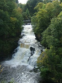
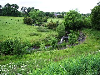
Shinnel Water, also spelt Shinnell, is a river in the region of Dumfries and Galloway, Scotland.
Spruce Falls was the local name for a small waterfall where the Swan River empties into Duck Lake in northeastern Saskatchewan, near the Manitoba boundary. It is located at 55°37′ N and 102°7′ W.
The Clyde Walkway is a foot and mountain bike path which runs from Glasgow, Scotland, to just above the UNESCO World Heritage Site of New Lanark. The path runs close to the River Clyde for most of its length. It was completed in 2005, and is now designated as one of Scotland's Great Trails by NatureScot. The route is 65 kilometres (40 mi) long, and combines rural sections on the upper Clyde in South Lanarkshire, including the Clyde Valley Woodlands National Nature Reserve and the Falls of Clyde, with urban walking through the centre of Glasgow. About 155,000 people use the path every year, of whom about 7,750 undertake multi-day journeys including those covering the entire route.

The River Afton is a small river in Ayrshire, Scotland, which flows north from Alwhat Hill in the Carsphairn and Scaur Hills, through Afton Reservoir and then for eight miles down Glen Afton before joining the River Nith at New Cumnock.

The River Garnock, the smallest of Ayrshire's six principal rivers, has its source on the southerly side of the Hill of Stake in the heart of the Clyde Muirshiel Regional Park. About a mile and a half south of this starting point the untested stream tumbles over the Spout of Garnock, the highest waterfall in Ayrshire, once thought to be the river's origin. The river then continues, for a total length of 20 miles (32 km) or so, through the towns of Kilbirnie, Glengarnock, Dalry and Kilwinning to its confluence with the River Irvine at Irvine Harbour.
The B800 is a short road in eastern Scotland, connecting the Forth Road Bridge to Kirkliston. It is a two-way single carriageway road.
The North Calder Water is a river in North Lanarkshire, Scotland. It flows for 12 miles (19 km) from the Black Loch via the Hillend Reservoir, Caldercruix, Plains, Airdrie, Calderbank, Carnbroe and Viewpark to the River Clyde at Daldowie, south-east of Glasgow. For the last 2 miles (3.2 km) of its course, it forms part of the boundary between North Lanarkshire and Glasgow. The name Calder is thought to be Brythonic and to mean 'hard cold flowing' water.
The River Nadder is a tributary of the River Avon, flowing in south Wiltshire, England.

Wetherby Ings are water meadows, by the River Wharfe now used as parkland in Wetherby, West Yorkshire, England. The ings on the north and south bank are used as parkland and for sports grounds for the town's football and rugby league teams. The area is liable to flooding during heavy rain and the river has broken its banks frequently.

The Lowther Hills, also sometimes known as the Lowthers, are an extensive area of hill country in the Southern Uplands of Scotland, though some sub-ranges of hills in this area also go under their own local names - see "Hillwalking" below. They form a roughly rhomboidal or lozenge shape on the map with the acute angles being to north and south. It has river valleys along its boundaries to north east (Clydesdale) and south west (Nithsdale) which carry the two largest arterial routes northwards into the west side of the Central Belt of Scotland. A string of small towns have long since developed along these routes. Most of the Lowther Hills lie in the Administrative County of Dumfries and Galloway, though part in the administrative county of South Lanarkshire moves into them around the village of Leadhills and the Daer Reservoir.

The Carsphairn and Scaur Hills are the western and eastern hills respectively of a hill range in the Southern Uplands of Scotland. Ordnance Survey maps don't have a general name for the hill area as a whole. Also, Ordnance Survey use "Scar" rather than the local spelling of "Scaur" - the word is pronounced as "Scar" however. In their Landranger Series of maps, it requires four separate sheets to cover the area.

Manor Water is a river in the parish of Manor, Peeblesshire in the Scottish Borders. It rises in the Ettrick Forest and flows down through the Maynor valley, passing the various farms and hamlets of Maynor as well as Kirkton Manynor, where the Maynor kirk and village hall are flowing into the River Tweed one mile south of Peebles at Olde Maynor Brig, which is closed to traffic for the foreseeable future.

Dryfe Water is a river in Scotland about 18 miles in length which flows into the River Annan at grid reference NY 107 820, near Lockerbie. It starts at NT 170 041 on the southern slopes of Loch Fell, near Moffat, and then flows along a narrow valley to the Annan.


